Category:SVG maps of France
Jump to navigation
Jump to search

Subcategories
This category has the following 9 subcategories, out of 9 total.
Media in category "SVG maps of France"
The following 101 files are in this category, out of 101 total.
-
 Caisses régionales du Crédit agricole-région.svg 2,000 × 1,922; 2.85 MB
-
 Caisses régionales du Crédit agricole.svg 2,000 × 1,922; 2.87 MB
-
 Cammino di Santiago di Compostela.svg 1,065 × 1,114; 1.83 MB
-
 Canal du Midi map-ca.svg 1,047 × 689; 395 KB
-
 Canal du Midi map-de.svg 1,047 × 689; 551 KB
-
 Canal du Midi map-el.svg 1,048 × 582; 291 KB
-
 Canal du Midi map-es.svg 1,117 × 735; 308 KB
-
 Canal du Midi map-fr mirrored.svg 1,047 × 689; 395 KB
-
 Canal du Midi map-fr.svg 1,048 × 582; 295 KB
-
 Canal du Midi map-HE.svg 1,047 × 689; 401 KB
-
 Carte de France.svg 657 × 550; 101 KB
-
 Carte des sites majeurs de Vauban-HE.svg 1,996 × 1,918; 1.07 MB
-
 Carte des sites majeurs de Vauban.svg 1,996 × 1,918; 1.07 MB
-
 Carte Originale Sillon Alpin.svg 685 × 790; 17.78 MB
-
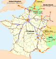 Carte TGV.svg 1,000 × 1,056; 992 KB
-
 CarteEPCIFrance.svg 1,000 × 900; 3.37 MB
-
 Chemins-Saint-Jacques-PM-en-France de.svg 1,065 × 1,114; 1.83 MB
-
 Chemins-Saint-Jacques-PM-en-France fr.svg 1,060 × 1,109; 1.83 MB
-
 Coal power plants in France map-fr - 2011.svg 1,003 × 952; 579 KB
-
 Coal power plants in France map-fr - 2016.svg 1,003 × 952; 548 KB
-
 Coal power plants in France map-fr - 2022.svg 1,003 × 952; 538 KB
-
 Course Channeltunnel ar.svg 472 × 387; 44 KB
-
 Course Channeltunnel az.svg 472 × 387; 28 KB
-
 Course Channeltunnel bn.svg 472 × 387; 80 KB
-
 Course Channeltunnel br.svg 472 × 387; 47 KB
-
 Course Channeltunnel en.svg 472 × 387; 43 KB
-
 Course Channeltunnel et.svg 472 × 387; 29 KB
-
 Course Channeltunnel fi.svg 472 × 387; 28 KB
-
 Course Channeltunnel fr.svg 472 × 387; 28 KB
-
 Course Channeltunnel ga.svg 472 × 387; 28 KB
-
 Course Channeltunnel mk.svg 474 × 389; 29 KB
-
 Course Channeltunnel sco.svg 472 × 387; 27 KB
-
 Course Channeltunnel sv.svg 512 × 420; 56 KB
-
 Course Channeltunnel yue.svg 472 × 387; 27 KB
-
 Côtes de France.svg 1,797 × 1,796; 3.7 MB
-

-

-
 Flag Map of French Regions (Logo Flags).svg 512 × 448; 538 KB
-
 France - Density of Monuments historiques by commune.svg 1,000 × 900; 13.34 MB
-
 France autoroutes map-fr.svg 2,000 × 1,922; 4.62 MB
-
 France cities-es.svg 1,797 × 1,796; 878 KB
-
 France cities.svg 1,797 × 1,796; 383 KB
-
 France Columbia drainage basin Size.svg 645 × 650; 281 KB
-
 France international electricity exchanges.svg 1,796 × 1,796; 1.1 MB
-
 France Köppen.svg 765 × 1,013; 1.07 MB
-
 France location map-Powdery mildew.svg 2,000 × 1,922; 863 KB
-
 France map Lambert-93 topographic-ancient Roman roads.svg 1,766 × 1,645; 1.6 MB
-
 France Missing Normandy.svg 1,000 × 960; 227 KB
-
 France OlympusMons Size br.svg 500 × 500; 122 KB
-
 France OlympusMons Size.svg 500 × 500; 119 KB
-
 France-hexagon.svg 942 × 953; 15 KB
-
 France-title.svg 1,002 × 924; 195 KB
-
 French electricity sales 2009.svg 1,003 × 952; 543 KB
-
 French electricity sales 2012.svg 1,003 × 952; 523 KB
-
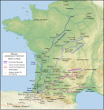
 French vineyards de.svg 1,796 × 1,797; 385 KB
-
 French vineyards.svg 1,796 × 1,797; 634 KB
-
 Genève Switzerland street map.svg 4,076 × 3,555; 36.76 MB
-
 Haras nationaux en France.svg 2,000 × 2,000; 2.79 MB
-
 Herkunft der Reimser Stammspieler 1945–1955 fr.svg 1,937 × 1,784; 631 KB
-
 Herkunft der Reimser Stammspieler 1945–1955.svg 1,937 × 1,784; 633 KB
-
 Klaus storm track - 20090124 - map-ca.svg 2,000 × 1,922; 1.08 MB
-
 Klaus storm track - 20090124 - map-en.svg 2,000 × 1,922; 1.08 MB
-
 Klaus storm track - 20090124 - map-es.svg 2,000 × 1,922; 1.08 MB
-
 Klaus storm track - 20090124 - map-fr.svg 2,000 × 1,922; 1.09 MB
-
 Klaus storm track - 20090124 - map-it.svg 2,000 × 1,922; 1.08 MB
-
 LGV Bordeaux - Frontière espagnole.svg 1,376 × 1,806; 358 KB
-
 LGV Bordeaux Toulouse sur une carte topographique.svg 1,028 × 885; 2.91 MB
-
 LGV Est-de with legend.svg 939 × 553; 272 KB
-
 LGV Est-en with legend.svg 939 × 553; 113 KB
-
 LGV Est-en.svg 939 × 553; 109 KB
-
 LGV Est-fr with legend.svg 939 × 553; 156 KB
-
 LGV Est-fr.svg 939 × 553; 109 KB
-
 LGV Interconnexion Est.svg 1,000 × 1,056; 52 KB
-
 Ligne Paris-Bordeaux.svg 1,000 × 1,056; 69 KB
-
 Ligne St-Denis Dieppe.svg 1,921 × 1,894; 122 KB
-
 Listes de discussion locales WMfr.svg 588 × 550; 251 KB
-
 Map of communes of France where at least one road in named after Paris.svg 1,000 × 900; 8.51 MB
-
 Map of Communes of France without Church.svg 1,000 × 900; 8.51 MB
-
 Métropoles en France.svg 840 × 663; 3.05 MB
-
 North and south of the Pyrenees (Year 760).svg 549 × 478; 205 KB
-
 Nuclear power plants map France-br.svg 1,100 × 1,100; 538 KB
-
 Nuclear power plants map France-fr.svg 1,100 × 1,100; 538 KB
-
 Octogone de Reclus.svg 942 × 953; 15 KB
-
 Parcs naturels français d'outre-mer.svg 2,920 × 2,347; 526 KB
-
 Parcs naturels français de métropole.svg 2,000 × 1,930; 539 KB
-
 Parcs naturels français.svg 4,920 × 2,347; 1.12 MB
-
 Railway stations on departure from Paris map-en.svg 1,400 × 1,400; 1.92 MB
-
 Railway stations on departure from Paris map-fr.svg 1,400 × 1,400; 1.92 MB
-
 Regions of France by HDI (2017).svg 512 × 524; 104 KB
-
 Ressorts TA et CAA.svg 588 × 579; 141 KB
-
 Régions de France 2016.svg 1,000 × 960; 485 KB
-
 Régions Icône.svg 300 × 300; 215 KB
-
 The Political Geography of Revolutionary France.svg 3,067 × 2,267; 1.06 MB
-
 Tour de France 1978 map-fr.svg 2,000 × 1,922; 1.18 MB
-
 Tour de France 2010 map-fr.svg 2,000 × 1,922; 1.18 MB
-
 Tramways en France en 2020.svg 2,000 × 1,922; 687 KB
-
 Travel times by road in France from Paris - en.svg 588 × 550; 725 KB
-
 Travel times by road in France from Paris - fr.svg 588 × 550; 737 KB
-
 Travel times by road in France from Paris v2 - fr.svg 588 × 550; 605 KB
-
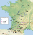
 Vignobles champagne.svg 1,300 × 1,000; 491 KB
-
 Église protestante unie de France organisation.svg 548 × 550; 122 KB


.svg)


.svg)


.svg)


