Category:SVG topographic maps of Italy
Jump to navigation
Jump to search
Countries of Europe: Albania · Andorra · Armenia‡ · Austria · Azerbaijan‡ · Belarus · Belgium · Bosnia and Herzegovina · Bulgaria · Croatia · Cyprus‡ · Czech Republic · Denmark · Estonia · Finland · France‡ · Georgia‡ · Germany · Greece · Hungary · Iceland · Republic of Ireland · Italy · Kazakhstan‡ · Latvia · Liechtenstein · Lithuania · Luxembourg · Malta · Moldova · Montenegro · Netherlands‡ · North Macedonia · Norway · Poland · Portugal‡ · Romania · Russia‡ · San Marino · Serbia · Slovakia · Slovenia · Spain‡ · Sweden · Switzerland · Turkey‡ · Ukraine · United Kingdom
‡: partly located in Europe
‡: partly located in Europe
Media in category "SVG topographic maps of Italy"
The following 19 files are in this category, out of 19 total.
-
 Alpenkarte.svg 3,178 × 1,871; 2.42 MB
-
 Carte topographique de l'île d'Elbe.svg 1,052 × 744; 3.09 MB
-
 CordilleraDeLosAlpes.svg 785 × 557; 23.29 MB
-
 CordilleraDeLosApeninos.svg 988 × 696; 29.94 MB
-
 Fond de carte Tour de France-blank.svg 2,110 × 2,525; 1.79 MB
-
 ItaliaMapaTopográfico.svg 988 × 696; 29.9 MB
-
 ItaliaMapaTopográfico3.svg 988 × 696; 31 MB
-
 Italy Bassa padana map-fr.svg 736 × 482; 1.66 MB
-
 Italy bassa parmense on bassa padana map.svg 736 × 482; 1.66 MB
-
 Italy topographic map-ancient Roman roads-pt.svg 512 × 591; 1.52 MB
-
 Italy topographic map-ancient Roman roads.svg 1,587 × 1,833; 1.75 MB
-
 Italy topographic map-blank relief only.svg 1,759 × 2,167; 1.25 MB
-
 Italy topographic map-blank.svg 1,759 × 2,167; 1.98 MB
-
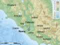
 Latium -5th Century map-en.svg 900 × 675; 321 KB
-
 Latium -5th Century map-fr.svg 900 × 675; 336 KB
-
 Latium -5th Century map-id.svg 900 × 675; 321 KB
-
 Latium -5th Century map-it.svg 900 × 675; 321 KB
-
 Latium -5th Century map-la.svg 900 × 675; 336 KB
-
 Latium -5th Century map-pt.svg 900 × 675; 336 KB


