Category:19th-century maps of Togo
Jump to navigation
Jump to search
Countries of Africa: Algeria · Angola · Benin · Botswana · Cameroon · Cape Verde · Chad · Democratic Republic of the Congo · Republic of the Congo · Djibouti · Egypt‡ · Equatorial Guinea · Eritrea · Eswatini · Ethiopia · Gabon · The Gambia · Ghana · Guinea · Guinea-Bissau · Ivory Coast · Kenya · Lesotho · Liberia · Libya · Madagascar · Mali · Mauritania · Morocco · Mozambique · Namibia · Niger · Nigeria · Senegal · Seychelles · Sierra Leone · Somalia · South Africa · South Sudan · Sudan · Tanzania · Togo · Tunisia · Uganda · Zambia · Zimbabwe
Other areas: Canary Islands · Madeira · Western Sahara
‡: partly located in Africa
Other areas: Canary Islands · Madeira · Western Sahara
‡: partly located in Africa
Media in category "19th-century maps of Togo"
The following 13 files are in this category, out of 13 total.
-
-
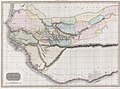
 1813 pinkerton.jpg 2,829 × 2,082; 6.16 MB
-
 BOWDICH(1819) p012 MAP - GEOGRAPHY OF WESTERN AFRICA.jpg 1,775 × 1,802; 1.85 MB
-
 Karte des deutschen Gebietes an der Sklavenküste.png 3,322 × 2,215; 10.51 MB
-
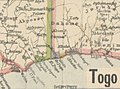
 163 of 'Das deutsche Togogebiet und meine Afrikareise 1887' (11195366355).jpg 3,648 × 3,937; 3.22 MB
-
 Das Gebiet der Ewe-Stämme und die deutschen Erwerbungen im Togo-Land.png 2,243 × 2,589; 8.8 MB
-

-

-
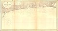 Admiralty Chart No 1861 Cape St Paul to Lekki, Published 1922.jpg 21,222 × 11,299; 44.12 MB
-
 Guinea from Milner's Atlas.jpg 1,008 × 717; 1.24 MB
-
-
 Meyer‘s Zeitungsatlas 101 – Senegambien (West-Africa).jpg 7,455 × 6,224; 14.1 MB
-
 Europas Kolonien. 1 1885 (150829056).jpg 5,053 × 3,632; 9.49 MB
_-_Geographicus_-_WesternAfrica-pinkerton-1813.jpg)

_p012_MAP_-_GEOGRAPHY_OF_WESTERN_AFRICA.jpg)

.jpg)

.jpg)


%27_(16404263999).jpg)
.jpg)
.jpg)
.jpg)