Category:March 2009 in the East Riding of Yorkshire
Jump to navigation
Jump to search
Ceremonial counties of England: Bedfordshire · Berkshire · Buckinghamshire · Cambridgeshire · Cheshire · Cornwall · Cumbria · Derbyshire · Devon · Dorset · Durham · East Riding of Yorkshire · East Sussex · Essex · Gloucestershire · Greater London · Greater Manchester · Hampshire · Herefordshire · Hertfordshire · Isle of Wight · Kent · Lancashire · Leicestershire · Lincolnshire · Merseyside · Norfolk · North Yorkshire · Northamptonshire · Northumberland · Nottinghamshire · Oxfordshire · Shropshire · Somerset · South Yorkshire · Staffordshire · Suffolk · Surrey · Tyne and Wear · Warwickshire · West Midlands · West Sussex · West Yorkshire · Wiltshire · Worcestershire
City-counties: Bristol ·
Former historic counties:
Other former counties:
City-counties: Bristol ·
Former historic counties:
Other former counties:
Deutsch: Bilder, die im März 2009 in the East Riding of Yorkshire aufgenommen worden sind. Bitte beachten Sie, dass dies weder das Datum des Uploads noch das Datum des Scannens eines Fotos ist.
English: Images/pictures taken in the East Riding of Yorkshire during March 2009. Note this is not the date of the upload, nor the date a photo was scanned.
Español: Fotografías o imágenes tomadas en the East Riding of Yorkshire durante marzo 2009. No es la fecha de subida ni escaneo, sino la fecha en que las fotografías o imágenes se crearon.
Esperanto: Bildoj faritaj en the East Riding of Yorkshire en marto 2009. Tio ne estas la dato, kiam la bildoj estis alŝutitaj aŭ skanitaj.
Français : Photographies ou images prises en the East Riding of Yorkshire durant mars 2009. Ce n'est pas la date du téléchargement ou du scan.
Galego: Fotografías ou imaxes tomadas en the East Riding of Yorkshire durante marzo 2009. Non é a data de subida nin escaneamento, senón a data na que se crearon as fotografías ou imaxes.
Italiano: Fotografie o immagini scattate a the East Riding of Yorkshire nel marzo 2009. Nota bene: la data non si riferisce né a quella di upload né a quella in cui la foto è stata digitalizzata.
Norsk bokmål: Bilder tatt i the East Riding of Yorkshire i løpet av mars 2009. Merk at dette ikke er datoen for opplasting, eller når et bilde har blitt skannet.
Norsk nynorsk: Bilete teke i the East Riding of Yorkshire i løpet av mars 2009. Merk at dette ikkje er datoen for opplasting, eller når eit bilete har vorte skanna.
Русский: Изображения, сделанные в the East Riding of Yorkshire в течение март 2009 (не дата загрузки изображения).
Українська: Зображення, зроблені в the East Riding of Yorkshire протягом березень 2009. Зауважте, що це не дата завантаження чи дата сканування фотографії.
| March 2008 | ← | March 2009 | → | March 2010 | |||||||
| Jan | Feb | Mar | Apr | May | Jun | Jul | Aug | Sep | Oct | Nov | Dec |
| 148 | 203 | 905 | 767 | 930 | 719 | 783 | 588 | 336 | 712 | 202 | 287 |
|---|---|---|---|---|---|---|---|---|---|---|---|
Subcategories
This category has only the following subcategory.
- March 2009 in Kingston upon Hull (52 F)
Media in category "March 2009 in the East Riding of Yorkshire"
The following 200 files are in this category, out of 904 total.
(previous page) (next page)-
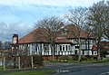
 "Huckleberry House", Tower Hill, Hessle - geograph.org.uk - 1189709.jpg 640 × 415; 107 KB
-
 Humber Bridge Sunset Wideshot.jpg 4,000 × 3,000; 5.15 MB
-
-
 Ellerker Sewage Works - geograph.org.uk - 1216990.jpg 640 × 480; 61 KB
-
 Mill Beck looking northwest - geograph.org.uk - 1216996.jpg 640 × 480; 91 KB
-
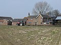
 Mill Farms across Mill Beck - geograph.org.uk - 1217000.jpg 640 × 480; 82 KB
-
 217 West Ella Road - geograph.org.uk - 1185863.jpg 640 × 490; 111 KB
-
 219 West Ella Road - geograph.org.uk - 1185881.jpg 640 × 468; 127 KB
-
 A cottage near England Springs Crossing - geograph.org.uk - 1200382.jpg 640 × 357; 317 KB
-

-
 A Dip in the Road - geograph.org.uk - 1212554.jpg 640 × 427; 91 KB
-
 A house in Milldale - geograph.org.uk - 1215571.jpg 640 × 405; 361 KB
-
 A pudding stone - geograph.org.uk - 1201900.jpg 640 × 427; 404 KB
-
 A railway came and went - geograph.org.uk - 1219802.jpg 640 × 480; 87 KB
-
 A Recently Planted Wolds Field - geograph.org.uk - 1226817.jpg 640 × 480; 108 KB
-
 A Seafront Building at Withernsea - geograph.org.uk - 1194090.jpg 640 × 480; 90 KB
-
 A stream in Ganstead - geograph.org.uk - 1209342.jpg 640 × 427; 525 KB
-
 A track in Milldale Plantation - geograph.org.uk - 1215574.jpg 640 × 427; 429 KB
-
 A View Up Bempton Lane - geograph.org.uk - 1207447.jpg 640 × 480; 94 KB
-
 A Withernsea Beach Groyne - geograph.org.uk - 1195802.jpg 640 × 451; 75 KB
-
 A1174 Swine Moor Roundabout - geograph.org.uk - 1201269.jpg 640 × 427; 303 KB
-
 A161 Sandhall Road - geograph.org.uk - 1198528.jpg 640 × 480; 41 KB
-
 A165 - Ganstead Lane junction - geograph.org.uk - 1209366.jpg 640 × 419; 264 KB
-

-
 A165 Direction Bridlington - geograph.org.uk - 1218328.jpg 640 × 480; 76 KB
-
 A165 Direction Fraisthorpe - geograph.org.uk - 1223842.jpg 640 × 481; 133 KB
-
 A165 Lissett to Beeford - geograph.org.uk - 1222523.jpg 640 × 427; 346 KB
-
 A165 Roundabout - geograph.org.uk - 1211997.jpg 640 × 480; 73 KB
-
 A165 towards Fraisthorpe - geograph.org.uk - 1223601.jpg 640 × 481; 84 KB
-
 A614 Near Bessingby - geograph.org.uk - 1223468.jpg 640 × 481; 131 KB
-
 Above Kilnsea - geograph.org.uk - 1196074.jpg 640 × 427; 332 KB
-
 Aglais io - geograph.org.uk - 1227757.jpg 640 × 480; 80 KB
-
 Aike Lane, Aike - geograph.org.uk - 1193306.jpg 640 × 386; 225 KB
-
 Airmyn A614 Roundabout - geograph.org.uk - 1214868.jpg 640 × 480; 66 KB
-
 Aldbrough Church - geograph.org.uk - 1221139.jpg 487 × 640; 67 KB
-

-
 All Saints C. of E., Mappleton - geograph.org.uk - 1206998.jpg 640 × 427; 300 KB
-
 All Saints Church Londesborough 3.jpg 426 × 640; 208 KB
-
 All Saints Church, Barmston - geograph.org.uk - 1222016.jpg 640 × 420; 374 KB
-
 All Saints Church, Holme on Spalding Moor - panoramio.jpg 701 × 1,000; 485 KB
-
 Angling pond - geograph.org.uk - 1199582.jpg 640 × 480; 70 KB
-
 Annumhills Road - geograph.org.uk - 1214980.jpg 640 × 480; 53 KB
-
 Arram Beck meets the River Hull - geograph.org.uk - 1194184.jpg 640 × 426; 202 KB
-
 Arram Grange Bridge - geograph.org.uk - 1194143.jpg 640 × 426; 170 KB
-
 Auburn Beach - geograph.org.uk - 1223896.jpg 640 × 481; 60 KB
-
 Auburn Farm - geograph.org.uk - 1223877.jpg 640 × 481; 86 KB
-
 Aughton Plantation - geograph.org.uk - 1215009.jpg 640 × 480; 73 KB
-
 B 1246 Westbeck Hill - geograph.org.uk - 1202682.jpg 640 × 480; 80 KB
-
 B1253 Near the Woods - geograph.org.uk - 1215629.jpg 640 × 480; 105 KB
-
 Baggaby Hill on the B1246 - geograph.org.uk - 1202724.jpg 640 × 443; 86 KB
-
 Baileywood Lane, Holme-on-Spalding-Moor - geograph.org.uk - 1200802.jpg 640 × 463; 198 KB
-
 Baileywood Lane, Holme-on-Spalding-Moor - geograph.org.uk - 1200918.jpg 640 × 426; 182 KB
-
 Barn Conversion - geograph.org.uk - 1213555.jpg 640 × 480; 100 KB
-
 Bayle Gate - geograph.org.uk - 1212038.jpg 640 × 480; 99 KB
-
 Beach at Wilsthorpe - geograph.org.uk - 1208115.jpg 640 × 480; 61 KB
-
 Beachfront Building at Withernsea - geograph.org.uk - 1195800.jpg 467 × 640; 106 KB
-
 Beachfront Building at Withernsea - geograph.org.uk - 1195801.jpg 491 × 640; 74 KB
-
 Beacon Lagoons - geograph.org.uk - 1196080.jpg 640 × 381; 302 KB
-
 Beeford Store and Post Office - geograph.org.uk - 1222542.jpg 640 × 427; 312 KB
-
 Bempton Cliffs - geograph.org.uk - 1207537.jpg 640 × 480; 87 KB
-

-
 Bend in the Road - geograph.org.uk - 1223847.jpg 640 × 481; 99 KB
-
 Bessingby Hall - geograph.org.uk - 1223465.jpg 640 × 506; 126 KB
-
 Beverley and Barmston Drain - geograph.org.uk - 1200639.jpg 427 × 640; 310 KB
-
 Beverley and Barmston Drain - geograph.org.uk - 1200645.jpg 640 × 427; 350 KB
-
 Beverley and Barmston Drain at Aike - geograph.org.uk - 1194161.jpg 640 × 451; 198 KB
-

-
 Beverley Lane - geograph.org.uk - 1227273.jpg 640 × 480; 75 KB
-
 Binsdale Farm - geograph.org.uk - 1215609.jpg 640 × 466; 89 KB
-
 Black dike lane - geograph.org.uk - 1198520.jpg 640 × 480; 79 KB
-
 Black Plantation, Holme Common - geograph.org.uk - 1199949.jpg 476 × 640; 218 KB
-
 Boat House Cafe - geograph.org.uk - 1211683.jpg 640 × 480; 67 KB
-

-
 Booth Lane - geograph.org.uk - 1214886.jpg 640 × 480; 55 KB
-

-
 Bottoms Drain - geograph.org.uk - 1202736.jpg 640 × 480; 53 KB
-
 Boundary Drain, Aike - geograph.org.uk - 1193315.jpg 640 × 426; 223 KB
-
 Boundary Wood - geograph.org.uk - 1209939.jpg 640 × 480; 54 KB
-
 Bowthorpe Ings - geograph.org.uk - 1199554.jpg 640 × 480; 94 KB
-
 Boynton Hall.jpg 640 × 480; 108 KB
-
 Boynton Primary School - geograph.org.uk - 1215624.jpg 640 × 480; 72 KB
-
 Brackendale Farm - geograph.org.uk - 1223584.jpg 640 × 481; 43 KB
-
 Braffords Hall Lodge - geograph.org.uk - 1185918.jpg 640 × 470; 89 KB
-
 Brandesburton, St Mary - geograph.org.uk - 1225149.jpg 640 × 380; 279 KB
-
 Breakwater North beach - geograph.org.uk - 1208036.jpg 640 × 427; 99 KB
-
 Breighton Airfield Entrance - geograph.org.uk - 1199423.jpg 640 × 440; 40 KB
-
 Breil Nook - geograph.org.uk - 1228929.jpg 640 × 480; 101 KB
-
 Bridge Farm Wilsthorpe.jpg 640 × 480; 108 KB
-
 Bridge over disused railway - geograph.org.uk - 1216182.jpg 640 × 480; 76 KB
-
 Bridge Over Gypsey Race - geograph.org.uk - 1215590.jpg 640 × 480; 134 KB
-
 Bridge over River Foulness - geograph.org.uk - 1222712.jpg 640 × 480; 83 KB
-
 Bridge over the Earls Dike Fraisthorpe.jpg 640 × 480; 90 KB
-
 Bridges Old and New - geograph.org.uk - 1198439.jpg 640 × 480; 68 KB
-
 Bridlington 20, Beverley 3 (miles) - geograph.org.uk - 1222430.jpg 640 × 538; 461 KB
-
 Bridlington Ambulance Station - geograph.org.uk - 1212018.jpg 640 × 480; 80 KB
-
 Bridlington Belverdere Golf Club - geograph.org.uk - 1218352.jpg 640 × 424; 55 KB
-
 Bridlington Cemetery - geograph.org.uk - 1209021.jpg 640 × 480; 42 KB
-
 Bridlington Fire Station - geograph.org.uk - 1212024.jpg 640 × 411; 57 KB
-
 Bridlington Funfair - geograph.org.uk - 1208075.jpg 640 × 427; 85 KB
-
 Bridlington Harbour - geograph.org.uk - 1202654.jpg 640 × 480; 69 KB
-
 Bridlington Harbour fish dock - geograph.org.uk - 1202657.jpg 640 × 480; 71 KB
-
 Bridlington Hospital - geograph.org.uk - 1212015.jpg 640 × 480; 56 KB
-
 Bridlington Priory Church 2009 03 20.jpg 640 × 480; 138 KB
-
 Bridlington Promenade - geograph.org.uk - 1227688.jpg 640 × 427; 55 KB
-
 Bridlington Railway Station Exterior - geograph.org.uk - 1212027.jpg 640 × 480; 62 KB
-
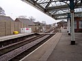 Bridlington Railway Station Platform - geograph.org.uk - 1212035.jpg 640 × 480; 83 KB
-
 Bridlington Railway Station Platforms - geograph.org.uk - 1212031.jpg 462 × 640; 113 KB
-
 Bridlington Residential - geograph.org.uk - 1207449.jpg 640 × 480; 62 KB
-
 Bridlington School.jpg 640 × 480; 73 KB
-
 Bright Crescent - geograph.org.uk - 1227677.jpg 640 × 427; 57 KB
-
 Brind Lane - geograph.org.uk - 1215074.jpg 640 × 480; 65 KB
-
 Broadacres Pub - geograph.org.uk - 1218344.jpg 640 × 442; 103 KB
-
 Brook Farm - geograph.org.uk - 1219809.jpg 640 × 480; 87 KB
-
 Brough Station - geograph.org.uk - 1187088.jpg 640 × 480; 117 KB
-
 Brough Station's Footbridge - geograph.org.uk - 1187097.jpg 640 × 480; 91 KB
-
 Bubwith bridge - geograph.org.uk - 1199327.jpg 640 × 480; 92 KB
-
 Bubwith Ings - geograph.org.uk - 1198688.jpg 640 × 480; 82 KB
-
 Bubwith Village - geograph.org.uk - 1199381.jpg 640 × 480; 70 KB
-
 Buckton Barn - geograph.org.uk - 1213427.jpg 640 × 480; 60 KB
-
 Buckton Cliffs.jpg 480 × 640; 114 KB
-
 Buckton Duck Pond - geograph.org.uk - 1208791.jpg 640 × 480; 93 KB
-
 Buckton Hall Rear View - geograph.org.uk - 1211025.jpg 640 × 411; 42 KB
-
 Buckton Hall.jpg 640 × 480; 92 KB
-
 Buckton Mill, Buckton.jpg 640 × 480; 80 KB
-
 Buckton Road Towards Buckton - geograph.org.uk - 1215278.jpg 640 × 480; 60 KB
-
 Bulmer Lane, Water End - geograph.org.uk - 1199330.jpg 640 × 451; 215 KB
-
 Bungalow Farm near Buckton Hall - geograph.org.uk - 1208830.jpg 640 × 480; 62 KB
-
 Burlington Row, Londesborough - geograph.org.uk - 1231297.jpg 547 × 640; 205 KB
-
 Burstwick Drain from Thorn Road in Hedon - geograph.org.uk - 1201860.jpg 480 × 640; 119 KB
-
 Burton Constable Main Entrance - geograph.org.uk - 1201736.jpg 640 × 408; 331 KB
-
 Butterwicks Farm - geograph.org.uk - 1212810.jpg 640 × 427; 89 KB
-
 Canal junction - geograph.org.uk - 1184374.jpg 640 × 480; 50 KB
-
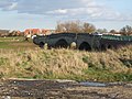
 Carlton Bridge - geograph.org.uk - 1198384.jpg 640 × 480; 69 KB
-
 Carnaby Level Crossing.jpg 640 × 398; 54 KB
-
 Carnaby Roundabout - geograph.org.uk - 1218267.jpg 640 × 480; 52 KB
-
 Carnaby Station - geograph.org.uk - 1218250.jpg 640 × 458; 104 KB
-
 Carnaby Temple - geograph.org.uk - 1217407.jpg 499 × 640; 67 KB
-
 Carr House Farm, Weel - geograph.org.uk - 1201447.jpg 640 × 479; 103 KB
-
 Carr House, Swine Carrs - geograph.org.uk - 1192707.jpg 640 × 454; 119 KB
-
 Carr House, Wawne - geograph.org.uk - 1201422.jpg 640 × 478; 100 KB
-

-
 Carter Lane - geograph.org.uk - 1229003.jpg 640 × 427; 110 KB
-
 Cattery and Horse Riding Centre - geograph.org.uk - 1217387.jpg 640 × 480; 89 KB
-
 Cave Common Farm - geograph.org.uk - 1217016.jpg 640 × 480; 77 KB
-
 Cave Common Farm from field path - geograph.org.uk - 1219731.jpg 640 × 480; 63 KB
-
 Celandine near Scale Nab - geograph.org.uk - 1205035.jpg 640 × 427; 337 KB
-
 Cemetery Gravestones - geograph.org.uk - 1209042.jpg 640 × 480; 92 KB
-
 Cemetery Lodge House - geograph.org.uk - 1209030.jpg 640 × 480; 56 KB
-
 Chalk Wolds panorama - geograph.org.uk - 1360193.jpg 640 × 480; 75 KB
-
 Charleston Farm Entrance - geograph.org.uk - 1215500.jpg 640 × 480; 115 KB
-
 Cherry Tree Farm - geograph.org.uk - 1224132.jpg 640 × 480; 34 KB
-
 Chestnut Avenue, Hessle - geograph.org.uk - 1189557.jpg 608 × 640; 156 KB
-
 Church Hill, Holme-on-Spalding-Moor - geograph.org.uk - 1199320.jpg 464 × 640; 206 KB
-
 Church Lane - geograph.org.uk - 1198583.jpg 640 × 480; 51 KB
-
 Church of St Andrew - geograph.org.uk - 1215566.jpg 480 × 640; 95 KB
-
 Church of St John the Baptist - geograph.org.uk - 1218222.jpg 640 × 480; 76 KB
-
 Church of St Magnus, Bessingby - geograph.org.uk - 1223494.jpg 640 × 481; 89 KB
-
 Cliff House Hessle.jpg 640 × 480; 134 KB
-
 Cliff Lane Bempton - geograph.org.uk - 1207522.jpg 640 × 480; 63 KB
-
 Cliff top path, towards Mount Pleasant - geograph.org.uk - 1201875.jpg 640 × 429; 350 KB
-
 Cliff Top Walk - geograph.org.uk - 1226819.jpg 640 × 480; 89 KB
-
 Cliff top, beach and sea, near Aldbrough - geograph.org.uk - 1201865.jpg 640 × 415; 321 KB
-
 Cliffs Near Bempton - geograph.org.uk - 1207596.jpg 640 × 480; 88 KB
-
 Clifftop Walk - geograph.org.uk - 1209140.jpg 640 × 480; 88 KB
-

-
 Clifftop Walk, Bempton Cliffs - geograph.org.uk - 1207546.jpg 640 × 480; 77 KB
-
 Clock Tower Tearoom - geograph.org.uk - 1204680.jpg 640 × 481; 89 KB
-
 Coastal Erosion - geograph.org.uk - 1209177.jpg 640 × 480; 113 KB
-
 Coastal Erosion - geograph.org.uk - 1223904.jpg 640 × 481; 95 KB
-
 Coastal Path - geograph.org.uk - 1227566.jpg 640 × 427; 75 KB
-
 Coastal Path Heading West - geograph.org.uk - 1227586.jpg 640 × 480; 51 KB
-
 Cobdale Lane - geograph.org.uk - 1215598.jpg 640 × 427; 315 KB
-
 Cobdale Lane crosses Cold Wold - geograph.org.uk - 1215612.jpg 640 × 427; 327 KB
-

-
 Colt Lane - geograph.org.uk - 1224127.jpg 640 × 480; 53 KB
-
 Common Farm House and Yard - geograph.org.uk - 1219838.jpg 640 × 480; 66 KB
-
 Common Lane, Wawne - geograph.org.uk - 1192717.jpg 485 × 640; 132 KB
-
 Concrete mirror - geograph.org.uk - 1196057.jpg 640 × 344; 261 KB
-

-
 Coniston Lane, Swine - geograph.org.uk - 1192643.jpg 640 × 464; 117 KB
-

-
-
 Corporation Farm access road - geograph.org.uk - 1201251.jpg 640 × 427; 419 KB
-
 Cottage at Argham - geograph.org.uk - 1215464.jpg 640 × 480; 98 KB
-
 Cottage in Carnaby.jpg 640 × 465; 140 KB
-
 Cottage, South Boynton - geograph.org.uk - 1215551.jpg 640 × 480; 68 KB
-
 Cottingham to Beverley line - geograph.org.uk - 1200358.jpg 640 × 427; 311 KB
-
 Country Golf Driving Range - geograph.org.uk - 1209291.jpg 640 × 471; 291 KB
-
 County Farm - geograph.org.uk - 1213381.jpg 640 × 480; 55 KB
-
 Cradle Head - geograph.org.uk - 1229020.jpg 640 × 427; 75 KB
-
 Cradle Head - geograph.org.uk - 1229028.jpg 640 × 427; 78 KB
-
 Cresting the Hill - geograph.org.uk - 1212761.jpg 640 × 427; 45 KB
-
 Cross on the village green, Brandesburton - geograph.org.uk - 1748513.jpg 2,112 × 2,816; 2.61 MB
-
 Crossroads near Newsholme Farm - geograph.org.uk - 1215097.jpg 640 × 480; 37 KB
-
 Crumbling Cliffs - geograph.org.uk - 1221438.jpg 640 × 427; 48 KB
-
 Danes Dyke - geograph.org.uk - 1211621.jpg 640 × 480; 129 KB
-
 Danes Dyke - geograph.org.uk - 1226771.jpg 640 × 494; 162 KB
-
 Danes Dyke From the Flamborough Road - geograph.org.uk - 1212540.jpg 640 × 427; 63 KB
-
 Danes Dyke Looking North From B12229 - geograph.org.uk - 1212783.jpg 640 × 427; 102 KB
-
 Danes Dyke Near the B1229 - geograph.org.uk - 1212796.jpg 640 × 427; 128 KB


_-_geograph.org.uk_-_1222430.jpg)


_-_geograph.org.uk_-_1223514.jpg)