Category:March 2010 in the East Riding of Yorkshire
Jump to navigation
Jump to search
Ceremonial counties of England: Bedfordshire · Berkshire · Buckinghamshire · Cambridgeshire · Cheshire · Cornwall · Cumbria · Derbyshire · Devon · Dorset · Durham · East Riding of Yorkshire · East Sussex · Essex · Gloucestershire · Greater London · Greater Manchester · Hampshire · Herefordshire · Hertfordshire · Isle of Wight · Kent · Lancashire · Leicestershire · Lincolnshire · Merseyside · Norfolk · North Yorkshire · Northamptonshire · Northumberland · Nottinghamshire · Oxfordshire · Rutland · Shropshire · Somerset · South Yorkshire · Staffordshire · Suffolk · Surrey · Tyne and Wear · Warwickshire · West Midlands · West Sussex · West Yorkshire · Wiltshire · Worcestershire
City-counties: Bristol ·
Former historic counties:
Other former counties:
City-counties: Bristol ·
Former historic counties:
Other former counties:
Deutsch: Bilder, die im März 2010 in the East Riding of Yorkshire aufgenommen worden sind. Bitte beachten Sie, dass dies weder das Datum des Uploads noch das Datum des Scannens eines Fotos ist.
English: Images/pictures taken in the East Riding of Yorkshire during March 2010. Note this is not the date of the upload, nor the date a photo was scanned.
Español: Fotografías o imágenes tomadas en the East Riding of Yorkshire durante marzo 2010. No es la fecha de subida ni escaneo, sino la fecha en que las fotografías o imágenes se crearon.
Esperanto: Bildoj faritaj en the East Riding of Yorkshire en marto 2010. Tio ne estas la dato, kiam la bildoj estis alŝutitaj aŭ skanitaj.
Français : Photographies ou images prises en the East Riding of Yorkshire durant mars 2010. Ce n'est pas la date du téléchargement ou du scan.
Galego: Fotografías ou imaxes tomadas en the East Riding of Yorkshire durante marzo 2010. Non é a data de subida nin escaneamento, senón a data na que se crearon as fotografías ou imaxes.
Italiano: Fotografie o immagini scattate a the East Riding of Yorkshire nel marzo 2010. Nota bene: la data non si riferisce né a quella di upload né a quella in cui la foto è stata digitalizzata.
Norsk bokmål: Bilder tatt i the East Riding of Yorkshire i løpet av mars 2010. Merk at dette ikke er datoen for opplasting, eller når et bilde har blitt skannet.
Norsk nynorsk: Bilete teke i the East Riding of Yorkshire i løpet av mars 2010. Merk at dette ikkje er datoen for opplasting, eller når eit bilete har vorte skanna.
Русский: Изображения, сделанные в the East Riding of Yorkshire в течение март 2010 (не дата загрузки изображения).
Українська: Зображення, зроблені в the East Riding of Yorkshire протягом березень 2010. Зауважте, що це не дата завантаження чи дата сканування фотографії.
| March 2009 | ← | March 2010 | → | March 2011 | |||||||
| Jan | Feb | Mar | Apr | May | Jun | Jul | Aug | Sep | Oct | Nov | Dec |
| 47 | 234 | 398 | 54 | 97 | 28 | 37 | 65 | 3 | 71 | 30 | 73 |
|---|---|---|---|---|---|---|---|---|---|---|---|
Subcategories
This category has only the following subcategory.
- March 2010 in Kingston upon Hull (45 F)
Media in category "March 2010 in the East Riding of Yorkshire"
The following 200 files are in this category, out of 397 total.
(previous page) (next page)-
 A Cracking Railway Bridge - geograph.org.uk - 1730666.jpg 3,648 × 2,736; 4.57 MB
-
 A view of North Cave Wetlands - geograph.org.uk - 1754255.jpg 640 × 480; 315 KB
-
 A1079, Beverley Bypass - geograph.org.uk - 1733167.jpg 800 × 600; 107 KB
-
 A1105, Hessle - geograph.org.uk - 1734692.jpg 800 × 499; 105 KB
-
 A63, North Ferriby - geograph.org.uk - 1733648.jpg 800 × 600; 124 KB
-
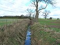
 Across Roos Drain, near Halsham - geograph.org.uk - 1768041.jpg 640 × 466; 174 KB
-
 Adlingfleet - All Saints Church - geograph.org.uk - 1740857.jpg 640 × 480; 89 KB
-
 All Saints Church, Hessle - geograph.org.uk - 1774448.jpg 640 × 480; 49 KB
-
 All Saints Church, North Cave - geograph.org.uk - 1772875.jpg 640 × 480; 128 KB
-
 All Saints Church, Roos - geograph.org.uk - 1766439.jpg 454 × 640; 184 KB
-
 All Saints Church, Tunstall - geograph.org.uk - 1743070.jpg 800 × 600; 123 KB
-
 Along the line to Beverley Station - geograph.org.uk - 1774976.jpg 640 × 480; 134 KB
-
 Anlaby Common - geograph.org.uk - 1774468.jpg 640 × 480; 66 KB
-
 Arthur Street, Withernsea - geograph.org.uk - 1743249.jpg 800 × 600; 114 KB
-
 B1230 towards North Cave - geograph.org.uk - 1733461.jpg 800 × 600; 172 KB
-
 B1230 towards Walkington - geograph.org.uk - 1733145.jpg 800 × 600; 118 KB
-
 B1231 towards North Ferriby - geograph.org.uk - 1733646.jpg 800 × 600; 112 KB
-
 B1232 towards Hessle - geograph.org.uk - 1774437.jpg 640 × 480; 85 KB
-
 Barmston Main Drain at Barmston Sea End - geograph.org.uk - 1780515.jpg 3,504 × 1,971; 1.11 MB
-
 Barmston Main Drain from Barmston Sea End - geograph.org.uk - 1780462.jpg 3,431 × 1,930; 867 KB
-
 Baulk Cottage, near Winestead - geograph.org.uk - 1739355.jpg 640 × 592; 181 KB
-
 Beach Huts, South Sands - geograph.org.uk - 1745887.jpg 800 × 599; 110 KB
-
 Beach near Tunstall - geograph.org.uk - 1743035.jpg 800 × 600; 74 KB
-
 Beach North of Withernsea - geograph.org.uk - 1743305.jpg 800 × 600; 110 KB
-
 South transept, Beverley Minster - geograph.org.uk - 1774861.jpg 480 × 640; 129 KB
-
 Times of services at Beverley Minster - geograph.org.uk - 1774743.jpg 640 × 465; 135 KB
-
 Beverley Minster - geograph.org.uk - 1733055.jpg 800 × 600; 135 KB
-
 Beverley Minster - geograph.org.uk - 1774828.jpg 640 × 480; 131 KB
-
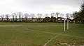
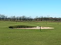 Beverley Westwood Golf Course - geograph.org.uk - 1733139.jpg 800 × 600; 96 KB
-
 Bin day, Winestead - geograph.org.uk - 1739332.jpg 640 × 415; 192 KB
-
 Bio Ethanol on the Way - geograph.org.uk - 1773771.jpg 3,648 × 2,736; 6.51 MB
-

-
 Blacktoft Sands RSPB Reserve - geograph.org.uk - 1742115.jpg 640 × 480; 61 KB
-
 Bluestone Bottoms - geograph.org.uk - 1733477.jpg 800 × 600; 151 KB
-
 Bluestone Farm - geograph.org.uk - 1733472.jpg 800 × 582; 68 KB
-
 Bridge Farm, Old Goole - geograph.org.uk - 1776190.jpg 640 × 455; 216 KB
-
 Bridleway near Model Farm - geograph.org.uk - 1774072.jpg 640 × 480; 116 KB
-
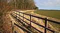
 Bridleway off the B1230 - geograph.org.uk - 1733162.jpg 800 × 600; 183 KB
-
 Bridleway to Halfpenny Gate Cottage - geograph.org.uk - 1733467.jpg 800 × 600; 182 KB
-
 Bridleway to Halfpenny Gate Cottage - geograph.org.uk - 1733493.jpg 800 × 600; 159 KB
-
 Bridleway to Halfpenny Gate Cottage - geograph.org.uk - 1733496.jpg 800 × 600; 168 KB
-
 Bridleway towards Cottingham - geograph.org.uk - 1774085.jpg 640 × 480; 66 KB
-
 Bridleway towards Cottingham - geograph.org.uk - 1774088.jpg 640 × 480; 52 KB
-
 British Isles rural and coastal (4452303640).jpg 2,048 × 1,371; 863 KB
-
 British Isles rural and coastal Lincolnshire (4452298172).jpg 2,048 × 1,371; 763 KB
-
 Bursting at the Seams - geograph.org.uk - 1746000.jpg 3,648 × 2,736; 2.21 MB
-
-
 Bydales Lane, Winestead - geograph.org.uk - 1737940.jpg 640 × 426; 210 KB
-
 Byway, North Ferriby - geograph.org.uk - 1733653.jpg 800 × 600; 176 KB
-
 Chalk cliffs and beaches - geograph.org.uk - 1774407.jpg 3,504 × 1,971; 1.46 MB
-
 Chapel Street and the Fishermans Memorial - geograph.org.uk - 1768873.jpg 3,010 × 1,693; 2.16 MB
-
 Christ Church, Cottingham - geograph.org.uk - 1774274.jpg 640 × 480; 84 KB
-
 Church Farm, Tunstall - geograph.org.uk - 1743075.jpg 800 × 600; 122 KB
-
 Church of St. Barnabas, Swanland - geograph.org.uk - 1733636.jpg 800 × 600; 101 KB
-
 Churchyard gate and Church Lane - geograph.org.uk - 1774268.jpg 2,470 × 1,379; 3.37 MB
-
 Cliff erosion, Holderness (4451525067).jpg 2,048 × 1,371; 731 KB
-
 Cliff erosion, Holderness (4451528999).jpg 2,048 × 1,371; 297 KB
-
 Cliff Top Path, Withernsea South - geograph.org.uk - 1743454.jpg 800 × 600; 104 KB
-
 Cliff Top Track, Tunstall Cliffs - geograph.org.uk - 1743049.jpg 800 × 600; 72 KB
-
 Clifton Gardens, Goole - geograph.org.uk - 1776370.jpg 640 × 445; 204 KB
-
 Clifton Hotel, Goole - geograph.org.uk - 1776922.jpg 640 × 490; 203 KB
-
 Cobbled Highgate, Beverley - geograph.org.uk - 1773106.jpg 480 × 640; 108 KB
-
 Coppleflat Lane, Bentley - geograph.org.uk - 1733523.jpg 800 × 600; 126 KB
-
 Council Offices, Cottingham - geograph.org.uk - 1774289.jpg 640 × 480; 77 KB
-
 Crossing Cottage, Cottingham - geograph.org.uk - 1774141.jpg 640 × 514; 90 KB
-
 Cycle path beside Priory Road - geograph.org.uk - 1774580.jpg 640 × 480; 79 KB
-
 Cycle Path beside the A15 - geograph.org.uk - 1734678.jpg 800 × 600; 169 KB
-
 Cycle Path near the A164 - geograph.org.uk - 1733534.jpg 800 × 600; 145 KB
-
 Drainage ditch beside the B1232 - geograph.org.uk - 1774429.jpg 640 × 480; 148 KB
-
 Drinking Fountain, Hornsea - geograph.org.uk - 1779347.jpg 1,600 × 986; 1.31 MB
-
 Dual Connection - geograph.org.uk - 1730832.jpg 3,648 × 2,736; 5.79 MB
-
 Duck Pond, Bentley - geograph.org.uk - 1733520.jpg 800 × 600; 182 KB
-
 Duck swims across grid line - geograph.org.uk - 1772904.jpg 640 × 480; 150 KB
-
 Dunflat Road - geograph.org.uk - 1733500.jpg 800 × 600; 176 KB
-
 Dunswell Road - geograph.org.uk - 1774150.jpg 640 × 480; 78 KB
-
 Dunswell Road near North farm - geograph.org.uk - 1774160.jpg 640 × 480; 53 KB
-
 Easington All Saints Church - panoramio.jpg 1,000 × 654; 448 KB
-
 Easington beach - panoramio.jpg 1,000 × 666; 359 KB
-
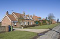
 East End, Halsham - geograph.org.uk - 1736536.jpg 640 × 426; 216 KB
-
 Eastgate, Beverley - geograph.org.uk - 1775040.jpg 640 × 480; 146 KB
-
 Elim Gardens, Hornsea - geograph.org.uk - 1779317.jpg 1,600 × 1,200; 1.82 MB
-
 End of the road Easington - panoramio.jpg 1,000 × 666; 433 KB
-
 End of the Road, Tunstall Cliffs - geograph.org.uk - 1743039.jpg 800 × 600; 96 KB
-
 Endyke Lane, Cottingham - geograph.org.uk - 1774278.jpg 640 × 480; 118 KB
-
 Entering sunny Swinefleet - geograph.org.uk - 1740761.jpg 640 × 473; 62 KB
-
 Eppleworth Grange - geograph.org.uk - 1733574.jpg 800 × 600; 97 KB
-
 Far Stions Farm - geograph.org.uk - 1733571.jpg 800 × 600; 170 KB
-
 Farm at Fraisethorpe Sands - geograph.org.uk - 1731170.jpg 3,664 × 2,748; 5.05 MB
-
 Farm Building, Main Street, Tunstall - geograph.org.uk - 1743080.jpg 800 × 600; 89 KB
-
 Farm Track off Ferriby High Road - geograph.org.uk - 1734602.jpg 800 × 600; 105 KB
-
 Farm Track off Walkington Road - geograph.org.uk - 1733484.jpg 800 × 600; 157 KB
-
 Farmland East of North Ferriby - geograph.org.uk - 1733654.jpg 800 × 600; 130 KB
-
 Farmland near Bentley - geograph.org.uk - 1733522.jpg 800 × 600; 80 KB
-
 Farmland near Bluestone Farm - geograph.org.uk - 1733475.jpg 800 × 600; 146 KB
-
 Farmland near Kirk Ella Grange - geograph.org.uk - 1733613.jpg 800 × 600; 126 KB
-
 Farmland near Little Wauldby Farm - geograph.org.uk - 1733620.jpg 800 × 600; 145 KB
-
 Farmland near Little Weighton - geograph.org.uk - 1733490.jpg 800 × 600; 99 KB
-
 Farmland near Model Farm - geograph.org.uk - 1774063.jpg 640 × 480; 74 KB
-
 Farmland near Model Farm - geograph.org.uk - 1774074.jpg 640 × 465; 66 KB
-
 Farmland near Park Farm - geograph.org.uk - 1733512.jpg 800 × 600; 117 KB
-
 Farmland near Poplar Farm - geograph.org.uk - 1774087.jpg 640 × 482; 79 KB
-
 Farmland near Risby Grange - geograph.org.uk - 1733504.jpg 800 × 600; 141 KB
-
 Farmland near Welton Wold Farm - geograph.org.uk - 1734770.jpg 800 × 600; 126 KB
-
 Farmland near Woodhouse Farm - geograph.org.uk - 1733600.jpg 800 × 600; 128 KB
-
 Farmland North of Jenny Brough Lane - geograph.org.uk - 1734725.jpg 800 × 600; 124 KB
-
 Farmland North of Little Weighton - geograph.org.uk - 1733479.jpg 800 × 600; 122 KB
-
 Farmland North of the Humber - geograph.org.uk - 1734634.jpg 800 × 600; 116 KB
-
 Farmland off Beverley Road - geograph.org.uk - 1733563.jpg 800 × 600; 55 KB
-
 Farmland off Dunswell Road - geograph.org.uk - 1774158.jpg 640 × 480; 51 KB
-
 Farmland off Greenstiles Lane - geograph.org.uk - 1733639.jpg 800 × 600; 124 KB
-
 Farmland off Melton Bottom - geograph.org.uk - 1733627.jpg 800 × 600; 157 KB
-
 Farmland off Priory Road - geograph.org.uk - 1774573.jpg 640 × 480; 67 KB
-
 Farmland off Riplingham Road - geograph.org.uk - 1733554.jpg 800 × 600; 87 KB
-
 Farmland off Riplingham Road - geograph.org.uk - 1733556.jpg 800 × 600; 144 KB
-
 Farmland off Shepherd Lane - geograph.org.uk - 1774048.jpg 640 × 480; 58 KB
-
 Farmland off Shepherd Lane - geograph.org.uk - 1774055.jpg 640 × 480; 69 KB
-
 Farmland off Swanland Dale - geograph.org.uk - 1733616.jpg 800 × 600; 122 KB
-
 Farmland off Swanland Dale - geograph.org.uk - 1733622.jpg 800 × 600; 198 KB
-
 Farmland off the B1231 - geograph.org.uk - 1733644.jpg 800 × 600; 77 KB
-
 Farmland off Westfield Road - geograph.org.uk - 1733605.jpg 800 × 600; 176 KB
-
 Farmland off Willerby Low Road - geograph.org.uk - 1774313.jpg 640 × 480; 63 KB
-
 Farmland West of Halfpenny Gate Cottage - geograph.org.uk - 1733470.jpg 800 × 600; 118 KB
-
 Farmland west of Priory Road - geograph.org.uk - 1774565.jpg 640 × 480; 90 KB
-
 Farmland West of Walkington - geograph.org.uk - 1733462.jpg 800 × 600; 149 KB
-
 Farmland, Eppleworth - geograph.org.uk - 1733578.jpg 800 × 600; 144 KB
-
 Farmland, Risby Park - geograph.org.uk - 1733495.jpg 800 × 600; 156 KB
-
 Farmland, Tunstall - geograph.org.uk - 1743063.jpg 800 × 600; 103 KB
-
 Farmland, Westwood - geograph.org.uk - 1733127.jpg 800 × 600; 102 KB
-
 Ferriby High Road - geograph.org.uk - 1734605.jpg 800 × 600; 166 KB
-
 Fertiliser, Farming and Ferry - geograph.org.uk - 1737437.jpg 3,282 × 2,424; 1.68 MB
-
 Field drain near Burn Park Cottages - geograph.org.uk - 1774102.jpg 640 × 480; 71 KB
-
 Field drain near Poplar Farm - geograph.org.uk - 1774079.jpg 640 × 480; 100 KB
-
 Fir Tree Farm, Winestead - geograph.org.uk - 1739247.jpg 640 × 458; 197 KB
-
 First Lane - geograph.org.uk - 1774456.jpg 640 × 480; 65 KB
-
 First Lane - geograph.org.uk - 1774462.jpg 640 × 480; 82 KB
-
 Flamborough Castle - geograph.org.uk - 1771992.jpg 3,344 × 1,881; 5.15 MB
-
 Flamborough Castle - geograph.org.uk - 1772013.jpg 2,854 × 1,628; 1.05 MB
-
 Flamborough Castle - geograph.org.uk - 1772032.jpg 3,340 × 1,879; 1,006 KB
-

-
-

-
 Footpath from Flamborough - geograph.org.uk - 1772739.jpg 640 × 360; 74 KB
-
 Footpath junction near Halsham - geograph.org.uk - 1767424.jpg 484 × 640; 185 KB
-
 Footpath to Beverley - geograph.org.uk - 1774053.jpg 640 × 480; 94 KB
-
 Footpath to Flamborough - geograph.org.uk - 1772721.jpg 640 × 360; 99 KB
-
 Footpath to Flamborough - geograph.org.uk - 1772753.jpg 640 × 360; 81 KB
-
 Footpath to Flamborough - geograph.org.uk - 1772768.jpg 640 × 360; 73 KB
-
 Footpath, Owthorne - geograph.org.uk - 1743391.jpg 800 × 600; 72 KB
-
 Former school, North Cave - geograph.org.uk - 1772879.jpg 640 × 458; 129 KB
-
 Foss Farm - geograph.org.uk - 1733943.jpg 3,488 × 2,616; 4.6 MB
-
 St. Edmund's Church Fraisthorpe - geograph.org.uk - 1731200.jpg 3,116 × 2,554; 4.51 MB
-
 Fraisthorpe Beach - geograph.org.uk - 1731133.jpg 3,488 × 2,616; 4.2 MB
-
 Fraisthorpe Beach - geograph.org.uk - 1731150.jpg 3,488 × 2,616; 4.38 MB
-
 Garden centre, Cottingham - geograph.org.uk - 1774133.jpg 640 × 480; 55 KB
-
 Gatesby Road, Goole - geograph.org.uk - 1776354.jpg 640 × 446; 205 KB
-
 Geyhorn Bridge, near Halsham - geograph.org.uk - 1768038.jpg 640 × 456; 212 KB
-
 Godman's Lane, Kirk Ella - geograph.org.uk - 1774398.jpg 640 × 480; 75 KB
-
 Goole and District Hospital - geograph.org.uk - 1776337.jpg 640 × 411; 180 KB
-
 Goole cranes - geograph.org.uk - 1776144.jpg 547 × 640; 228 KB
-
 Goole gasometer - geograph.org.uk - 1776110.jpg 496 × 640; 219 KB
-
 Grain silos, Goole - geograph.org.uk - 1777608.jpg 640 × 544; 189 KB
-
 Grain wharf, Goole - geograph.org.uk - 1780210.jpg 628 × 640; 240 KB
-
 Grazing land off Dunswell Road - geograph.org.uk - 1774153.jpg 640 × 480; 62 KB
-
 Grazing Land off Wood Hill Way - geograph.org.uk - 1733542.jpg 800 × 600; 146 KB
-
 Greenstiles Lane, Swanland - geograph.org.uk - 1733640.jpg 800 × 600; 160 KB
-
 Groyne, Withernsea Beach - geograph.org.uk - 1743276.jpg 800 × 570; 74 KB
-
 Groyne, Withernsea South Beach - geograph.org.uk - 1743424.jpg 800 × 600; 92 KB
-
 Guest House on Keldgate, Beverley - geograph.org.uk - 1733079.jpg 800 × 600; 146 KB
-
 Gypsey Race Burton Fleming 3 (Nigel Coates).jpg 2,592 × 1,944; 910 KB
-
 Gypsey Race Burton Fleming 5 (Nigel Coates).jpg 2,592 × 1,944; 1.54 MB
-
 Halsham Carrs - geograph.org.uk - 1767635.jpg 640 × 426; 188 KB
-
 Halsham footpath - geograph.org.uk - 1767648.jpg 485 × 640; 203 KB
-
 Heads Lane, Hessle Mount - geograph.org.uk - 1734703.jpg 800 × 600; 129 KB
-
 Heber Street, Old Goole - geograph.org.uk - 1776214.jpg 640 × 480; 217 KB
-
 Hedgerow and Field near Risby Grange - geograph.org.uk - 1733508.jpg 800 × 600; 196 KB
-
 Hedgerow beside Tranby Lane - geograph.org.uk - 1774419.jpg 640 × 480; 137 KB
-
 Hedon Churchyard Daffodils - geograph.org.uk - 1773789.jpg 2,526 × 3,472; 3.16 MB
-
 Heron Leaving Dyke - geograph.org.uk - 1740982.jpg 2,180 × 1,473; 2.28 MB
-
 Holderness Country Park - geograph.org.uk - 1743084.jpg 800 × 600; 95 KB
-
 Holme, or Vavasour's Canal - geograph.org.uk - 1752508.jpg 2,304 × 1,728; 1.59 MB
-
 Hornsea Sea Wall and Promenade - geograph.org.uk - 1779332.jpg 1,293 × 1,037; 1.42 MB
-
 Hotel Elizabeth - geograph.org.uk - 1734627.jpg 800 × 600; 86 KB
-
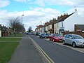
 Houses on Kingston Road - geograph.org.uk - 1774367.jpg 640 × 471; 49 KB
-
 Humberside Police HQ - geograph.org.uk - 1774567.jpg 640 × 480; 65 KB
-
 It wasnt real love!! (4469140323).jpg 5,070 × 2,766; 3.39 MB
-
 Ivy Lane Shadows - geograph.org.uk - 1743228.jpg 3,648 × 2,736; 4.37 MB
-
 Jenny Brough Lane, Hessle - geograph.org.uk - 1734733.jpg 800 × 600; 85 KB
-
-
 Junction, Goole - geograph.org.uk - 1776279.jpg 640 × 467; 227 KB
-
 Kingston Road (B1232) - geograph.org.uk - 1774369.jpg 640 × 480; 75 KB
-
 Ladygate, Beverley - geograph.org.uk - 1773056.jpg 625 × 640; 151 KB
-
 Land drains near Halsham - geograph.org.uk - 1733463.jpg 426 × 640; 209 KB
-
 Lazaat Hotel - geograph.org.uk - 1733536.jpg 800 × 600; 140 KB
-
 Level crossing, Flemingate - geograph.org.uk - 1774951.jpg 640 × 480; 114 KB
-
 Lighthouse Road - B1259 - geograph.org.uk - 1771744.jpg 640 × 360; 48 KB
-
 Lily Lane - geograph.org.uk - 1771680.jpg 640 × 360; 62 KB
-
 Lily Lane and St. Oswald's Parish Church - geograph.org.uk - 1774195.jpg 640 × 640; 140 KB
-
 Lime Avenue, off the Parkway - geograph.org.uk - 1774384.jpg 640 × 480; 59 KB
-
 Lincoln Way, Beverley - geograph.org.uk - 1774042.jpg 640 × 480; 64 KB
-
 Lincoln Way, Beverley - geograph.org.uk - 1774046.jpg 640 × 480; 66 KB


.jpg)
.jpg)


.jpg)
.jpg)


_near_Reedness_-_geograph.org.uk_-_1740750.jpg)


.jpg)
.jpg)


.jpg)


_-_geograph.org.uk_-_1774369.jpg)


