Category:March 2009 in Derbyshire
Jump to navigation
Jump to search
Deutsch: Bilder, die im März 2009 in Derbyshire aufgenommen worden sind. Bitte beachten Sie, dass dies weder das Datum des Uploads noch das Datum des Scannens eines Fotos ist.
English: Images/pictures taken in Derbyshire during March 2009. Note this is not the date of the upload, nor the date a photo was scanned.
Español: Fotografías o imágenes tomadas en Derbyshire durante marzo 2009. No es la fecha de subida ni escaneo, sino la fecha en que las fotografías o imágenes se crearon.
Esperanto: Bildoj faritaj en Derbyshire en marto 2009. Tio ne estas la dato, kiam la bildoj estis alŝutitaj aŭ skanitaj.
Français : Photographies ou images prises en Derbyshire durant mars 2009. Ce n'est pas la date du téléchargement ou du scan.
Galego: Fotografías ou imaxes tomadas en Derbyshire durante marzo 2009. Non é a data de subida nin escaneamento, senón a data na que se crearon as fotografías ou imaxes.
Italiano: Fotografie o immagini scattate a Derbyshire nel marzo 2009. Nota bene: la data non si riferisce né a quella di upload né a quella in cui la foto è stata digitalizzata.
Norsk bokmål: Bilder tatt i Derbyshire i løpet av mars 2009. Merk at dette ikke er datoen for opplasting, eller når et bilde har blitt skannet.
Norsk nynorsk: Bilete teke i Derbyshire i løpet av mars 2009. Merk at dette ikkje er datoen for opplasting, eller når eit bilete har vorte skanna.
Русский: Изображения, сделанные в Derbyshire в течение март 2009 (не дата загрузки изображения).
Українська: Зображення, зроблені в Derbyshire протягом березень 2009. Зауважте, що це не дата завантаження чи дата сканування фотографії.
| March 2008 | ← | March 2009 | → | March 2010 | |||||||
| Jan | Feb | Mar | Apr | May | Jun | Jul | Aug | Sep | Oct | Nov | Dec |
| 55 | 60 | 77 | 182 | 72 | 58 | 75 | 74 | 63 | 273 | 62 | 35 |
|---|---|---|---|---|---|---|---|---|---|---|---|
Media in category "March 2009 in Derbyshire"
The following 77 files are in this category, out of 77 total.
-
 'Archie' - a screwy generator. - geograph.org.uk - 1206726.jpg 640 × 427; 98 KB
-
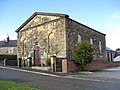 Fritchley Congregational Church - geograph.org.uk - 1194923.jpg 640 × 480; 83 KB
-
 43046 Claycross Jct (3354003829).jpg 2,523 × 2,112; 1.39 MB
-
 43366 Chesterfield 2009-03-20.JPG 3,872 × 2,592; 4.71 MB
-
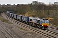 66414 Claycross Jct (3353560410).jpg 3,457 × 2,305; 2.33 MB
-
 Hathersage railway station in 2009.jpg 640 × 427; 88 KB
-
 Marston on Dove, St Mary.jpg 1,024 × 843; 251 KB
-
 River Wye near Ashford in the Water - geograph.org.uk - 1227881.jpg 640 × 480; 144 KB
-
 20901 & 20905 Coney Green,Claycross (3371083972).jpg 2,929 × 2,085; 1.98 MB
-
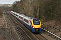 222001 South Wingfield,Derbyshire (3353410637).jpg 3,168 × 2,060; 2.93 MB
-
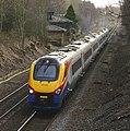 222002 South Wingfield (3353510801).jpg 1,878 × 1,890; 1.14 MB
-
 222003 Tapton Jct (3388124060).jpg 2,143 × 3,215; 4.34 MB
-
 31459 on the rear of 1Q17 (3370708823).jpg 2,000 × 1,333; 1.25 MB
-
 43058 Coney Green (3370709975).jpg 2,000 × 1,333; 1.31 MB
-
 59201 Claycross (3357114148).jpg 2,996 × 2,247; 3.33 MB
-
 66037 Claycross (3370576269).jpg 2,230 × 2,973; 2.57 MB
-
 66083 South Wingfield (3391375159).jpg 3,400 × 2,589; 3.26 MB
-
 66418 South Wingfield (3354280194).jpg 2,581 × 2,175; 1.92 MB
-
 66515 Claycross Jct (3371569418).jpg 3,629 × 2,549; 5.93 MB
-
 66557 Claycross Jct (3352798487).jpg 2,485 × 2,017; 2.41 MB
-
-
-
 Bakewell - geograph-1663298-by-Bill-Boaden.jpg 640 × 428; 57 KB
-
 Big Moor - geograph.org.uk - 1731564.jpg 640 × 480; 65 KB
-
 Buxton Opera House ceiling 3359874033.jpg 3,173 × 1,967; 1.55 MB
-
 BuxtonOperaHouse.jpg 3,872 × 2,592; 4.2 MB
-
 Class 37,s in the consist of 6Z37 (3370685701).jpg 2,000 × 1,333; 1.52 MB
-
 Class 37,s in the consist of 6Z37 (3371505746).jpg 2,000 × 1,333; 1.56 MB
-
 Clifton Station - geograph.org.uk - 1223941.jpg 640 × 480; 83 KB
-
 Fields below Pentrich - geograph.org.uk - 1211833.jpg 640 × 479; 49 KB
-
 FN04 BSY Claycross.jpg 2,000 × 1,639; 1.74 MB
-
 FN04BSU Claycross.jpg 2,679 × 1,786; 1.45 MB
-
 Footpath and Troughs near Shirland - geograph.org.uk - 1198743.jpg 640 × 480; 94 KB
-
 Footpath at Bridge Farm - geograph.org.uk - 1211843.jpg 640 × 479; 106 KB
-
 Footpath at Lower Hartshay - geograph.org.uk - 1210155.jpg 640 × 307; 61 KB
-
 Footpath at Lower Hartshay - geograph.org.uk - 1211803.jpg 479 × 640; 110 KB
-

-

-
 Footpath from Thornsett - geograph.org.uk - 1207588.jpg 640 × 480; 157 KB
-
 Footpath near Briargrove Farm - geograph.org.uk - 1207595.jpg 640 × 480; 111 KB
-
 Footpath near Fivewells Farms - geograph.org.uk - 1213004.jpg 640 × 480; 166 KB
-
 Footpath near Melbourne Farm - geograph.org.uk - 1216631.jpg 640 × 480; 136 KB
-

-
 Footpath to Fritchley - geograph.org.uk - 1200375.jpg 640 × 480; 149 KB
-

-
 Footpath to Pentrich - geograph.org.uk - 1211835.jpg 479 × 640; 72 KB
-
 Footpath to Priestcliffe - geograph.org.uk - 1213089.jpg 640 × 480; 154 KB
-
 Footpath toward Highlow Farm - geograph.org.uk - 1216183.jpg 640 × 480; 124 KB
-
 Footpath towards Arnfield - geograph.org.uk - 1191275.jpg 640 × 480; 141 KB
-
 Footpath towards Ashford in the Water - geograph.org.uk - 1228175.jpg 640 × 480; 127 KB
-
 Footpath towards Ayton Farm - geograph.org.uk - 1207603.jpg 640 × 480; 140 KB
-
 Footpath towards Chapel-en-le-Frith - geograph.org.uk - 1226212.jpg 640 × 480; 199 KB
-
 Footpath towards Far Cown Edge Farm - geograph.org.uk - 1207648.jpg 640 × 480; 130 KB
-
 Footpath towards Monyash - geograph.org.uk - 1216244.jpg 640 × 480; 153 KB
-
 Footpath towards Over Haddon - geograph.org.uk - 1216593.jpg 640 × 480; 145 KB
-
 Footpath towards Over Haddon - geograph.org.uk - 1216603.jpg 640 × 480; 146 KB
-
 Footpath towards Over Haddon - geograph.org.uk - 1216626.jpg 640 × 480; 138 KB
-
 Footpath towards Roych Farm - geograph.org.uk - 1226220.jpg 640 × 480; 125 KB
-
 Footpath towards Stanley House - geograph.org.uk - 1227871.jpg 640 × 480; 108 KB
-
 Former Great Longstone for Ashford Station (geograph 1664404).jpg 3,872 × 2,592; 3.26 MB
-
 G H B Ward Walk way marker - geograph.org.uk - 1198993.jpg 640 × 480; 105 KB
-
 King Street, Long Eaton - geograph.org.uk - 1202279.jpg 640 × 480; 68 KB
-
 Leyland Tiger Alizee, D229 HMT.jpg 3,000 × 2,061; 2.42 MB
-
 Millers Dale Station (geograph 1664518).jpg 3,872 × 2,592; 3.17 MB
-

-
 Optare Excel 35001, Claycross.jpg 3,000 × 2,000; 2.14 MB
-
 Salter's Brook Bridge - geograph.org.uk - 1204754.jpg 640 × 480; 139 KB
-
 Sawmills - River Amber - geograph.org.uk - 1191108.jpg 640 × 480; 100 KB
-
 Sheep pens by Barbrook Bridge - geograph.org.uk - 1198987.jpg 640 × 480; 91 KB
-
 Small reservoir near Barbrook Reservoir - geograph.org.uk - 1218696.jpg 480 × 640; 124 KB
-
 Stone circle and cairn - geograph.org.uk - 1214808.jpg 640 × 480; 206 KB
-
 The Torrs, New Mill - geograph.org.uk - 1206714.jpg 640 × 427; 88 KB
-
 The Victoria Inn - geograph.org.uk - 1225822.jpg 640 × 480; 188 KB
-
 Tommy Nutt,s carpet shop,Claycross (3376011381).jpg 2,000 × 1,500; 1.43 MB
-
 Vacant allotment (3377304986).jpg 2,000 × 1,500; 1.59 MB
-
 View from Lady's Cross, Big Moor - geograph.org.uk - 1198996.jpg 640 × 480; 77 KB
-
 Approaching Park Lane Railway Bridge - geograph.org.uk - 1195023.jpg 640 × 480; 125 KB


.jpg)

.jpg)


.jpg)
.jpg)
.jpg)
.jpg)
.jpg)
.jpg)
.jpg)
.jpg)
.jpg)
.jpg)
.jpg)
.jpg)


.jpg)
.jpg)


_-_geograph.org.uk_-_1206253.jpg)


.jpg)


.jpg)


.jpg)
.jpg)

