Category:August 2009 in the East Riding of Yorkshire
Jump to navigation
Jump to search
Ceremonial counties of England: Bedfordshire · Berkshire · Buckinghamshire · Cambridgeshire · Cheshire · Cornwall · Cumbria · Derbyshire · Devon · Dorset · East Riding of Yorkshire · East Sussex · Essex · Gloucestershire · Greater London · Greater Manchester · Hampshire · Herefordshire · Hertfordshire · Isle of Wight · Kent · Lancashire · Leicestershire · Lincolnshire · Merseyside · Norfolk · North Yorkshire · Northamptonshire · Northumberland · Nottinghamshire · Oxfordshire · Shropshire · Somerset · South Yorkshire · Staffordshire · Suffolk · Surrey · Tyne and Wear · Warwickshire · West Midlands · West Sussex · West Yorkshire · Wiltshire · Worcestershire
City-counties: Bristol ·
Former historic counties:
Other former counties:
City-counties: Bristol ·
Former historic counties:
Other former counties:
Deutsch: Bilder, die im August 2009 in the East Riding of Yorkshire aufgenommen worden sind. Bitte beachten Sie, dass dies weder das Datum des Uploads noch das Datum des Scannens eines Fotos ist.
English: Images/pictures taken in the East Riding of Yorkshire during August 2009. Note this is not the date of the upload, nor the date a photo was scanned.
Español: Fotografías o imágenes tomadas en the East Riding of Yorkshire durante agosto 2009. No es la fecha de subida ni escaneo, sino la fecha en que las fotografías o imágenes se crearon.
Esperanto: Bildoj faritaj en the East Riding of Yorkshire en aŭgusto 2009. Tio ne estas la dato, kiam la bildoj estis alŝutitaj aŭ skanitaj.
Français : Photographies ou images prises en the East Riding of Yorkshire durant août 2009. Ce n'est pas la date du téléchargement ou du scan.
Galego: Fotografías ou imaxes tomadas en the East Riding of Yorkshire durante agosto 2009. Non é a data de subida nin escaneamento, senón a data na que se crearon as fotografías ou imaxes.
Italiano: Fotografie o immagini scattate a the East Riding of Yorkshire nel agosto 2009. Nota bene: la data non si riferisce né a quella di upload né a quella in cui la foto è stata digitalizzata.
Norsk bokmål: Bilder tatt i the East Riding of Yorkshire i løpet av august 2009. Merk at dette ikke er datoen for opplasting, eller når et bilde har blitt skannet.
Norsk nynorsk: Bilete teke i the East Riding of Yorkshire i løpet av august 2009. Merk at dette ikkje er datoen for opplasting, eller når eit bilete har vorte skanna.
Русский: Изображения, сделанные в the East Riding of Yorkshire в течение август 2009 (не дата загрузки изображения).
Українська: Зображення, зроблені в the East Riding of Yorkshire протягом серпень 2009. Зауважте, що це не дата завантаження чи дата сканування фотографії.
| August 2008 | ← | August 2009 | → | August 2010 | |||||||
| Jan | Feb | Mar | Apr | May | Jun | Jul | Aug | Sep | Oct | Nov | Dec |
| 148 | 203 | 905 | 767 | 930 | 719 | 783 | 588 | 336 | 712 | 202 | 287 |
|---|---|---|---|---|---|---|---|---|---|---|---|
Subcategories
This category has the following 2 subcategories, out of 2 total.
H
Media in category "August 2009 in the East Riding of Yorkshire"
The following 200 files are in this category, out of 586 total.
(previous page) (next page)-
 Field Boundary and Hedgerow - geograph.org.uk - 1453847.jpg 640 × 480; 122 KB
-
 Minor Road Towards Watton - geograph.org.uk - 1453844.jpg 640 × 480; 59 KB
-
 Provence Farm - geograph.org.uk - 1466186.jpg 640 × 480; 52 KB
-
 Middlebeck Bank - geograph.org.uk - 1466176.jpg 640 × 480; 54 KB
-
 Pylons off Ings Lane - geograph.org.uk - 1466179.jpg 640 × 480; 69 KB
-
 A Burstwick Gravel Pond - geograph.org.uk - 1426183.jpg 640 × 480; 120 KB
-
 A Burstwick Pond - geograph.org.uk - 1426867.jpg 640 × 480; 127 KB
-
 A Burstwick Pond at Sunset - geograph.org.uk - 1426188.jpg 528 × 640; 74 KB
-
 A Cracking Road There - geograph.org.uk - 1460260.jpg 480 × 640; 128 KB
-

-
 A popular route^ - geograph.org.uk - 1430340.jpg 640 × 480; 134 KB
-
 A Rural Scene - geograph.org.uk - 1429337.jpg 640 × 480; 84 KB
-
 A15 Roundabout, Hessle - geograph.org.uk - 1461483.jpg 640 × 480; 64 KB
-
 A164 towards Beverley - geograph.org.uk - 1453860.jpg 640 × 480; 106 KB
-
 A164 towards Cranswick - geograph.org.uk - 1453863.jpg 640 × 480; 94 KB
-
 A165 towards Skirlaugh - geograph.org.uk - 1468269.jpg 640 × 480; 59 KB
-
 A165 towards Skirlaugh - geograph.org.uk - 1468279.jpg 640 × 480; 74 KB
-
 A63 towards the M62 - geograph.org.uk - 1462053.jpg 640 × 491; 48 KB
-
 Access road to Beech Farm.jpg 640 × 480; 76 KB
-
 After the Harvest - geograph.org.uk - 1453662.jpg 640 × 416; 103 KB
-
 After the harvest, Lund - geograph.org.uk - 1444856.jpg 475 × 640; 185 KB
-
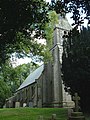
 All Hallows Church, Goodmanham - geograph.org.uk - 1432153.jpg 640 × 480; 65 KB
-
 All Saints C. of E., Rise - geograph.org.uk - 1427025.jpg 427 × 640; 335 KB
-
 All Saints Church gate, Rise - geograph.org.uk - 1427048.jpg 574 × 640; 614 KB
-
 All Saints Church Londesborough 2.jpg 640 × 442; 66 KB
-
 All Saints Church, Mappleton - geograph.org.uk - 1467174.jpg 640 × 480; 59 KB
-
 All Saints Church, Rise - geograph.org.uk - 1467829.jpg 480 × 640; 102 KB
-
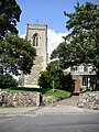
 All Saints Church, Thwing - geograph.org.uk - 1456181.jpg 640 × 427; 140 KB
-
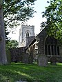
 All Saints Church, Thwing, burial ground - geograph.org.uk - 1456187.jpg 640 × 427; 193 KB
-
 All Saints Churchyard, Rise - geograph.org.uk - 1427035.jpg 640 × 427; 463 KB
-
 All Saints, Easington - geograph.org.uk - 1516210.jpg 480 × 640; 117 KB
-
 All Saints, Easington - geograph.org.uk - 1516215.jpg 480 × 640; 120 KB
-

-
 Applegarth Lane, East of Bainton - geograph.org.uk - 1453811.jpg 640 × 480; 109 KB
-
 Approach to Thorns Wood - geograph.org.uk - 1429339.jpg 640 × 480; 79 KB
-
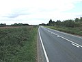
 B1242 towards Aldbrough - geograph.org.uk - 1442443.jpg 640 × 480; 62 KB
-
 B1242 towards Aldbrough - geograph.org.uk - 1442455.jpg 640 × 480; 56 KB
-
 B1242 towards Aldbrough - geograph.org.uk - 1442465.jpg 640 × 480; 47 KB
-
 B1242 towards Aldbrough - geograph.org.uk - 1442472.jpg 640 × 480; 71 KB
-
 B1242 towards Hornsea - geograph.org.uk - 1442499.jpg 640 × 480; 71 KB
-
 B1242 towards Hornsea - geograph.org.uk - 1442508.jpg 640 × 480; 62 KB
-
 B1243 towards Sigglesthorne - geograph.org.uk - 1463905.jpg 640 × 480; 87 KB
-
 B1243 towards Skirlaugh - geograph.org.uk - 1463923.jpg 640 × 480; 59 KB
-
 B1243 towards Skirlaugh - geograph.org.uk - 1467841.jpg 640 × 480; 82 KB
-
 B1244 towards Catwick - geograph.org.uk - 1463783.jpg 640 × 480; 76 KB
-
 B1244 towards Catwick - geograph.org.uk - 1463814.jpg 640 × 480; 56 KB
-
 B1244 towards Hornsea - geograph.org.uk - 1463750.jpg 640 × 480; 86 KB
-
 B1244 towards the A165 - geograph.org.uk - 1463867.jpg 640 × 480; 45 KB
-
 B1248 north of Lund - geograph.org.uk - 1445622.jpg 640 × 489; 180 KB
-
 Back Lane, Garton - geograph.org.uk - 1442433.jpg 640 × 480; 89 KB
-
 Balk Lane, Arnold - geograph.org.uk - 1468273.jpg 640 × 480; 60 KB
-
 Barf Lane - geograph.org.uk - 1426858.jpg 640 × 425; 60 KB
-
 Barley on Lund Moor - geograph.org.uk - 1444867.jpg 476 × 640; 203 KB
-
 Beach groynes, Withernsea - geograph.org.uk - 1515593.jpg 640 × 480; 50 KB
-
 Beach near Aldbrough - geograph.org.uk - 1442187.jpg 640 × 480; 53 KB
-
 Beck Plantation - geograph.org.uk - 1429224.jpg 640 × 480; 68 KB
-
 Beverley and Barmston Drain - geograph.org.uk - 1454061.jpg 640 × 480; 64 KB
-
 Beverley Minster - geograph.org.uk - 1463325.jpg 450 × 640; 55 KB
-
 Beverley Minster, Highgate-Pforte.jpg 1,536 × 2,048; 631 KB
-
 Beverley Minster, Langhaus-Nordseite.jpg 1,536 × 2,048; 554 KB
-
 Beverley Minster, Westfassade.jpg 1,536 × 2,048; 671 KB
-
 Beverley Road - geograph.org.uk - 1467553.jpg 640 × 480; 75 KB
-
 Bird ringing station near Kilnsea - geograph.org.uk - 1515285.jpg 640 × 480; 60 KB
-
 Boathouse, South Landing - geograph.org.uk - 1451759.jpg 640 × 480; 94 KB
-
 Bratt Wood, Nunburnholme - geograph.org.uk - 1430320.jpg 640 × 409; 93 KB
-
 Brickyard Lane ends - geograph.org.uk - 1462077.jpg 640 × 480; 75 KB
-
 Bridge over Drain - geograph.org.uk - 1467344.jpg 640 × 480; 121 KB
-
 Bridge over East Newton Drain - geograph.org.uk - 1442383.jpg 640 × 480; 74 KB
-
 Bridge over Trans Pennine Trail Hornsea.jpg 640 × 480; 145 KB
-
 Bridleway along Etton West Wood - geograph.org.uk - 1436710.jpg 640 × 535; 91 KB
-
 Bridleway East of Rise - geograph.org.uk - 1467746.jpg 640 × 480; 77 KB
-
 Bridleway Little Catwick.jpg 640 × 480; 57 KB
-
 Bridleway near Bugthorpe Beck - geograph.org.uk - 1429227.jpg 640 × 480; 135 KB
-
 Bridleway near Rise - geograph.org.uk - 1467734.jpg 640 × 480; 74 KB
-
 Bridleway near Sigglesthorne Grange - geograph.org.uk - 1463703.jpg 640 × 480; 124 KB
-
 Bridleway near Wetwang - geograph.org.uk - 1430767.jpg 480 × 640; 122 KB
-
 Bridleway South of Langthorpe Hall.jpg 640 × 480; 88 KB
-

-
 Bridleway to Beck Plantation, Bugthorpe - geograph.org.uk - 1429218.jpg 480 × 640; 130 KB
-
 Bridleway to Stud Farm - geograph.org.uk - 1463715.jpg 640 × 480; 94 KB
-
 Bridleway to Tibthorpe Lodge - geograph.org.uk - 1430772.jpg 640 × 480; 96 KB
-
 Bridleway towards Garton - geograph.org.uk - 1442372.jpg 640 × 480; 65 KB
-
 Bridleway towards Garton - geograph.org.uk - 1442386.jpg 640 × 480; 66 KB
-
 Bridleway towards Sigglesthorne - geograph.org.uk - 1467601.jpg 640 × 480; 105 KB
-
 Bridleway towards Weather Hill Farm - geograph.org.uk - 1463660.jpg 640 × 480; 85 KB
-
 Bridleway, Tophill Low - geograph.org.uk - 1454059.jpg 640 × 480; 120 KB
-
 Bromhill Farm - geograph.org.uk - 1467265.jpg 640 × 480; 88 KB
-
 Broomfleet Carr Lane junction - geograph.org.uk - 1466217.jpg 640 × 480; 62 KB
-
 Broomfleet Level Crossing - geograph.org.uk - 1466213.jpg 640 × 480; 62 KB
-
 Brough Level Crossing - geograph.org.uk - 1466145.jpg 640 × 480; 38 KB
-
 Bugthorpe Beck - geograph.org.uk - 1427698.jpg 480 × 640; 121 KB
-
 Bugthorpe Lane - geograph.org.uk - 1429231.jpg 640 × 480; 89 KB
-
 Bugthorpe Village Green - geograph.org.uk - 1429245.jpg 640 × 480; 94 KB
-
 Burn Butts - geograph.org.uk - 1453833.jpg 640 × 480; 48 KB
-
 Burnbutts Lane - geograph.org.uk - 1453831.jpg 640 × 480; 81 KB
-
 Burstwick Pond's Headquarters - geograph.org.uk - 1426857.jpg 640 × 406; 124 KB
-
 Bustard Nest Farm - geograph.org.uk - 1453842.jpg 640 × 463; 79 KB
-
 Cadger Castle junction near Wetwang - geograph.org.uk - 1430665.jpg 640 × 480; 65 KB
-
 Carr House Farm - geograph.org.uk - 1467935.jpg 640 × 480; 81 KB
-
 Carr Lane - geograph.org.uk - 1454141.jpg 640 × 480; 104 KB
-
 Carr Lane, Long Riston - geograph.org.uk - 1467924.jpg 640 × 480; 83 KB
-
 Catchwater Drain - geograph.org.uk - 1467547.jpg 640 × 480; 160 KB
-
 Catwick fields - geograph.org.uk - 1576057.jpg 640 × 480; 74 KB
-
 Catwick Fields being harvested - geograph.org.uk - 1576034.jpg 640 × 480; 173 KB
-
 Catwick Harvester - geograph.org.uk - 1576046.jpg 640 × 480; 96 KB
-
 Catwick Heads - geograph.org.uk - 1463801.jpg 640 × 480; 71 KB
-
 Catwick Lane Long Riston 1.jpg 640 × 480; 106 KB
-
 Catwick Lane, Long Riston - geograph.org.uk - 1467910.jpg 640 × 480; 93 KB
-
 Cave Crossing, Broomfleet - geograph.org.uk - 1466202.jpg 640 × 480; 66 KB
-
 Cave Road, Elloughton - geograph.org.uk - 1466149.jpg 640 × 480; 93 KB
-
 Church Farm, Garton - geograph.org.uk - 1442393.jpg 640 × 480; 58 KB
-
 Church Lane, East of Watton - geograph.org.uk - 1454135.jpg 640 × 480; 118 KB
-
 Church Lane, Nunburnholme - geograph.org.uk - 1429389.jpg 640 × 480; 61 KB
-
 Church Lane, Skirlaugh (B1243) - geograph.org.uk - 1468316.jpg 640 × 480; 54 KB
-
 Church Lane, Skirlaugh - geograph.org.uk - 1468310.jpg 640 × 480; 58 KB
-
 Church of All Saints, Tunstall - geograph.org.uk - 1516193.jpg 640 × 419; 60 KB
-
 Church of St Everilda, Everingham - geograph.org.uk - 1503463.jpg 640 × 480; 78 KB
-
 Church Street, Aldbrough - geograph.org.uk - 1442303.jpg 640 × 480; 64 KB
-
 Clegdike Bridge - geograph.org.uk - 1466221.jpg 640 × 480; 46 KB
-
 Cliff Road, Mappleton - geograph.org.uk - 1467181.jpg 640 × 496; 80 KB
-

-
 Coastal Defences, Mappleton Sands - geograph.org.uk - 1442097.jpg 640 × 480; 65 KB
-

-
 Coastal Path towards Ringbrough Farm - geograph.org.uk - 1442327.jpg 640 × 480; 52 KB
-
 Coastal Path, near Aldbrough - geograph.org.uk - 1442179.jpg 640 × 480; 60 KB
-
 Coastal Path, near Low Farm - geograph.org.uk - 1442197.jpg 640 × 480; 53 KB
-

-
 Common Road, Broomfleet - geograph.org.uk - 1466219.jpg 640 × 480; 53 KB
-
 Council Offices, Skirlaugh - geograph.org.uk - 1468293.jpg 640 × 381; 67 KB
-
 County Boundary near Bugthorpe - geograph.org.uk - 1428460.jpg 640 × 480; 91 KB
-
 Cowden Lane, Withernwick - geograph.org.uk - 1467383.jpg 640 × 480; 60 KB
-
 Crabley Creek Level Crossing - geograph.org.uk - 1466182.jpg 640 × 480; 77 KB
-
 Creykes Crossing - geograph.org.uk - 1458888.jpg 640 × 480; 81 KB
-
 Crop Field, Great Cowden - geograph.org.uk - 1442122.jpg 640 × 480; 74 KB
-
 Crossmere Hill Farm - geograph.org.uk - 1442477.jpg 640 × 480; 57 KB
-
 Crossroads west of Kilnwick - geograph.org.uk - 1444876.jpg 640 × 426; 177 KB
-
 Disused Railway and Platform Great Hatfield.jpg 640 × 480; 144 KB
-
 Disused Railway Platform, Great Hatfield - geograph.org.uk - 1463970.jpg 640 × 480; 140 KB
-
 Dorr Lane Level Crossing - geograph.org.uk - 1427363.jpg 640 × 480; 107 KB
-
 Drain beside Bridleway, Tophill Low - geograph.org.uk - 1454002.jpg 640 × 480; 105 KB
-
 Drain beside Bridleway, Tophill Low - geograph.org.uk - 1454010.jpg 640 × 480; 93 KB
-
 Drain next to East Carr Road - geograph.org.uk - 1426886.jpg 480 × 640; 116 KB
-
 East Carr Road - geograph.org.uk - 1426840.jpg 480 × 640; 169 KB
-
 East Newton Road - geograph.org.uk - 1442308.jpg 640 × 480; 49 KB
-
 East Nook and Great Scars from West Nook - geograph.org.uk - 1456159.jpg 640 × 408; 184 KB
-
 East Riding Crematorium - geograph.org.uk - 1456198.jpg 640 × 427; 163 KB
-
 Eastfield Farm - geograph.org.uk - 1453884.jpg 640 × 480; 67 KB
-
 Eelmere Lane Great Cowden.jpg 640 × 480; 64 KB
-
 Eelmere Lane, Great Cowden - geograph.org.uk - 1442118.jpg 640 × 480; 65 KB
-
 Egrets on the shore - geograph.org.uk - 1515240.jpg 640 × 480; 59 KB
-

-
 End of the Road, Mount Pleasant - geograph.org.uk - 1442157.jpg 640 × 480; 56 KB
-
 Entrance to BAE systems, Brough - geograph.org.uk - 1466148.jpg 640 × 444; 41 KB
-
 Entrance to Brook Farm, Goodmanham - geograph.org.uk - 1432188.jpg 480 × 640; 63 KB
-
 Entrance to Corner House Farm, Fimber - geograph.org.uk - 1430797.jpg 640 × 480; 112 KB
-
 Entrance to Cowden Caravan Park.jpg 640 × 480; 81 KB
-

-
 Entrance to Far Falls Farm - geograph.org.uk - 1430754.jpg 640 × 480; 67 KB
-
 Entrance to Fosse Hill Caravan Park - geograph.org.uk - 1463852.jpg 640 × 480; 53 KB
-
 Entrance to Freestone Farm House - geograph.org.uk - 1429253.jpg 640 × 480; 83 KB
-
 Entrance to Holme Farm, Etton - geograph.org.uk - 1436751.jpg 640 × 480; 55 KB
-

-
 Entrance to Londesborough Park - geograph.org.uk - 1430478.jpg 640 × 480; 75 KB
-
 Entrance to Manor Farm, Etton - geograph.org.uk - 1436734.jpg 640 × 480; 92 KB
-
 Entrance to Manor Farm, Goodmanham - geograph.org.uk - 1432194.jpg 640 × 480; 84 KB
-
 Entrance to Mill House - geograph.org.uk - 1432077.jpg 640 × 480; 113 KB
-

-
-
 Entrance to Rectory Farm, Goodmanham - geograph.org.uk - 1432120.jpg 640 × 480; 76 KB
-
 Entrance to The Elms Farm - geograph.org.uk - 1432103.jpg 640 × 480; 92 KB
-
 Entrance to The Old Rectory - geograph.org.uk - 1430329.jpg 640 × 480; 111 KB
-

-
 Entrance track to Southwold Farm - geograph.org.uk - 1436462.jpg 640 × 480; 70 KB
-
 Everingham Village Centre.jpg 640 × 480; 86 KB
-
 Farm Building, West of Mappleton - geograph.org.uk - 1467234.jpg 640 × 457; 61 KB
-
 Farm Buildings along the Wolds Way - geograph.org.uk - 1429329.jpg 640 × 480; 59 KB
-

-
 Farm buildings near Winestead - geograph.org.uk - 1451739.jpg 640 × 480; 87 KB
-
 Farm track near Winestead - geograph.org.uk - 1451720.jpg 640 × 480; 62 KB
-
 Farm Track off the B1242 - geograph.org.uk - 1442462.jpg 640 × 480; 78 KB
-
 Farm Track to Withernwick Grange - geograph.org.uk - 1467355.jpg 640 × 480; 63 KB
-
 Farm Track, Cranswick Common - geograph.org.uk - 1453890.jpg 640 × 480; 80 KB
-
 Farm Track, West of Mappleton - geograph.org.uk - 1467248.jpg 640 × 480; 75 KB
-
 Farmland East of Aldbrough - geograph.org.uk - 1442311.jpg 640 × 480; 63 KB
-
 Farmland East of Bainton - geograph.org.uk - 1453814.jpg 640 × 480; 88 KB
-
 Farmland East of Catwick - geograph.org.uk - 1463808.jpg 640 × 480; 80 KB
-
 Farmland East of Rise - geograph.org.uk - 1467752.jpg 640 × 480; 70 KB
-
 Farmland East of Skirlaugh - geograph.org.uk - 1468324.jpg 640 × 480; 82 KB
-
 Farmland East of the A165 - geograph.org.uk - 1468276.jpg 640 × 480; 73 KB
-
 Farmland East of the A165 - geograph.org.uk - 1468282.jpg 640 × 480; 68 KB
-
 Farmland near Abbey Farm - geograph.org.uk - 1453933.jpg 640 × 480; 76 KB
-
 Farmland near Aldbrough - geograph.org.uk - 1442523.jpg 640 × 480; 62 KB
-
 Farmland near Aldbrough - geograph.org.uk - 1442545.jpg 640 × 480; 77 KB
-
 Farmland near Bustard Nest Farm - geograph.org.uk - 1453838.jpg 640 × 480; 70 KB
-
 Farmland near Carr House Farm - geograph.org.uk - 1467950.jpg 640 × 480; 39 KB
-
 Farmland near Catfoss Hall Farm - geograph.org.uk - 1463793.jpg 640 × 480; 91 KB
-
 Farmland near Catwick - geograph.org.uk - 1463823.jpg 640 × 480; 69 KB
-
 Farmland near Goxhill - geograph.org.uk - 1463667.jpg 640 × 480; 103 KB
-
 Farmland near Great Hatfield - geograph.org.uk - 1463976.jpg 640 × 480; 69 KB
-
 Farmland near Great Hatfield - geograph.org.uk - 1467327.jpg 640 × 480; 60 KB


_-_geograph.org.uk_-_1468316.jpg)


