Category:March 2009 in Wiltshire
Jump to navigation
Jump to search
Deutsch: Bilder, die im März 2009 in Wiltshire aufgenommen worden sind. Bitte beachten Sie, dass dies weder das Datum des Uploads noch das Datum des Scannens eines Fotos ist.
English: Images/pictures taken in Wiltshire during March 2009. Note this is not the date of the upload, nor the date a photo was scanned.
Español: Fotografías o imágenes tomadas en Wiltshire durante marzo 2009. No es la fecha de subida ni escaneo, sino la fecha en que las fotografías o imágenes se crearon.
Esperanto: Bildoj faritaj en Wiltshire en marto 2009. Tio ne estas la dato, kiam la bildoj estis alŝutitaj aŭ skanitaj.
Français : Photographies ou images prises en Wiltshire durant mars 2009. Ce n'est pas la date du téléchargement ou du scan.
Galego: Fotografías ou imaxes tomadas en Wiltshire durante marzo 2009. Non é a data de subida nin escaneamento, senón a data na que se crearon as fotografías ou imaxes.
Italiano: Fotografie o immagini scattate a Wiltshire nel marzo 2009. Nota bene: la data non si riferisce né a quella di upload né a quella in cui la foto è stata digitalizzata.
Norsk bokmål: Bilder tatt i Wiltshire i løpet av mars 2009. Merk at dette ikke er datoen for opplasting, eller når et bilde har blitt skannet.
Norsk nynorsk: Bilete teke i Wiltshire i løpet av mars 2009. Merk at dette ikkje er datoen for opplasting, eller når eit bilete har vorte skanna.
Русский: Изображения, сделанные в Wiltshire в течение март 2009 (не дата загрузки изображения).
Українська: Зображення, зроблені в Wiltshire протягом березень 2009. Зауважте, що це не дата завантаження чи дата сканування фотографії.
| March 2008 | ← | March 2009 | → | March 2010 | |||||||
| Jan | Feb | Mar | Apr | May | Jun | Jul | Aug | Sep | Oct | Nov | Dec |
| 24 | 20 | 79 | 81 | 22 | 15 | 101 | 54 | 35 | 20 | 30 | 14 |
|---|---|---|---|---|---|---|---|---|---|---|---|
Media in category "March 2009 in Wiltshire"
The following 79 files are in this category, out of 79 total.
-
 2009 at Westbury station - panel signal box.jpg 1,024 × 768; 224 KB
-
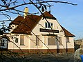
 The Cathedral, Box Mine - geograph.org.uk - 1195167.jpg 1,830 × 2,751; 1.52 MB
-
 England 2009-03-13 (3413425841).jpg 1,280 × 853; 293 KB
-
 England 2009-03-13 (3413425987).jpg 853 × 1,280; 399 KB
-
 England 2009-03-13 (3413426095).jpg 853 × 1,280; 276 KB
-
 England 2009-03-13 (3414231796).jpg 853 × 1,280; 311 KB
-
 England 2009-03-13 (3414232062).jpg 780 × 1,280; 398 KB
-
 An almost dry valley near Castle Combe - geograph.org.uk - 1210726.jpg 640 × 474; 215 KB
-
 An unusual way to deliver cherries - geograph.org.uk - 1231377.jpg 640 × 537; 180 KB
-

-
 Beaufort Arms, Wootton Bassett - geograph.org.uk - 1210133.jpg 640 × 480; 155 KB
-
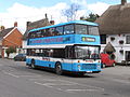 Bus img 9037 (16312344045).jpg 3,072 × 2,304; 1.85 MB
-
 Bus img 9039 (16311479122).jpg 3,072 × 2,304; 1.65 MB
-
 Bus img 9047 (15689932154).jpg 3,072 × 2,304; 1.8 MB
-
 Cotswold view south of West Kington - geograph.org.uk - 1231340.jpg 640 × 482; 151 KB
-
 Farmland and coombe near West Kington - geograph.org.uk - 1228785.jpg 640 × 481; 121 KB
-

-
 Field and a dead tree - geograph.org.uk - 1213138.jpg 640 × 480; 163 KB
-
 Field and a few rooks, near Broad Town - geograph.org.uk - 1213229.jpg 640 × 479; 133 KB
-
 Field and new crop, near Yatesbury - geograph.org.uk - 1189704.jpg 640 × 480; 218 KB
-
 Field and poplars near Lydiard Millicent - geograph.org.uk - 1204421.jpg 640 × 480; 125 KB
-
 Field and woodland, north of Brunton - geograph.org.uk - 1229586.jpg 640 × 480; 102 KB
-

-
 Field entrance near Hook - geograph.org.uk - 1213207.jpg 640 × 480; 230 KB
-
 Field gate on Edington Hill - geograph.org.uk - 1215035.jpg 640 × 427; 78 KB
-
 Field margin, near Hook Street - geograph.org.uk - 1213143.jpg 640 × 480; 187 KB
-
 Field margin, north of Brunton - geograph.org.uk - 1229623.jpg 640 × 480; 84 KB
-
 Field margin, south of Burbage - geograph.org.uk - 1229249.jpg 640 × 480; 134 KB
-

-
 Field near Braydon Side - geograph.org.uk - 1219577.jpg 640 × 480; 124 KB
-
 Field near Coped Hall - geograph.org.uk - 1213216.jpg 640 × 480; 154 KB
-
 Field near Crew's House, near Brinkworth - geograph.org.uk - 1209443.jpg 640 × 480; 135 KB
-
 Field near Yatesbury - geograph.org.uk - 1189696.jpg 640 × 395; 115 KB
-
 Field on the northern edge of Brinkworth - geograph.org.uk - 1209565.jpg 640 × 480; 181 KB
-
 Field west of Trow Lane, Tockenham - geograph.org.uk - 1209051.jpg 640 × 479; 217 KB
-
 Fields near Great Cheverell - geograph.org.uk - 1235930.jpg 640 × 521; 177 KB
-
 Fields near Hook - geograph.org.uk - 1213190.jpg 640 × 480; 141 KB
-
 Footpath entrance, A3102, near Tockenham - geograph.org.uk - 1209256.jpg 640 × 480; 214 KB
-

-

-

-

-
 Footpath near Waldron's Farm, Brinkworth - geograph.org.uk - 1209552.jpg 640 × 480; 194 KB
-

-

-

-
 Footpath to Goatacre - geograph.org.uk - 1187130.jpg 640 × 480; 186 KB
-

-

-

-
 Footpath, Hook Street - geograph.org.uk - 1213073.jpg 640 × 480; 127 KB
-
 Footpath, near West Marsh Farm, Purton - geograph.org.uk - 1205002.jpg 640 × 480; 300 KB
-

-
 Former MandSWR trackbed, Marlborough - geograph.org.uk - 1225718.jpg 480 × 640; 284 KB
-

-
 Lane south of West Kington Wick - geograph.org.uk - 1231604.jpg 640 × 493; 224 KB
-
 Lane to West Kington - geograph.org.uk - 1210624.jpg 640 × 472; 111 KB
-
 Lane to West Kington Wick - geograph.org.uk - 1231525.jpg 640 × 482; 238 KB
-
 Latimer Farm, West Kington - geograph.org.uk - 1210632.jpg 640 × 460; 169 KB
-
 Lydiard Green, Lydiard Millicent - geograph.org.uk - 1204424.jpg 640 × 480; 178 KB
-
 Lydiard Millicent - geograph.org.uk - 1204429.jpg 640 × 480; 232 KB
-
 Plough near Norton Bavant - geograph.org.uk - 1206718.jpg 640 × 482; 151 KB
-
 Railway cutting, west of Savernake - geograph.org.uk - 1229141.jpg 640 × 480; 129 KB
-
 River Avon, Salisbury, England 2009-03-13 (3414232172).jpg 853 × 1,280; 386 KB
-
 Salisbury station 1856 GWR offices.jpg 800 × 340; 94 KB
-
 Salisbury station 1856 offices.jpg 1,024 × 526; 167 KB
-
 Salisbury station 1859 offices.jpg 1,024 × 768; 280 KB
-
 Salisbury station 1902 offices.jpg 1,024 × 768; 260 KB
-
 Salisbury TMD 159003 159017 159022 158887 960012.jpg 1,024 × 768; 301 KB
-
 Site of Wootton Bassett railway station - geograph.org.uk - 1210079.jpg 640 × 480; 151 KB
-
 South of West Kington - geograph.org.uk - 1231530.jpg 640 × 472; 181 KB
-
 The Broadmead Brook valley, West Kington - geograph.org.uk - 1231355.jpg 640 × 526; 175 KB
-

-

-
 Water Lane Walk - geograph.org.uk - 1243300.jpg 480 × 640; 67 KB
-
 A quiet lane in the middle of nowhere - geograph.org.uk - 1210596.jpg 640 × 461; 119 KB
-
 West Kington - geograph.org.uk - 1231346.jpg 640 × 486; 160 KB
-
 West Kington, the bit in the middle - geograph.org.uk - 1231510.jpg 640 × 499; 138 KB
-


.jpg)
.jpg)
.jpg)
.jpg)
.jpg)


.jpg)
.jpg)
.jpg)


.jpg)


