Category:March 2009 in Northumberland
Jump to navigation
Jump to search
Deutsch: Bilder, die im März 2009 in Northumberland aufgenommen worden sind. Bitte beachten Sie, dass dies weder das Datum des Uploads noch das Datum des Scannens eines Fotos ist.
English: Images/pictures taken in Northumberland during March 2009. Note this is not the date of the upload, nor the date a photo was scanned.
Español: Fotografías o imágenes tomadas en Northumberland durante marzo 2009. No es la fecha de subida ni escaneo, sino la fecha en que las fotografías o imágenes se crearon.
Esperanto: Bildoj faritaj en Northumberland en marto 2009. Tio ne estas la dato, kiam la bildoj estis alŝutitaj aŭ skanitaj.
Français : Photographies ou images prises en Northumberland durant mars 2009. Ce n'est pas la date du téléchargement ou du scan.
Galego: Fotografías ou imaxes tomadas en Northumberland durante marzo 2009. Non é a data de subida nin escaneamento, senón a data na que se crearon as fotografías ou imaxes.
Italiano: Fotografie o immagini scattate a Northumberland nel marzo 2009. Nota bene: la data non si riferisce né a quella di upload né a quella in cui la foto è stata digitalizzata.
Norsk bokmål: Bilder tatt i Northumberland i løpet av mars 2009. Merk at dette ikke er datoen for opplasting, eller når et bilde har blitt skannet.
Norsk nynorsk: Bilete teke i Northumberland i løpet av mars 2009. Merk at dette ikkje er datoen for opplasting, eller når eit bilete har vorte skanna.
Русский: Изображения, сделанные в Northumberland в течение март 2009 (не дата загрузки изображения).
Українська: Зображення, зроблені в Northumberland протягом березень 2009. Зауважте, що це не дата завантаження чи дата сканування фотографії.
| March 2008 | ← | March 2009 | → | March 2010 | |||||||
| Jan | Feb | Mar | Apr | May | Jun | Jul | Aug | Sep | Oct | Nov | Dec |
| 40 | 34 | 179 | 34 | 29 | 60 | 28 | 38 | 47 | 54 | 10 | 29 |
|---|---|---|---|---|---|---|---|---|---|---|---|
Media in category "March 2009 in Northumberland"
The following 179 files are in this category, out of 179 total.
-
 A cottage at Crookham Westfield Farm - geograph.org.uk - 1195603.jpg 640 × 480; 64 KB
-
 A dismantled railway at Twizel - geograph.org.uk - 1206486.jpg 640 × 427; 131 KB
-
 A rock in a hard place - geograph.org.uk - 1248005.jpg 640 × 480; 114 KB
-
 A ruined building at White Knowe - geograph.org.uk - 1257007.jpg 640 × 427; 151 KB
-
 A1 - Great North Road - geograph.org.uk - 1193890.jpg 640 × 480; 73 KB
-
-
 Aubretia (x cultorum) - geograph.org.uk - 1232733.jpg 426 × 640; 142 KB
-

-
 Berwick-upon-Tweed Station Car Park - geograph.org.uk - 1238904.jpg 640 × 480; 77 KB
-
 Blyth Harbour - geograph.org.uk - 1208572.jpg 640 × 420; 104 KB
-
 Blyth Harbour - geograph.org.uk - 1208577.jpg 640 × 425; 73 KB
-
 Blyth Harbour - geograph.org.uk - 1208583.jpg 640 × 480; 67 KB
-
 Blyth Harbour - geograph.org.uk - 1208587.jpg 640 × 480; 66 KB
-
 Blyth Harbour - geograph.org.uk - 1208591.jpg 640 × 480; 43 KB
-
 Blyth Harbour - geograph.org.uk - 1208595.jpg 479 × 640; 120 KB
-
 Bridge-ford over River Alwin - geograph.org.uk - 1214464.jpg 640 × 480; 105 KB
-

-

-
 Bywell Bridge - geograph.org.uk - 1188277.jpg 640 × 480; 95 KB
-

-

-
-

-

-

-

-
 Cottage on the bend - geograph.org.uk - 1195476.jpg 640 × 480; 57 KB
-
 Cottages in the village square - geograph.org.uk - 1191788.jpg 640 × 426; 81 KB
-
-
 Ditch, Holy Island, Northumberland - geograph.org.uk - 1230841.jpg 640 × 426; 84 KB
-

-

-

-
 Field boundary near Carr Hill Farm - geograph.org.uk - 1211889.jpg 640 × 480; 117 KB
-
 Field south of Great Whittington - geograph.org.uk - 1211899.jpg 640 × 480; 101 KB
-
 Fields near Birling - geograph.org.uk - 1201482.jpg 640 × 480; 102 KB
-
-
-

-
 Footpath just north of Heugh - geograph.org.uk - 1191520.jpg 640 × 360; 59 KB
-
 Footpath near Darden Pike - geograph.org.uk - 1216621.jpg 640 × 480; 96 KB
-
 Footpath Near Shiel Sike - geograph.org.uk - 1224084.jpg 640 × 480; 61 KB
-
 Footpath south-east of Loundon Hill - geograph.org.uk - 1214699.jpg 640 × 360; 59 KB
-
 Footpath through Harwood Forest - geograph.org.uk - 1220353.jpg 480 × 640; 94 KB
-
 Footpath to East Matfen - geograph.org.uk - 1184915.jpg 640 × 480; 93 KB
-
 Foreshore near causeway, Holy Island - geograph.org.uk - 1235476.jpg 640 × 426; 86 KB
-
 Foreshore near causeway, Holy Island - geograph.org.uk - 1235493.jpg 640 × 426; 70 KB
-
 Foreshore near causeway, Holy Island - geograph.org.uk - 1235524.jpg 640 × 465; 81 KB
-
 Foreshore near causeway, Holy Island - geograph.org.uk - 1235532.jpg 640 × 426; 83 KB
-
 Foreshore near causeway, Holy Island - geograph.org.uk - 1235556.jpg 640 × 426; 85 KB
-
 Foreshore near causeway, Holy Island - geograph.org.uk - 1235577.jpg 640 × 426; 83 KB
-
 Foreshore near causeway, Holy Island - geograph.org.uk - 1235649.jpg 640 × 426; 69 KB
-
 Foreshore near Holy Island - geograph.org.uk - 1238897.jpg 640 × 353; 40 KB
-
 Foreshore, Holy Island, Northumberland - geograph.org.uk - 1232398.jpg 640 × 425; 109 KB
-
 Foreshore, Holy Island, Northumberland - geograph.org.uk - 1232704.jpg 640 × 425; 100 KB
-

-

-

-

-
 Gate to field, Holy Island - geograph.org.uk - 1235384.jpg 640 × 426; 129 KB
-

-

-
 Green, Holy Island, Northumberland - geograph.org.uk - 1233647.jpg 640 × 426; 117 KB
-
 Grouse butt south of Shorngate Cross - geograph.org.uk - 1248138.jpg 640 × 480; 87 KB
-
 Grouse butts near Shorngate Cross - geograph.org.uk - 1267820.jpg 640 × 480; 97 KB
-
 Harbour and boat sheds, Holy Island - geograph.org.uk - 1239998.jpg 640 × 484; 93 KB
-
 Holy Island Sands, Northumberland - geograph.org.uk - 1235362.jpg 640 × 426; 100 KB
-
 Holy Island, Northumberland - geograph.org.uk - 1231929.jpg 640 × 426; 73 KB
-
 Holy Island, Northumberland - geograph.org.uk - 1232327.jpg 640 × 426; 73 KB
-
 Holy Island, Northumberland - geograph.org.uk - 1233852.jpg 640 × 426; 91 KB
-
 Holy Island, Northumberland - geograph.org.uk - 1234290.jpg 640 × 426; 121 KB
-
 Holy Island, Northumberland - geograph.org.uk - 1234500.jpg 640 × 426; 102 KB
-
 Holy Island, Northumberland - geograph.org.uk - 1234763.jpg 640 × 426; 86 KB
-
 Holy Island, Northumberland - geograph.org.uk - 1234782.jpg 640 × 426; 106 KB
-
 Holy Island, Northumberland - geograph.org.uk - 1234815.jpg 640 × 426; 90 KB
-
 Holy Island, Pilgrim's Way Refuge - geograph.org.uk - 1725721.jpg 640 × 427; 98 KB
-

-

-

-

-
 Houses, Holy Island, Northumberland - geograph.org.uk - 1232799.jpg 640 × 428; 108 KB
-
 Houses, Holy Island, Northumberland - geograph.org.uk - 1232805.jpg 433 × 640; 77 KB
-
 Interior of Pillbox on Coquet Stop Line.jpg 2,592 × 1,944; 651 KB
-
 Jackdaw (Corvus monedula) - geograph.org.uk - 1239508.jpg 640 × 480; 219 KB
-
 Jackdaw (Corvus monedula) - geograph.org.uk - 1239513.jpg 640 × 480; 212 KB
-
 Large Lichen, Holy Island - geograph.org.uk - 1232736.jpg 426 × 640; 103 KB
-

-
 Lichen on rocks, Lindisfarne - geograph.org.uk - 1231791.jpg 640 × 426; 156 KB
-

-

-

-

-

-

-

-

-

-

-

-

-

-
 Lindisfarne Priory, Holy Island - geograph.org.uk - 1234647.jpg 640 × 426; 108 KB
-

-

-

-

-
-

-

-

-
 Marina, Blyth Harbour - geograph.org.uk - 1208568.jpg 640 × 341; 80 KB
-
-
-

-
-

-

-

-
 Notice, Lindisfarne Castle - geograph.org.uk - 1231767.jpg 640 × 426; 141 KB
-
 Oak Lea, Holy Island, Northumberland - geograph.org.uk - 1233363.jpg 640 × 429; 119 KB
-
 P305 Catheugh Plantation Pillbox.JPG 2,592 × 1,944; 928 KB
-
 Pasture, Holy Island, Northumberland - geograph.org.uk - 1230830.jpg 640 × 426; 67 KB
-
 Pasture, Holy Island, Northumberland - geograph.org.uk - 1235448.jpg 640 × 426; 87 KB
-
 Pathway, Lindisfarne Castle - geograph.org.uk - 1232382.jpg 640 × 425; 114 KB
-
-
 Pilgrim's Way, Holy Island Sands - geograph.org.uk - 1238917.jpg 640 × 421; 61 KB
-
 Pine Tree, Holy Island, Northumberland - geograph.org.uk - 1233471.jpg 426 × 640; 105 KB
-
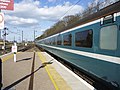
 Plymouth Train, Berwick-upon-Tweed - geograph.org.uk - 1242167.jpg 640 × 480; 86 KB
-
 Public Footpath sign, Holy Island - geograph.org.uk - 1235377.jpg 426 × 640; 160 KB
-
 Public Footpath, Holy Island - geograph.org.uk - 1241878.jpg 480 × 640; 153 KB
-

-
 Remains of Chapel, Holy Island - geograph.org.uk - 1235372.jpg 640 × 426; 99 KB
-
 River Lyne - geograph.org.uk - 1191070.jpg 640 × 480; 71 KB
-
-
-

-

-
 Seat, Holy Island, Northumberland - geograph.org.uk - 1232411.jpg 640 × 426; 76 KB
-
 Sheepfold above the Alwin valley - geograph.org.uk - 1221963.jpg 640 × 480; 104 KB
-
 Sheepfold below Cold Law - geograph.org.uk - 1213440.jpg 640 × 480; 96 KB
-
 Sheepfold by Biddlestone Burn - geograph.org.uk - 1213522.jpg 640 × 480; 99 KB
-
 Sheepfold east of Kidlandlee - geograph.org.uk - 1214498.jpg 640 × 480; 114 KB
-
 Sheepfold near Ridley Shield - geograph.org.uk - 1221978.jpg 640 × 480; 83 KB
-
 Sheepfold north of Puncherton Hill - geograph.org.uk - 1214388.jpg 640 × 480; 82 KB
-
 Sheepfold west of Hazeltonrig - geograph.org.uk - 1204517.jpg 640 × 480; 64 KB
-

-

-
 Shorngate Cross Currick - geograph.org.uk - 1220375.jpg 640 × 480; 62 KB
-

-
 Signpost, Holy Island, Northumberland - geograph.org.uk - 1239820.jpg 640 × 486; 140 KB
-
 South Beach, Blyth - geograph.org.uk - 1208596.jpg 640 × 434; 44 KB
-

-

-

-
 St. Helen's Church, Cornhill - geograph.org.uk - 1219388.jpg 640 × 480; 84 KB
-
 St. John Lee - embroidered banner - geograph.org.uk - 1269390.jpg 480 × 640; 97 KB
-
 St. John Lee - interior - geograph.org.uk - 1269336.jpg 640 × 480; 91 KB
-
 Station area, Berwick-upon-Tweed - geograph.org.uk - 1240661.jpg 640 × 481; 74 KB
-

-
 Steep path to Lindisfarne Castle - geograph.org.uk - 1231803.jpg 640 × 426; 108 KB
-

-

-
 The Fishers' Arms at Horncliffe - geograph.org.uk - 1219410.jpg 640 × 480; 71 KB
-
 The Harbour, Holy Island, Northumberland - geograph.org.uk - 1231777.jpg 640 × 425; 118 KB
-

-
 The Harbour, Holy Island, Northumberland - geograph.org.uk - 1239057.jpg 640 × 480; 101 KB
-

-

-

-
 The road leading away from Wark - geograph.org.uk - 1195681.jpg 640 × 400; 45 KB
-
 Traditional repairs - geograph.org.uk - 1232745.jpg 640 × 426; 138 KB
-
 Village Centre, Holy Island - geograph.org.uk - 1239828.jpg 479 × 640; 150 KB
-

-
 Wallflowers, Holy Island - geograph.org.uk - 1232802.jpg 640 × 426; 151 KB
-
 Wark, Northumberland - geograph.org.uk - 1195690.jpg 640 × 480; 69 KB
-
 Water Pump, Holy Island, Northumberland - geograph.org.uk - 1232716.jpg 426 × 640; 118 KB
-
 Weather vane, Hexham Abbey - geograph.org.uk - 1265282.jpg 480 × 640; 46 KB
-
 West Pier, Blyth - geograph.org.uk - 1208509.jpg 640 × 480; 69 KB
-


_-_geograph.org.uk_-_1232733.jpg)


,_Holy_Island_-_geograph.org.uk_-_1239498.jpg)
,_Holy_Island_-_geograph.org.uk_-_1239869.jpg)
,_Holy_Island_-_geograph.org.uk_-_1239876.jpg)
,_Holy_Island_-_geograph.org.uk_-_1239933.jpg)


_-_geograph.org.uk_-_1239508.jpg)
_-_geograph.org.uk_-_1239513.jpg)

_posts_of_Pilgrim%27s_Way,_Holy_Island_-_geograph.org.uk_-_1238973.jpg)


_-_geograph.org.uk_-_1268116.jpg)


