
Category:Maps of the history of Connecticut
States of the United States: Alabama · Alaska · Arizona · Arkansas · California · Colorado · Connecticut · Delaware · Florida · Georgia · Hawaii · Idaho · Illinois · Indiana · Iowa · Kansas · Kentucky · Louisiana · Maine · Maryland · Massachusetts · Michigan · Minnesota · Mississippi · Missouri · Montana · Nebraska · Nevada · New Hampshire · New Jersey · New Mexico · New York · North Carolina · North Dakota · Ohio · Oklahoma · Oregon · Pennsylvania · Rhode Island · South Carolina · South Dakota · Tennessee · Texas · Utah · Vermont · Virginia · Washington · West Virginia · Wisconsin · Wyoming – Washington, D.C.
Puerto Rico
Puerto Rico
Subcategories
This category has only the following subcategory.
Media in category "Maps of the history of Connecticut"
The following 18 files are in this category, out of 18 total.
-

-
 24 of 'The Boundary Disputes of Connecticut' (11281857415).jpg 1,577 × 1,273; 205 KB
-
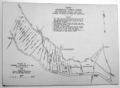
 27 of 'The Boundary Disputes of Connecticut' (11160534073).jpg 3,172 × 2,192; 1.14 MB
-
 Connecticut 1660.jpg 1,873 × 1,751; 766 KB
-
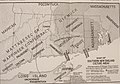
 113 of 'The Boundary Disputes of Connecticut' (11148460834).jpg 1,179 × 2,877; 328 KB
-
 62 of 'The Boundary Disputes of Connecticut' (11157263106).jpg 2,634 × 3,172; 901 KB
-
 63 of 'The Boundary Disputes of Connecticut' (11151429553).jpg 2,667 × 3,025; 663 KB
-
-
 Connecticut claims.svg 512 × 374; 227 KB
-
 Connecticut western reserve.png 370 × 403; 2 KB
-
 Ctcolony.png 1,428 × 1,000; 817 KB
-
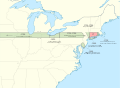
 Ctdispute.png 500 × 427; 29 KB
-
 Ctwestclaims.png 582 × 320; 37 KB
-
 EB9 United States - historical maps (top).jpg 2,488 × 1,803; 997 KB
-
 Indiantrails1625.jpg 640 × 480; 39 KB
-
 Original Home Lots.png 1,236 × 902; 1.08 MB
-
 Tribal Territories Southern New England ru.png 1,701 × 1,169; 525 KB
-
 Tribal Territories Southern New England.png 1,701 × 1,169; 490 KB
.jpg)
.jpg)
.jpg)

.jpg)
.jpg)
_(19173685358).jpg)


.jpg)


.jpg)