Category:Maps of the history of Michigan
Appearance
States of the United States: Alabama · Alaska · Arizona · Arkansas · California · Colorado · Connecticut · Delaware · Florida · Georgia · Hawaii · Idaho · Illinois · Indiana · Iowa · Kansas · Kentucky · Louisiana · Maine · Maryland · Massachusetts · Michigan · Minnesota · Mississippi · Missouri · Montana · Nebraska · Nevada · New Hampshire · New Jersey · New Mexico · New York · North Carolina · North Dakota · Ohio · Oklahoma · Oregon · Pennsylvania · Rhode Island · South Carolina · South Dakota · Tennessee · Texas · Utah · Vermont · Virginia · Washington · West Virginia · Wisconsin · Wyoming – Washington, D.C.
Puerto Rico
Puerto Rico
Subcategories
This category has only the following subcategory.
Media in category "Maps of the history of Michigan"
The following 12 files are in this category, out of 12 total.
-
Chicago Road 19-07-19 388.jpg 4,608 × 3,072; 3.4 MB
-
Disputed Toledo Strip.png 660 × 200; 68 KB
-
EB9 United States - historical maps (top).jpg 2,488 × 1,803; 997 KB
-
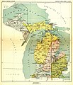
Map from Indian land cessions in the United States by Charles C. Royce 44.jpg 2,464 × 3,339; 2.35 MB
-
Mascouten01.png 1,366 × 1,140; 2.31 MB
-
Michigan-territory-1830-blue.png 495 × 314; 88 KB
-
Michigan-territory-1834-blue.png 459 × 281; 79 KB
-
Michigan-territory-1836.png 469 × 311; 85 KB
-
Royce-areas-michigan.jpg 1,495 × 1,740; 511 KB
-
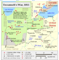
Tecumseh's War.png 822 × 840; 322 KB
-
United States Central change 1785-04-19.png 2,046 × 1,321; 249 KB
-
Upper peninsula Toledo War.png 553 × 382; 21 KB


