Category:Old maps of Connecticut
Jump to navigation
Jump to search
States of the United States: Alabama · Alaska · Arizona · Arkansas · California · Colorado · Connecticut · Delaware · Florida · Georgia · Hawaii · Idaho · Illinois · Indiana · Iowa · Kansas · Kentucky · Louisiana · Maine · Maryland · Massachusetts · Michigan · Minnesota · Mississippi · Missouri · Montana · Nebraska · Nevada · New Hampshire · New Jersey · New Mexico · New York · North Carolina · North Dakota · Ohio · Oklahoma · Oregon · Pennsylvania · Rhode Island · South Carolina · South Dakota · Tennessee · Texas · Utah · Vermont · Virginia · Washington · West Virginia · Wisconsin · Wyoming – District of Columbia: Washington, D.C.
Guam · Northern Mariana Islands · Puerto Rico
Guam · Northern Mariana Islands · Puerto Rico
Subcategories
This category has the following 12 subcategories, out of 12 total.
H
L
N
T
Media in category "Old maps of Connecticut"
The following 200 files are in this category, out of 263 total.
(previous page) (next page)-
(Bird's-eye view of Thompsonville (now Enfield), Connecticut). LOC 91680391.jpg 8,384 × 5,904; 14.74 MB
-
(Map of town of Canaan, Connecticut). LOC 2004626473.jpg 7,676 × 11,531; 14.16 MB
-
(Map of town of Canaan, Connecticut). LOC 2004626473.tif 7,676 × 11,531; 253.23 MB
-
102 of 'The Boundary Disputes of Connecticut' (11149905813).jpg 2,336 × 2,206; 271 KB
-
113 of 'The Boundary Disputes of Connecticut' (11148460834).jpg 3,168 × 1,446; 404 KB
-
A correct map of Connecticut from actual survey (4578699907).jpg 2,000 × 1,648; 3.39 MB
-
1827 Finley Map of Connecticut - Geographicus - Connecticut-finley-1827.jpg 3,000 × 2,348; 2.01 MB
-
1857 Colton Map of Connecticut and Long Island - Geographicus - Connecticut-colton-1857.jpg 3,500 × 2,824; 3.08 MB
-
1867 Map of Trumbull Connecticut.JPG 2,468 × 2,985; 12.11 MB
-
1879 map of Seymour, Connecticut.jpg 4,000 × 3,187; 3.54 MB
-
1893 Connecticut Railroads Map.jpg 8,368 × 6,784; 18.96 MB
-
39 of 'The Boundary Disputes of Connecticut' (11152365274).jpg 2,583 × 2,000; 331 KB
-
98 of 'The Boundary Disputes of Connecticut' (11150666066).jpg 6,790 × 1,788; 1.45 MB
-
A correct map of Connecticut from actual survey. LOC 99466757.jpg 5,206 × 4,363; 3.58 MB
-
A correct map of Connecticut from actual survey. LOC 99466757.tif 5,206 × 4,363; 64.98 MB
-
A map of Connecticut and Rhode Island with Long Island Sound, etc. LOC 99466764.tif 2,790 × 2,368; 18.9 MB
-
A new and accurate map of Connecticut and Rhode Island, from best authorities. LOC 99466763.tif 4,096 × 3,120; 36.56 MB
-
Admiralty Chart No 2755 Long Island Sound Sheet 2 New Haven Oyster Bay &c, Published 1861.jpg 11,934 × 8,141; 18.59 MB
-
Aero view of Ansonia, Connecticut 1921. LOC 75693145.jpg 9,968 × 6,880; 9.56 MB
-
Aero view of Ansonia, Connecticut 1921. LOC 75693145.tif 9,968 × 6,880; 196.21 MB
-
Aero view of Manchester, Connecticut 1914. LOC 75693150.tif 15,546 × 10,989; 488.76 MB
-
Aero view of Meriden, Connecticut 1918. LOC 73693115.jpg 11,616 × 7,680; 20.97 MB
-
Aero view of Meriden, Connecticut 1918. LOC 73693115.tif 11,616 × 7,680; 255.23 MB
-
Aero view of Middletown, Connecticut 1915 LOC 73693133.jpg 11,264 × 7,104; 12.65 MB
-
Aero view of Middletown, Connecticut 1915 LOC 73693133.tif 11,264 × 7,104; 228.94 MB
-
Aero view of Middletown, Connecticut, 1915 LOC 78692975.jpg 11,584 × 7,552; 15.69 MB
-
Aero view of Middletown, Connecticut, 1915 LOC 78692975.tif 11,584 × 7,552; 250.29 MB
-
Aero view of Norwich, Connecticut 1912. LOC 75693159.jpg 12,416 × 9,856; 26.97 MB
-
Aero view of Norwich, Connecticut 1912. LOC 75693159.tif 12,416 × 9,856; 350.11 MB
-
Aero view of Shelton, Connecticut 1919. LOC 75693162.jpg 9,744 × 6,544; 9.87 MB
-
Aero view of Shelton, Connecticut 1919. LOC 75693162.tif 9,744 × 6,544; 182.43 MB
-
Aero view of Southington, Connecticut 1914. LOC 75693163.tif 11,712 × 8,752; 293.26 MB
-
Aero view of Waterbury, Connecticut 1917 LOC gm71005376.jpg 10,032 × 7,200; 14.58 MB
-
Aero view of Watertown, Connecticut 1918. LOC 75693168.jpg 10,736 × 6,976; 11.94 MB
-
Aero view of Willimantic, Connecticut 1909. LOC 75693169.jpg 10,432 × 8,896; 13.94 MB
-
Aero view of Windsor Locks, Connecticut, 1913. LOC 2008624183.jpg 12,211 × 8,688; 20.87 MB
-
Aero view of Windsor Locks, Connecticut, 1913. LOC 2008624183.tif 12,211 × 8,688; 303.52 MB
-
BattleOfRidgefield1.png 1,351 × 1,777; 4.8 MB
-
BattleOfRidgefield2.png 1,351 × 1,777; 4.79 MB
-
Bell telephone magazine (1922) (14756067232).jpg 1,418 × 1,172; 199 KB
-
Bicycle road-map - New Haven, Connecticut, to New London, Connecticut. LOC 2010592716.jpg 3,817 × 4,784; 1.64 MB
-
Bicycle road-map - New Haven, Connecticut, to New London, Connecticut. LOC 2010592716.tif 3,817 × 4,784; 52.24 MB
-
Bird's eye view of Plainville, Connecticut 1907. LOC 75693161.jpg 9,040 × 6,272; 16.8 MB
-
Bird's eye view of Torrington, Connecticut 1907. LOC 75693164.jpg 11,392 × 9,120; 16.45 MB
-
Bird's eye view of Winsted, Connecticut 1908. LOC 75693170.jpg 10,912 × 9,824; 24.38 MB
-
Bird's-eye view of Naugatuck, Connecticut 1906. LOC 75693152.jpg 11,504 × 8,304; 14.78 MB
-
Bird's-eye view of Naugatuck, Connecticut 1906. LOC 75693152.tif 11,504 × 8,304; 273.31 MB
-
Bird's-eye-view of New Milford, Connecticut, 1906. LOC 75693155.jpg 9,536 × 7,840; 14.26 MB
-
Bird's-eye-view of New Milford, Connecticut, 1906. LOC 75693155.tif 9,536 × 7,840; 213.9 MB
-
Birmingham, Conn. 1876. LOC 74693153.jpg 7,808 × 6,496; 9.05 MB
-
Bridgeport 1824.png 3,450 × 2,762; 6.04 MB
-
Britannica Connecticut.jpg 2,603 × 1,890; 2.42 MB
-
City of Bridgeport, Fairfield County, Connecticut LOC 2017591006.jpg 4,822 × 6,595; 5.72 MB
-
City of Bridgeport, Fairfield County, Connecticut LOC 2017591006.tif 4,822 × 6,595; 90.98 MB
-
Connecticut (3046242030).jpg 2,000 × 1,466; 3.04 MB
-
Connecticut (4586563441).jpg 2,000 × 1,197; 3.47 MB
-
Connecticut for schools, families, and general use LOC gm70001741.jpg 12,368 × 9,249; 15.38 MB
-
Connecticut from the best authorites. LOC 99466756.jpg 5,388 × 4,381; 4.15 MB
-
Connecticut from the best authorites. LOC 99466756.tif 5,388 × 4,381; 67.53 MB
-
Connecticut from the best authorities (3046153908).jpg 2,000 × 1,777; 3.2 MB
-
Connecticut, from actual survey (4071868211).jpg 2,000 × 1,730; 3.39 MB
-
Connecticut, from actual survey. LOC 00561205.jpg 11,169 × 9,122; 16.44 MB
-
Connecticut, from actual survey. LOC 00561205.tif 11,169 × 9,122; 291.49 MB
-
Connecticut, from the best authorities. LOC 99466758.jpg 4,504 × 3,673; 3.04 MB
-
Connecticut, from the best authorities. LOC 99466758.tif 4,504 × 3,673; 47.33 MB
-
Connecticut, from the best authorities. LOC gm71000973.jpg 5,490 × 4,510; 3.09 MB
-
Connecticut, from the best authorities. LOC gm71000973.tif 5,490 × 4,510; 70.84 MB
-
Connecticut. LOC 99466759.jpg 5,316 × 4,349; 5 MB
-
Connecticut. LOC 99466759.tif 5,316 × 4,349; 66.15 MB
-
Connecticut. LOC 99466761.jpg 2,736 × 2,172; 1,010 KB
-
Connecticut. LOC 99466761.tif 2,736 × 2,172; 17 MB
-
Connecticut. NYPL1401777.tiff 5,475 × 4,848; 75.96 MB
-
Connecticut; a study of a commonwealth-democracy (1903) (14580730828).jpg 4,240 × 3,496; 1.33 MB
-
Connecticut; county subdivisions, towns and places. 1970. LOC gm72003038.jpg 5,816 × 4,800; 1.98 MB
-
Connecticut; county subdivisions, towns and places. 1970. LOC gm72003038.tif 5,816 × 4,800; 79.87 MB
-
Books from the Library of Congress (IA connecticuthisto01barbe).pdf 800 × 1,306, 570 pages; 47.09 MB
-
CT Pikes.jpg 2,788 × 2,036; 1.24 MB
-
Danbury, Conn. LOC 85695099.jpg 11,744 × 6,208; 16.17 MB
-
Danbury, Conn. LOC 85695099.tif 11,744 × 6,208; 208.59 MB
-
Driving chart of Hartford and vicinity - 15 miles around. LOC 2012590164.jpg 12,413 × 12,512; 21.12 MB
-
Driving chart of Hartford and vicinity - 15 miles around. LOC 2012590164.tif 12,413 × 12,512; 444.35 MB
-
EB9 Connecticut.jpg 2,500 × 1,819; 2.18 MB
-
EB9 New Haven.jpg 829 × 752; 360 KB
-
FMIB 37686 Oyster Grounds - State of Connecticut, 1889.jpeg 1,188 × 972; 309 KB
-
Fort-Griswold. LOC gm71000696.jpg 2,388 × 2,903; 998 KB
-
Fort-Griswold. LOC gm71000696.tif 2,388 × 2,903; 19.83 MB
-
Geer's New map of the city of Hartford - from the latest surveys. LOC 79695213.jpg 3,398 × 4,748; 2.41 MB
-
Geer's New map of the city of Hartford - from the latest surveys. LOC 79695213.tif 3,398 × 4,748; 46.16 MB
-
Georgetown, Fairfield County, Connecticut, Clark 1856.jpg 600 × 451; 136 KB
-
Gov. Tryon's expedition to Danbury, 1777. LOC gm71000884.jpg 4,291 × 5,438; 3.06 MB
-
Gov. Tryon's expedition to Danbury, 1777. LOC gm71000884.tif 4,291 × 5,438; 66.76 MB
-
Litchfield County, Connecticut LOC 81690029.jpg 7,117 × 8,971; 9.22 MB
-
Litchfield County, Connecticut LOC 81690029.tif 7,117 × 8,971; 182.67 MB
-
LowsCTmap.jpeg 2,884 × 2,296; 3.13 MB
-
Map (of the) borough of Stonington, Connecticut, 1851. LOC 75692234.jpg 6,525 × 8,023; 7.52 MB
-
Map (of the) borough of Stonington, Connecticut, 1851. LOC 75692234.tif 6,525 × 8,023; 149.78 MB
-
Map of Bridgeport, 1824.jpg 2,370 × 1,918; 367 KB
-
Map of Long Island sound and Connecticut by Laura Roys in 1857.jpg 2,000 × 1,613; 3.34 MB
-
Map of Middlesex County, Connecticut. LOC 2001620491.jpg 15,331 × 14,870; 35.59 MB
-
Map of New London and Windham counties in Conn. LOC 2001620492.jpg 7,128 × 9,127; 13.54 MB
-
Map of New London and Windham counties in Conn. LOC 2001620492.tif 7,128 × 9,127; 186.13 MB
-
Map of New London County, Connecticut. LOC 2001620486.jpg 18,636 × 13,721; 45.92 MB
-
Map of New Milford, Litchfield Co., Conn.. LOC 2011589302.jpg 10,213 × 13,995; 18.84 MB
-
Map of New Milford, Litchfield Co., Conn.. LOC 2011589302.tif 10,213 × 13,995; 408.93 MB
-
Map of the city of Bridgeport, Conn. LOC gm71003380.jpg 11,110 × 11,468; 15 MB
-
Map of the city of Bridgeport, Conn. LOC gm71003380.tif 11,110 × 11,468; 364.52 MB
-
Map of the county of New Haven, Connecticut. LOC 2001620488.jpg 15,797 × 11,838; 24.24 MB
-
Map of the town of Goshen, Litchfield County, Connecticut LOC 2011589312.jpg 11,395 × 14,157; 16.49 MB
-
Map of the town of Goshen, Litchfield County, Connecticut LOC 2011589312.tif 11,395 × 14,157; 461.54 MB
-
Map of the town of New Hartford, Litchfield Co., Conn.. LOC 2011589292.jpg 15,368 × 11,682; 20.07 MB
-
Map of the town of Norfolk, Litchfield County, Ct. LOC 2011589304.jpg 9,970 × 15,309; 17.6 MB
-
Map of the town of Salisbury, Litchfield Co., Connecticut. LOC 2011589306.jpg 12,521 × 15,845; 24.11 MB
-
Map of the town of Salisbury, Litchfield Co., Connecticut. LOC 2011589306.tif 12,521 × 15,845; 567.61 MB
-
Map of the town of Washington, Litchfield Co., Conn. LOC 2011589308.jpg 10,203 × 15,579; 20.21 MB
-
Map of the town of Washington, Litchfield Co., Conn. LOC 2011589308.tif 10,203 × 15,579; 454.77 MB
-
Map of Tolland County, Connecticut. LOC 2001620485.jpg 14,069 × 16,066; 29.71 MB
-
Map of Windham County, Connecticut. LOC 2001620487.jpg 12,292 × 15,316; 31.05 MB
-
Map showing the routes of the contemplated rail road from New-Haven to Hartford LOC 00553990.tif 3,942 × 5,548; 62.57 MB
-
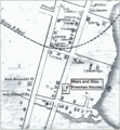
Mary and Eliza Freeman Houses map 1850.png 1,167 × 1,265; 917 KB
-
MeigsRaidMap.png 557 × 363; 379 KB
-
Middlesex County, Connecticut LOC 81690031.jpg 5,063 × 6,577; 4.68 MB
-
Middlesex County, Connecticut LOC 81690031.tif 5,063 × 6,577; 95.27 MB
-
Middlesex County, Connecticut LOC 88690920.jpg 10,057 × 12,574; 22.38 MB
-
Middlesex County, Connecticut LOC 88690920.tif 10,057 × 12,574; 361.8 MB
-
Middletown, Conn. 1877. LOC 75693151.jpg 12,180 × 10,366; 23.33 MB
-
Mill River, Hamden, Connecticut. Flood plains. LOC gm69002790.jpg 5,104 × 6,701; 4.01 MB
-
Mill River, Hamden, Connecticut. Flood plains. LOC gm69002790.tif 5,104 × 6,701; 97.85 MB
-
New Haven County, Connecticut LOC 81690030.jpg 8,360 × 7,350; 8.2 MB
-
New Haven County, Connecticut LOC 81690030.tif 8,360 × 7,350; 175.8 MB
-
New Haven County, Connecticut LOC 88690906.jpg 16,512 × 14,196; 36.45 MB
-
New Haven County, Connecticut LOC 88690906.tif 16,512 × 14,196; 670.64 MB
-
New Haven Harbor LOC 99447264.jpg 4,284 × 5,209; 3.88 MB
-
New Haven Harbor LOC 99447264.tif 4,284 × 5,209; 63.84 MB
-
New Haven Harbor LOC 99447265.jpg 4,576 × 5,803; 4.43 MB
-
New Haven Harbor LOC 99447265.tif 4,576 × 5,803; 75.97 MB
-
Norwalk 1847 Map, CT, 06854, USA.jpg 3,016 × 4,718; 3.2 MB
-
Norwalk, South Norwalk, and East Norwalk, Conn. LOC 75693156.jpg 13,840 × 9,856; 35.97 MB
-
Norwalk, South Norwalk, and East Norwalk, Conn. LOC 75693156.tif 13,840 × 9,856; 390.26 MB
-
A map of Connecticut (NYPL b14115138-1567523).jpg 6,598 × 5,428; 4.37 MB
-
Map of the state of New York (NYPL b14919980-2020738).jpg 5,496 × 4,680; 43.22 MB
-
Map of the state of New York (NYPL b14919980-2020738).tiff 6,300 × 5,248; 94.62 MB
-
Old Stratfield (Bridgeport) Map before 1886.jpg 1,851 × 2,267; 325 KB
-
Plan of New Haven LOC 2011589293.jpg 15,096 × 11,692; 20.35 MB
-
Plan of the city of Hartford - from a survey made in 1824 LOC 2011589284.jpg 8,029 × 10,317; 12.66 MB
-
Plan of the city of Hartford - from a survey made in 1824 LOC 2011589284.tif 8,029 × 10,317; 236.99 MB
-
Plan of the Colony of Connecticut, Moses Park, 1766.jpg 1,116 × 825; 220 KB
-
Rockville, Connecticut, 1895. LOC 2005628467.tif 9,996 × 7,677; 219.55 MB
-
Scantic River (Connecticut) map.jpg 1,700 × 2,800; 1.57 MB
-
Smith's map of Hartford County, Connecticut. LOC 2001620484.jpg 12,200 × 17,623; 38.23 MB
-
Smith's map of Hartford County, Connecticut. LOC 2001620484.tif 12,200 × 17,623; 615.12 MB
-
Stamford, Conn. LOC 74693237.jpg 11,328 × 6,528; 14.88 MB
-
State of Connecticut- Base map with highways and contours. LOC 76695372.jpg 16,601 × 13,008; 29.25 MB
-
State of Connecticut. LOC 76693266.jpg 16,326 × 12,638; 24.31 MB
-
Status of flood plain management studies, Connecticut - October 1994 LOC 2002621253.jpg 3,236 × 2,516; 1.11 MB
-
Status of flood plain management studies, Connecticut - October 1994 LOC 2002621253.tif 3,236 × 2,516; 23.29 MB
-
Status of flood warning projects, Connecticut - October 1987 LOC 89694237.jpg 3,268 × 2,542; 1.1 MB
-
Status of flood warning projects, Connecticut - October 1987 LOC 89694237.tif 3,268 × 2,542; 23.77 MB
-
Status of flood warning projects, Connecticut - October 1994 LOC 2002621254.jpg 3,232 × 2,516; 1.1 MB
-
Status of flood warning projects, Connecticut - October 1994 LOC 2002621254.tif 3,232 × 2,516; 23.27 MB
-
Status of river basin projects, Connecticut - October 1987 LOC 89694236.jpg 7,864 × 6,046; 11.12 MB
-
Status of river basin projects, Connecticut - October 1987 LOC 89694236.tif 7,864 × 6,046; 136.03 MB
-
Status of water resource projects, Connecticut - October 1987 LOC 89694235.jpg 3,245 × 2,531; 1.08 MB
-
Status of water resource projects, Connecticut - October 1987 LOC 89694235.tif 3,245 × 2,531; 23.5 MB


