Category:Maps of the history of North Dakota
Jump to navigation
Jump to search
States of the United States: Alabama · Alaska · Arizona · Arkansas · California · Colorado · Connecticut · Delaware · Florida · Georgia · Hawaii · Idaho · Illinois · Indiana · Iowa · Kansas · Kentucky · Louisiana · Maine · Maryland · Massachusetts · Michigan · Minnesota · Mississippi · Missouri · Montana · Nebraska · Nevada · New Hampshire · New Jersey · New Mexico · New York · North Carolina · North Dakota · Ohio · Oklahoma · Oregon · Pennsylvania · Rhode Island · South Carolina · South Dakota · Tennessee · Texas · Utah · Vermont · Virginia · Washington · West Virginia · Wisconsin · Wyoming – Washington, D.C.
Puerto Rico
Puerto Rico
Media in category "Maps of the history of North Dakota"
The following 7 files are in this category, out of 7 total.
-
 Arikara movements, 1795 to 1862.png 1,776 × 2,502; 7.43 MB
-

-
 Battlefields (approx.) - U.S. Army and Lakotas, 1854-1890.png 500 × 371; 298 KB
-
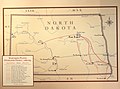
 Cooperative economic insect report (1957) (20698078925).jpg 3,442 × 2,206; 2.07 MB
-
 Dakotas 1 Indian Land Cessions.jpg 770 × 880; 203 KB
-
-
 Northern pony express map 1867-1868.svg 2,466 × 972; 1.22 MB

_-_U.S._Army_and_Lakotas,_1854-1868_(blue_x)_and_1869-1890_(red_x).png)
_-_U.S._Army_and_Lakotas,_1854-1890.png)
_(20698078925).jpg)

