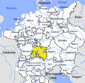
Category:Maps of territories in the Swabian Circle
Jump to navigation
Jump to search
Subcategories
This category has the following 8 subcategories, out of 8 total.
B
M
- Maps of the Old Confederacy (19 F)
Media in category "Maps of territories in the Swabian Circle"
The following 10 files are in this category, out of 10 total.
-
Autriche antérieure.png 900 × 730; 37 KB
-
Historische Karte CH 1315 IT.png 2,000 × 1,943; 655 KB
-
Historische Karte CH 1315.png 2,000 × 1,943; 411 KB
-
HRR 1789 EN rhine bank cut out.png 921 × 677; 530 KB
-
Karte Werdenberger.png 1,500 × 2,194; 615 KB
-
Kreisviertel.jpg 943 × 1,111; 664 KB
-
Lupfen.png 497 × 300; 7 KB
-
Swabian Circle hu.PNG 610 × 599; 212 KB
-
Swabian Circle-2005-10-15-de.png 727 × 714; 62 KB
-
Swabian Circle-2005-10-15-en.png 727 × 714; 67 KB


