Category:Maps of Württemberg
Jump to navigation
Jump to search
German princely territory of Württemberg | |||||
| Upload media | |||||
| Location |
| ||||
|---|---|---|---|---|---|
| |||||
Subcategories
This category has the following 12 subcategories, out of 12 total.
Media in category "Maps of Württemberg"
The following 22 files are in this category, out of 22 total.
-
 1575 H Schweickher Generaltafel WLB 00000011.jpg 2,646 × 2,194; 5.69 MB
-
 1596 Gadner Übersicht Herzogtum LABW HStA Stuttgart Blatt 4 Bild 1Web.jpg 2,381 × 2,394; 6.27 MB
-

-
 Altheim, Andelfingen, Langenenslingen, Warmtal (Warnthal), Friedingen und Pflummern.jpg 2,000 × 1,280; 200 KB
-
 Ausschnitt von Composite 618 Freudenstadt 5820618c.jpg 1,140 × 856; 1.13 MB
-
-
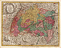 Duchy of Württemberg and other territories of Swabia.jpg 2,147 × 1,700; 2.6 MB
-
 Friedingen auf alter Landkarte.jpg 954 × 984; 195 KB
-
 Friedingen, Langenenslingen, Andelfingen, Altheim und Pflummern.jpg 2,000 × 1,388; 196 KB
-
 Friedinger Markung.jpg 972 × 986; 186 KB
-
 Geognostische Karte Württemberg Baden (1860).jpg 6,771 × 7,965; 14.03 MB
-
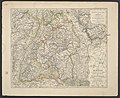
 Hertzogthum Würtenberg im Schwäbischen Creis Teutzschlandes mit angräntzenden Gegenden.jpg 2,759 × 2,497; 2.62 MB
-
 Wuitbreiding.jpg 261 × 350; 35 KB
-
 Württemberg Karte 1559.jpg 2,500 × 3,483; 3.6 MB
-
 Karte des Koenigreichs Württemberg von Gottlob Friedrich Haug, Stuttgart, 1813.jpg 3,702 × 4,745; 7.23 MB
-
 Lv württemberg.gif 162 × 215; 2 KB
-
 Modern Württemberg.png 1,351 × 1,844; 495 KB
-
 OACanstatt-Karte.jpg 5,600 × 6,300; 5.63 MB
-
 Quad Karte Wirtemberg 1600.jpg 1,413 × 1,013; 1.02 MB
-
 UBBasel Map 1559 Kartenslg AA 139 Wuertemberg.tiff 5,833 × 8,399, 2 pages; 140.19 MB
-
 Uebersicht der öffentlichen Wasser-Versorgung im Königreich Württemberg, 1889.jpg 4,793 × 6,560; 21.89 MB
-
 Wurtemberg 1600.jpg 800 × 600; 150 KB


,_Friedingen_und_Pflummern_(CR).jpg)
,_Friedingen_und_Pflummern.jpg)


.jpg)


