Category:Maps of the canton of Vaud
Jump to navigation
Jump to search
Cantons of Switzerland: Aargau (AG) · Appenzell Ausserrhoden (AR) · Appenzell Innerrhoden (AI) · Basel-Stadt (BS) · Basel-Landschaft (BL) · Bern (BE) · Fribourg (FR) · Geneva (GE) · Glarus (GL) · Graubünden (GR) · Jura (JU) · Luzern (LU) · Neuchâtel (NE) · Nidwalden (NW) · Obwalden (OW) · Schaffhausen (SH) · Schwyz (SZ) · Solothurn (SO) · St. Gallen (SG) · Thurgau (TG) · Ticino (TI) · Uri (UR) · Valais (VS) · Vaud (VD) · Zug (ZG) · Zürich (ZH)
Subcategories
This category has the following 39 subcategories, out of 39 total.
#
1
2
A
- Maps of Aigle (14 F)
B
- Maps of Bex (10 F)
E
L
- Maps of Leysin (4 F)
M
- Maps of Montreux (12 F)
N
- Maps of Nyon (7 F)
O
- Maps of Ollon (7 F)
R
- Maps of Renens (7 F)
S
- Maps of Sainte-Croix (Vaud) (3 F)
V
Y
- Maps of Yverdon-les-Bains (13 F)
Media in category "Maps of the canton of Vaud"
The following 69 files are in this category, out of 69 total.
-
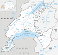 Karte Kanton Waadt 2022.png 2,066 × 1,940; 873 KB
-
 Karte Kanton Waadt Bezirke 2022.png 2,066 × 1,940; 836 KB
-
 1163 Travers.jpg 14,000 × 9,600; 105.21 MB
-
 1164 Neuchâtel.jpg 14,000 × 9,600; 70.87 MB
-
 1165 Murten.jpg 14,000 × 9,600; 74.94 MB
-
 1182 Sainte-Croix.jpg 14,000 × 9,600; 104.23 MB
-
 1183 Grandson.jpg 14,000 × 9,600; 82.55 MB
-
 1184 Payerne.jpg 14,000 × 9,600; 70.9 MB
-
 1185 Fribourg.jpg 14,000 × 9,600; 96.22 MB
-
 1201 Mouthe.jpg 14,000 × 9,600; 96.73 MB
-
 1202 Orbe.jpg 14,000 × 9,600; 108.76 MB
-
 1203 Yverdon-les-Bains.jpg 14,000 × 9,600; 84.74 MB
-
 1204 Romont.jpg 14,000 × 9,600; 89.19 MB
-
 1221 Le Sentier.jpg 14,000 × 9,600; 97.39 MB
-
 1222 Cossonay.jpg 14,000 × 9,600; 89.38 MB
-
 1223 Échallens.jpg 14,000 × 9,600; 86.2 MB
-
 1224 Moudon.jpg 14,000 × 9,600; 90.69 MB
-
 1240 Les Rousses.jpg 14,000 × 9,600; 103.15 MB
-
 1241 Marchairuz.jpg 14,000 × 9,600; 100.61 MB
-
 1242 Morges.jpg 14,000 × 9,600; 79.98 MB
-
 1243 Lausanne.jpg 14,000 × 9,600; 86.44 MB
-
 1244 Châtel-St-Denis.jpg 14,000 × 9,600; 121.23 MB
-
 1245 Château-d'Œx.jpg 14,000 × 9,600; 124.57 MB
-
 1260 Col de la Faucille.jpg 14,000 × 9,600; 117.47 MB
-
 1261 Nyon.jpg 14,000 × 9,600; 82.02 MB
-
 1262 Thonon-les-Bains.jpg 14,000 × 9,600; 34.89 MB
-
 1264 Montreux.jpg 14,000 × 9,600; 89.14 MB
-
 1265 Les Mosses.jpg 14,000 × 9,600; 124.09 MB
-
 1281 Coppet.jpg 14,000 × 9,600; 72.9 MB
-
 1284 Monthey.jpg 14,000 × 9,600; 111.2 MB
-
 1285 Les Diablerets.jpg 14,000 × 9,600; 128.79 MB
-
 1304 Val-d'Illiez.jpg 14,000 × 9,600; 125.89 MB
-
 1305 Dent de Morcles.jpg 14,000 × 9,600; 133.94 MB
-
 Karte Kanton Waadt Bezirke 2008-laveaux.png 1,181 × 1,110; 271 KB
-
 Armée suisse. Carte des manoeuvres du 1er Corps d'Armée - btv1b84601588.jpg 9,247 × 6,792; 15.63 MB
-
 Avenches plan 1731.jpg 400 × 331; 192 KB
-
 Bossey et Petit-Bossey-carte-SITG.jpg 426 × 587; 49 KB
-
 Bossey-carte-SITG.jpg 268 × 275; 24 KB
-
 Bossey-Céligny-1898 1915-Siegried.jpg 1,221 × 775; 742 KB
-
 Bossey-Céligny-2023-SITG-2.jpg 1,173 × 775; 188 KB
-
 Bossey-Céligny-2023-SITG-2.svg 1,100 × 727; 309 KB
-
 Bossey-Céligny-2023-SITG.jpg 1,173 × 775; 222 KB
-
 Bossey-PetitBossey-1898 1915-Siegried.jpg 989 × 693; 482 KB
-
 CEV Bahnstrecken 01.png 640 × 480; 25 KB
-
 Ch wh vd.png 320 × 214; 4 KB
-
 Col de Pétra Félix OSM.png 675 × 608; 598 KB
-
 ETH-BIB-Karte Montreux-Saxon-Dia 247-Z-00418.tif 2,995 × 3,475; 29.9 MB
-
 Genève Switzerland street map.svg 4,076 × 3,555; 36.76 MB
-
 Goldenpass Bahnstrecken 01.png 960 × 720; 38 KB
-
 Goldenpass Bahnstrecken 02.png 960 × 720; 37 KB
-
-
 Karte Gemeinden des Kantons Waadt 2022.png 2,952 × 2,924; 1.85 MB
-
 Karte Gemeinden des Kantons Waadt farbig 2022.png 2,952 × 2,924; 2.3 MB
-
 Karte Kanton Waadt Bezirke 2010 clair.png 2,066 × 1,940; 754 KB
-
 Map genopode.jpg 600 × 400; 113 KB
-
 Map tourdepeilz.png 633 × 324; 132 KB
-
 Mont Tendre.png 656 × 493; 302 KB
-
 Neuchatel-TF-uncorrected.jpg 4,800 × 2,700; 5.79 MB
-
 Reliefkarte Waadt blank.png 3,733 × 3,148; 6.6 MB
-
 Reliefkarte Waadt.png 3,989 × 3,785; 13.31 MB
-
 Stadt Gland 2021.png 4,190 × 4,944; 5.31 MB
-
 Swiss national map, 40 Le Léman.jpg 14,000 × 9,600; 111.37 MB
-
 Switzerland Locator Map VD.svg 1,052 × 744; 237 KB
-

-
-

-
 Vaud relief location map.jpg 412 × 387; 219 KB
-
 Vers-la-Crêtaz.jpg 1,016 × 682; 496 KB
-
 Wiki n10 VDMA jpeg.jpg 2,283 × 1,684; 1.82 MB


,_Neuenburg_(NW),_Waadt_(SW)_und_Fribourg_(SE)_-_(von_Swisstopo_Landeskarte_1165,_Raster_25).jpg)


_(14783295173).jpg)
_(14783429612).jpg)
_(14783782595).jpg)


