Category:Maps of the canton of Uri
Appearance
Cantons of Switzerland: Aargau (AG) · Appenzell Ausserrhoden (AR) · Appenzell Innerrhoden (AI) · Basel-Stadt (BS) · Basel-Landschaft (BL) · Bern (BE) · Fribourg (FR) · Geneva (GE) · Glarus (GL) · Graubünden (GR) · Jura (JU) · Luzern (LU) · Neuchâtel (NE) · Nidwalden (NW) · Obwalden (OW) · Schaffhausen (SH) · Schwyz (SZ) · Solothurn (SO) · St. Gallen (SG) · Thurgau (TG) · Ticino (TI) · Uri (UR) · Valais (VS) · Vaud (VD) · Zug (ZG) · Zürich (ZH)
Subcategories
This category has the following 7 subcategories, out of 7 total.
M
Media in category "Maps of the canton of Uri"
The following 37 files are in this category, out of 37 total.
-
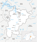
Karte Kanton Uri 2010.png 2,066 × 2,302; 1,003 KB
-
1171 Beckenried.jpg 14,000 × 9,600; 108.87 MB
-
1173 Linthal.jpg 14,000 × 9,600; 131.56 MB
-
1191 Engelberg.jpg 14,000 × 9,600; 132.92 MB
-
1192 Schächental.jpg 14,000 × 9,600; 133.61 MB
-
1193 Tödi.jpg 14,000 × 9,600; 131.02 MB
-
1211 Meiental.jpg 14,000 × 9,600; 142.47 MB
-
1212 Amsteg.jpg 14,000 × 9,600; 141.95 MB
-
1231 Urseren.jpg 14,000 × 9,600; 136.39 MB
-
1232 Oberalppass.jpg 14,000 × 9,600; 135.96 MB
-
1251 Val Bedretto.jpg 14,000 × 9,600; 134.9 MB
-
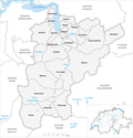
Karte Gemeinden des Kanton Uri 2021.png 1,476 × 1,532; 493 KB
-
Karte Gemeinden des Kantons Uri 2007.png 1,476 × 1,533; 659 KB
-
Altorf (von Swisstopo Dufourkarte BLATT XIV, LT TK 014 1859).tiff 701 × 575; 419 KB
-
Baliaggi-transalpini rev.png 1,500 × 1,516; 572 KB
-
ETH-BIB-Karte Göschenertal-Urserental-Dia 247-Z-00179.tif 3,600 × 2,861; 9.94 MB
-
GLS Oberalp.jpg 1,360 × 720; 238 KB
-
Gotthardtunnel-b2.png 296 × 640; 334 KB
-
Karte Gemeinden des Kantons Uri.png 826 × 860; 220 KB
-
Karte Kanton Uri 2010 clair.png 2,066 × 2,302; 659 KB
-
Karte Kanton Uri.png 885 × 986; 155 KB
-
Map of Canton Uri.png 488 × 600; 100 KB
-
Pfaffensprung-Kehrtunnel bei Wassen.png 318 × 280; 48 KB
-
Pfaffensprung-Kehrtunnel und Linienentwicklung bei Wassen.png 1,026 × 1,176; 416 KB
-
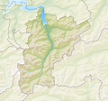
Reliefkarte Uri blank.png 1,715 × 1,605; 2.68 MB
-
Spescha Urserental.jpg 2,359 × 1,524; 1.63 MB
-
Standseilbahn Amsteg-Bristen, map OSM 2023.png 1,046 × 1,534; 750 KB
-
Stau- und Kraftwerk Andermatt.png 771 × 463; 252 KB
-
Stausee Hospental.png 693 × 362; 166 KB
-
Strassenschild am Urnerloch.jpg 540 × 720; 107 KB
-
Swiss Canton Map UR.png 320 × 214; 3 KB
-
Swisstopo Dufourkarte BLATT XIV. ALTORF CHUR LT TK 014 1859.tiff 11,680 × 8,600; 95.82 MB
-
Swisstopo Festungskarte Baezberg LT FK GOT 10 1926.tif 4,956 × 6,200; 87.94 MB
-
Switzerland Locator Map UR.svg 1,052 × 744; 213 KB
-
Urserenkraftwerk 1941.png 1,917 × 2,017; 2.18 MB
-
Urserenkraftwerk.png 1,917 × 2,017; 2.28 MB
-
Vorprojekt Eidgenössische Amt für Wasserwirtschaft (1935).png 1,053 × 1,318; 852 KB


