Category:Maps of the canton of Obwalden
Jump to navigation
Jump to search
Cantons of Switzerland: Aargau (AG) · Appenzell Ausserrhoden (AR) · Appenzell Innerrhoden (AI) · Basel-Stadt (BS) · Basel-Landschaft (BL) · Bern (BE) · Fribourg (FR) · Geneva (GE) · Glarus (GL) · Graubünden (GR) · Jura (JU) · Luzern (LU) · Neuchâtel (NE) · Nidwalden (NW) · Obwalden (OW) · Schaffhausen (SH) · Schwyz (SZ) · Solothurn (SO) · St. Gallen (SG) · Thurgau (TG) · Ticino (TI) · Uri (UR) · Valais (VS) · Vaud (VD) · Zug (ZG) · Zürich (ZH)
Subcategories
This category has the following 5 subcategories, out of 5 total.
- Maps of Engelberg (1 F)
- Maps of Lungern (4 F)
M
Media in category "Maps of the canton of Obwalden"
The following 18 files are in this category, out of 18 total.
-
 Karte Kanton Obwalden 2010.png 2,066 × 1,705; 785 KB
-
 1169 Schüpfheim.jpg 14,000 × 9,600; 118.8 MB
-
 1189 Sörenberg.jpg 14,000 × 9,600; 124.34 MB
-
 1190 Melchtal.jpg 14,000 × 9,600; 127.12 MB
-
 1191 Engelberg.jpg 14,000 × 9,600; 132.92 MB
-
 1209 Brienz.jpg 14,000 × 9,600; 121.45 MB
-
 1210 Innertkirchen.jpg 14,000 × 9,600; 132.52 MB
-
 1211 Meiental.jpg 14,000 × 9,600; 142.47 MB
-
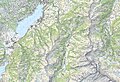
 ETH-BIB-Lungern-See und Melch-Aa-Stollen, Karte-Dia 247-Z-00365.tif 2,880 × 3,414; 28.23 MB
-
 ETH-BIB-Lungern-See, Karte 1836-1920-Dia 247-13302.tif 2,980 × 3,064; 8.77 MB
-
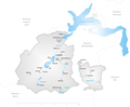
 Karte Gemeinden des Kantons Obwalden 2007.png 1,476 × 1,429; 489 KB
-
 Karte Gemeinden des Kantons Obwalden.png 1,062 × 803; 202 KB
-
 Karte Kanton Obwalden 2010 clair.png 2,066 × 1,705; 523 KB
-
 Karte Kanton Obwalden.png 1,181 × 975; 172 KB
-
 Map of Canton Obwalden.png 826 × 585; 141 KB
-
 Obwalden in Switzerland.png 1,347 × 864; 390 KB
-
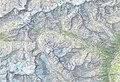
 Reliefkarte Obwalden blank.png 1,233 × 1,096; 1.33 MB
-
 Switzerland Locator Map OW.svg 1,052 × 744; 213 KB


