Category:Maps of the canton of Jura
Appearance
Cantons of Switzerland: Aargau (AG) · Appenzell Ausserrhoden (AR) · Appenzell Innerrhoden (AI) · Basel-Stadt (BS) · Basel-Landschaft (BL) · Bern (BE) · Fribourg (FR) · Geneva (GE) · Glarus (GL) · Graubünden (GR) · Jura (JU) · Luzern (LU) · Neuchâtel (NE) · Nidwalden (NW) · Obwalden (OW) · Schaffhausen (SH) · Schwyz (SZ) · Solothurn (SO) · St. Gallen (SG) · Thurgau (TG) · Ticino (TI) · Uri (UR) · Valais (VS) · Vaud (VD) · Zug (ZG) · Zürich (ZH)
Subcategories
This category has the following 14 subcategories, out of 14 total.
2
M
Media in category "Maps of the canton of Jura"
The following 43 files are in this category, out of 43 total.
-
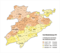
Karte Kanton Jura 2010.png 2,066 × 1,664; 586 KB
-
Karte Kanton Jura Bezirke 2010.png 2,066 × 1,664; 541 KB
-
Karte Kanton Jura 2009.png 1,476 × 1,188; 305 KB
-
1867 1869 a Cadastre gen.jpg 1,101 × 728; 121 KB
-
1867 1869 a Cadastre Montcroix.jpg 1,104 × 744; 131 KB
-
1869 a Cadastre Montcroix gen.jpg 1,134 × 716; 146 KB
-
1869 b Cadastre Montcroix zoom.jpg 1,134 × 851; 200 KB
-
1870 Plan topo a gen.jpg 1,134 × 851; 315 KB
-
1870 Plan topo b Montcroix.jpg 1,134 × 851; 354 KB
-
1870 Plan topo b zoom.jpg 1,134 × 851; 353 KB
-
1872 Plan projet alignement.jpg 1,134 × 851; 156 KB
-
1904 Cadastre Montcroix.jpg 1,134 × 789; 173 KB
-
1904 Cadastre.jpg 1,130 × 731; 143 KB
-
1936 a Cadastre.jpg 1,123 × 793; 214 KB
-
1936 Cadastre.jpg 1,098 × 851; 210 KB
-
1946 Cadastre Montcroix.jpg 1,134 × 851; 162 KB
-
Karte Kanton Jura Bezirke 2009.png 1,476 × 1,188; 275 KB
-
744x599-Carte-canton-du-Jura-Suisse-R3.jpg 744 × 599; 103 KB
-
Carte communes Question jurassienne 1er plébiscite 1974.jpg 897 × 745; 190 KB
-
Carte JU et JUBE.png 3,380 × 2,076; 3.13 MB
-
Carte Jura & Trois-Lacs.jpg 1,494 × 923; 413 KB
-
Carte Jura et Jura Bernois.png 1,311 × 802; 799 KB
-
Jura francophone.png 8,824 × 13,360; 5.5 MB
-
Karte 1. Volksabstimmung Kanton Jura 1974.png 1,500 × 1,323; 513 KB
-
Karte 2. Volksabstimmung Kanton Jura 1975.png 1,500 × 1,323; 447 KB
-
Karte 3. Volksabstimmung Kanton Jura 1975.png 1,500 × 1,323; 402 KB
-
Karte Bezirksergebnisse der Volksabstimmung Kanton Jura 1959.png 1,500 × 1,605; 382 KB
-
Karte Kanton Jura 2.png 1,641 × 1,253; 274 KB
-
Karte Kanton Jura Bezirke 2010 clair.png 2,066 × 1,664; 537 KB
-
Kt. JU.jpg 590 × 425; 26 KB
-
Map Canton Jura Bezirke.png 885 × 638; 122 KB
-
Reliefkarte Jura blank.png 1,988 × 1,509; 2.76 MB
-
Résultat de la votation de 1959.png 751 × 907; 408 KB
-
Résultat deuxième plébiscite jurassien 1975 (1).jpg 3,024 × 1,832; 482 KB
-
Résultat deuxième plébiscite jurassien 1975 (2).jpg 2,715 × 1,832; 486 KB
-
Résultat du deuxième plébiscite de 1975.png 862 × 944; 480 KB
-
Résultat du premier plébiscite de 1974.png 848 × 910; 573 KB
-
Résultat du troisième plébiscite de 1975.png 838 × 938; 552 KB
-
Résultat premier plébiscite jurassien 1974.jpg 2,562 × 1,821; 633 KB
-
Résultat troisième plébiscite jurassien 1975.jpg 2,681 × 1,832; 502 KB
-
Résultat votation bernoise 1959.jpg 1,813 × 1,832; 372 KB
-
Switzerland Locator Map JU.svg 1,052 × 744; 213 KB


