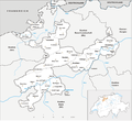
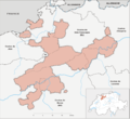
Category:Maps of the canton of Solothurn
Jump to navigation
Jump to search
Cantons of Switzerland: Aargau (AG) · Appenzell Ausserrhoden (AR) · Appenzell Innerrhoden (AI) · Basel-Stadt (BS) · Basel-Landschaft (BL) · Bern (BE) · Fribourg (FR) · Geneva (GE) · Glarus (GL) · Graubünden (GR) · Jura (JU) · Luzern (LU) · Neuchâtel (NE) · Nidwalden (NW) · Obwalden (OW) · Schaffhausen (SH) · Schwyz (SZ) · Solothurn (SO) · St. Gallen (SG) · Thurgau (TG) · Ticino (TI) · Uri (UR) · Valais (VS) · Vaud (VD) · Zug (ZG) · Zürich (ZH)
Subcategories
This category has the following 40 subcategories, out of 40 total.
- Maps of Balsthal (2 F)
- Maps of Biberist (6 F)
- Maps of Boningen (1 F)
- Maps of Dulliken (1 F)
- Maps of Egerkingen (3 F)
- Maps of Grenchen (4 F)
- Maps of Hägendorf (1 F)
- Maps of Hauenstein-Ifenthal (1 F)
- Maps of Kappel SO (1 F)
- Maps of Kleinlützel (2 F)
- Maps of Niederbuchsiten (2 F)
- Maps of Obergösgen (1 F)
- Maps of Olten (4 F)
- Maps of Rickenbach (1 F)
- Maps of Starrkirch-Wil (1 F)
- Maps of Trimbach (1 F)
- Maps of Wangen bei Olten (1 F)
- Maps of Winznau (1 F)
1
2
M
O
Media in category "Maps of the canton of Solothurn"
The following 35 files are in this category, out of 35 total.
-
 Karte Kanton Solothurn 2010.png 2,066 × 1,897; 1,009 KB
-
 Karte Kanton Solothurn Bezirke 2010.png 2,066 × 1,899; 909 KB
-
 Karte Kanton Solothurn Amtei 2010.png 2,066 × 1,899; 870 KB
-
 Karte Kanton Solothurn.png 1,062 × 977; 225 KB
-
 1108 Murgenthal.jpg 14,000 × 9,600; 97.1 MB
-
 1126 Büren an der Aare.jpg 14,000 × 9,600; 105.13 MB
-
 1127 Solothurn.jpg 14,000 × 9,600; 90.53 MB
-
 Karte Kanton Solothurn Bezirke.png 1,062 × 972; 201 KB
-
 Karte Bezirk Bucheggberg.png 1,062 × 949; 234 KB
-
 Kanton Solothurn Burgen und Schlösser.png 1,476 × 1,355; 354 KB
-
 Burgunderkriege.png 2,500 × 2,527; 1.13 MB
-
 Districts of Canton Solothurn.png 826 × 737; 198 KB
-
 Karte Bezirk Dorneck.png 1,062 × 949; 237 KB
-
 Karte Bezirk Gäu.png 1,062 × 949; 234 KB
-
 Karte Bezirk Gösgen.png 1,062 × 949; 236 KB
-

-
 Karte Gemeinden des Kantons Solothurn 2003.png 2,952 × 2,701; 1.08 MB
-
 Karte Gemeinden des Kantons Solothurn leer 2012.png 2,952 × 2,701; 640 KB
-
 Karte Kanton Solothurn Bezirke 2010 clair.png 2,066 × 1,899; 662 KB
-
 Karte Passwang Wanderwege.png 1,157 × 533; 958 KB
-
 Karte Passwangstrasse.png 1,252 × 645; 991 KB
-
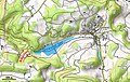 Karte Seewener See.jpg 733 × 465; 330 KB
-
 Karte-Historische-Gliederung-Solothurn.png 2,000 × 1,690; 345 KB
-
 Karte-Territoriale-Entwicklung-Kanton-Solothurn.png 2,500 × 2,112; 764 KB
-
 Karte Bezirk Lebern.png 1,062 × 949; 235 KB
-
 Map of Canton Solothurn.png 673 × 600; 211 KB
-
 Karte Bezirk Olten.png 1,062 × 949; 234 KB
-
 Reliefkarte Solothurn blank.png 1,734 × 1,433; 2.41 MB
-
 Reliefkarte Solothurn.png 2,263 × 1,771; 3.86 MB
-
 Reliefkarte Solothurner Seen.png 1,888 × 1,477; 1.97 MB
-
 Karte Bezirk Solothurn.png 1,062 × 949; 231 KB
-
 Switzerland Locator Map SO.svg 1,052 × 744; 213 KB
-
 Karte Bezirk Thal.png 1,062 × 949; 237 KB
-
 Karte Bezirk Thierstein.png 1,062 × 949; 236 KB
-
 Karte Bezirk Wasseramt.png 1,062 × 949; 235 KB


_und_Seehof_(SW)_im_Kanton_Bern_mit_Jura_(WSW),_Solothurn_(SE)_-_(von_Swisstopo_Landeskarte_1107,_Raster_25).jpg)


