Category:Maps of the Spanish Empire
Jump to navigation
Jump to search
Austrian Empire · Austria-Hungary · Great Britain · British Empire · Byzantine Empire · Carolingian Empire · Fatimid Caliphate · Republic of Genoa · Habsburg Monarchy · Holy Roman Empire · Polish-Lithuanian Commonwealth · Ottoman Empire · Papal States · Prussia · Grand Duchy of Moscow · Spanish Netherlands · Tsardom of Russia · Russian Empire · Soviet Union · Spanish Empire · Republic of Venice ·
Subcategories
This category has the following 8 subcategories, out of 8 total.
!
C
L
M
P
S
Media in category "Maps of the Spanish Empire"
The following 43 files are in this category, out of 43 total.
-
Adams onis map.png 800 × 654; 226 KB
-
Universidades fundadas por España en América y Filipinas.png 1,000 × 1,000; 258 KB
-
Capitanía general de Filipinas.svg 494 × 243; 200 KB
-
Dutch and Spanish Taiwan es.svg 627 × 720; 197 KB
-
Empresa de China.svg 1,974 × 1,974; 2.34 MB
-
España 1861-1865.jpg 2,301 × 1,127; 836 KB
-
España y Portugal.png 1,500 × 770; 254 KB
-
España y sus provincia de ultramar (1861).jpg 3,229 × 1,650; 269 KB
-
Flag map of Spanish Empire.png 1,776 × 972; 158 KB
-
Flag map of Viceroyalty of New Spain (1794).png 2,055 × 1,786; 169 KB
-
Flag-map of Spanish Empire.png 1,357 × 628; 20 KB
-
Fundaciones de hospitales en el Imperio Español.png 2,879 × 2,016; 1.12 MB
-
Habsburg Empire of Charles V.png 1,125 × 1,350; 539 KB
-
Imperio Español America 1800.png 809 × 1,270; 278 KB
-
Imperio Español Completo.png 4,371 × 2,284; 2.89 MB
-
Imperio español en Asia y Oceanía.png 300 × 323; 25 KB
-
Imperio Español en Asia y Oceanía.png 450 × 502; 32 KB
-
Karte Portugiesisch-Spanischer Verträge.png 1,500 × 775; 180 KB
-
Largest empires in history including claims.png 6,151 × 4,393; 2.63 MB
-
Linie Inter Caetera und Tordesillas.jpg 1,200 × 1,254; 103 KB
-
Andres Urdaneta Tornaviaje.jpg 1,590 × 1,306; 1.54 MB
-
Mayores imperios incluyendo reclamaciones.png 6,151 × 4,393; 2.67 MB
-
Portugal and Environs 1415-ar.png 350 × 203; 21 KB
-
Portugal and Environs 1415.png 350 × 203; 19 KB
-
Primera traza de Córdoba.jpg 1,584 × 1,273; 412 KB
-
Principales Rutas Comerciales del Imperio Español.jpg 5,400 × 2,700; 3.43 MB
-
Reinos e imperios católicos.svg 2,754 × 1,398; 1.87 MB
-
Size of Empires (Fuller Projection).svg 1,848 × 3,624; 1.21 MB
-
Spain and Portugal-ar.png 1,500 × 771; 225 KB
-
Spain and Portugal-fr.png 1,500 × 771; 188 KB
-
Spain and Portugal.png 1,500 × 771; 92 KB
-
Spanish contact in BC and Alaska.jpg 1,280 × 978; 118 KB
-
Spanish Empire Flag Map (Europe Metalic).png 4,032 × 6,000; 3.19 MB
-
Spanish Empire Map.jpg 772 × 376; 182 KB
-
Spanish North America.png 7,949 × 7,944; 25.09 MB
-
Spanish road (in red).png 829 × 720; 345 KB
-
Spanish territorial boundary changes in Northwest Africa 1885-1912.png 1,724 × 2,089; 323 KB
-
Spanish World Empire.png 15,967 × 9,052; 20.27 MB
-
SpanishEmpire.png 11,382 × 5,947; 11.93 MB
-
SpanishEmpireandControlledlands.png 5,762 × 3,038; 1.61 MB
-
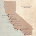
SpanishMissionsinCA.png 5,400 × 5,400; 9.23 MB
-
África Ecuatorial Española.svg 2,846 × 1,863; 1.91 MB
-
מפת חוזה סרגוסה.svg 1,219 × 627; 643 KB
Categories:
- Spanish Empire
- Spanish Catholic Monarchy
- Maps of colonial empires
- Maps of the history of Oceania by former country
- Maps of the history of Asia by former country
- Maps of the history of Africa by former country
- Maps of the history of South America by former country
- Maps of the history of North America by former country
- Maps of the history of Europe by former country
- Maps of the history of Spain


