Category:Old maps of the Spanish Empire
Jump to navigation
Jump to search
Austrian Empire · Austria-Hungary · Great Britain · British Empire · Byzantine Empire · Carolingian Empire · Republic of Genoa · Habsburg Monarchy · Holy Roman Empire · Polish-Lithuanian Commonwealth · Ottoman Empire · Prussia · Grand Duchy of Moscow · Tsardom of Russia · Russian Empire · Soviet Union · Spanish Empire ·
Old maps of the Spanish Empire.
Subcategories
This category has the following 9 subcategories, out of 9 total.
A
E
S
Media in category "Old maps of the Spanish Empire"
The following 27 files are in this category, out of 27 total.
-

-
 (Putzger) Spanish and Portuguese colonial empires in 16th century.jpg 3,974 × 3,118; 2.16 MB
-
 (Shepherd, 1911 Atlas) European colonial empires in the 16th century.jpg 4,593 × 2,222; 2.09 MB
-
 (Spruner-Menke, map 20) Spanish and Portuguese posessions in the 16th century.jpg 3,338 × 2,750; 2.23 MB
-

-
 T.V.(1857) - (5) MAPA-MUNDI DE TODAS LAS POSESIONES ESPAÑOLAS EN LOS SIGLOS XVI. Y XVII..jpg 4,241 × 3,165; 5.93 MB
-
 Aspecto Geographico del Mundo Hispanico (1761).jpg 4,789 × 7,880; 6.93 MB
-
 Blaeu 1645 - Artesia Comitatus Artois.jpg 3,589 × 3,031; 1.47 MB
-
 Carta de los descrubrimientos hechos en la costa N.O. de la America Septentrional.jpg 2,431 × 2,097; 563 KB
-

-
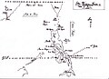
 Chile Araucania Map 1610.jpg 2,505 × 555; 403 KB
-
 Descripción de las Yndias Occidentales.jpg 1,253 × 988; 182 KB
-

-
 European dominions of Charles V (1519).jpg 460 × 404; 106 KB
-
 Mapa de Filippinas Formosa y costa de China para el Galeon de Manila.JPG 3,508 × 2,552; 930 KB
-
 First Map of Caracas, 1578.jpg 900 × 883; 186 KB
-
 Islas Marianas Palaos y Carolinas.JPG 902 × 489; 184 KB
-
 La Mamora 1621.jpg 1,996 × 1,278; 306 KB
-
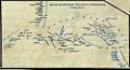
 Mapa Audiencia Guatemala con los límites de Costa Rica y Veragua, 1657.jpg 1,031 × 1,270; 828 KB
-
 Meyers b9 s0954a.jpg 1,589 × 2,048; 504 KB
-
 Flanders or the Spanish Provinces (NYPL b14428893-1503421).jpg 6,299 × 5,184; 6.84 MB
-
 Plano de la bahía de Assab (español).jpg 3,721 × 4,864; 10.66 MB
-
 Pueblo de Cayambe en el Corregimiento de Otavalo - AHG.jpg 9,049 × 5,563; 11.25 MB
-
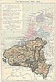 Southern Netherlands map 001.jpg 1,320 × 1,919; 582 KB
-
 Spain and Portugal, 1954.jpg 1,016 × 1,414; 216 KB
-
 Spruner-Menke Handatlas 1880 Karte 20.jpg 10,433 × 8,737; 16.46 MB
-

_European_explorations_and_colonies_from_the_fifteenth_to_the_seventeeth_century.jpg)
_Spanish_and_Portuguese_colonial_empires_in_16th_century.jpg)
_European_colonial_empires_in_the_16th_century.jpg)
_Spanish_and_Portuguese_posessions_in_the_16th_century.jpg)

_-_(5)_MAPA-MUNDI_DE_TODAS_LAS_POSESIONES_ESPA%C3%91OLAS_EN_LOS_SIGLOS_XVI._Y_XVII..jpg)
.jpg)


.jpg)


.jpg)
.jpg)


