Category:Maps of the Republic of Venice
Jump to navigation
Jump to search
Subcategories
This category has the following 5 subcategories, out of 5 total.
Media in category "Maps of the Republic of Venice"
The following 109 files are in this category, out of 109 total.
-
Venetie1494.jpg 1,203 × 787; 308 KB
-
Venetikà.gif 368 × 327; 16 KB
-
Republik Venedig.png 625 × 361; 409 KB
-
Italy 1050.jpg 994 × 1,050; 643 KB
-
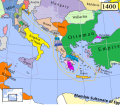
Venice1400.png 647 × 563; 195 KB
-
Venice1400.svg 647 × 562; 152 KB
-
Map of Italy (1402)-fr.svg 3,264 × 3,837; 336 KB
-
Eastern Mediterranean 1450 - Arabic.PNG 2,690 × 2,395; 636 KB
-
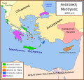
Eastern Mediterranean 1450 el.svg 2,529 × 2,395; 226 KB
-
Eastern Mediterranean 1450 tr.png 2,529 × 2,395; 624 KB
-
Eastern Mediterranean 1450-hu.svg 2,497 × 2,369; 180 KB
-
Eastern Mediterranean 1450-zh.svg 3,121 × 2,962; 219 KB
-
Eastern Mediterranean 1450.svg 2,497 × 2,369; 265 KB
-
Mediterraneo Orientale 1450.svg 2,449 × 2,320; 546 KB
-
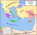
Se Easterna Wendelsæ in 1450.svg 2,529 × 2,395; 278 KB
-
Italia 1494b-es.svg 688 × 930; 418 KB
-
Italy 1494 AD hu.svg 688 × 930; 417 KB
-
Italy 1494 AD-ar.png 419 × 600; 92 KB
-
Italy 1494 AD-fr.svg 576 × 812; 417 KB
-
Italy 1494 AD-hu.svg 688 × 930; 416 KB
-
Italy 1494 AD-it.svg 688 × 930; 418 KB
-
Italy 1494 AD.png 1,261 × 1,805; 144 KB
-
Italy 1494 el.png 419 × 600; 98 KB
-
Italy 1494 shepherd.jpg 1,629 × 2,282; 1.39 MB
-
Map of Italy (1494)-en.svg 3,461 × 4,211; 403 KB
-
Map of Italy (1494)-it-2.png 493 × 600; 103 KB
-
Map of Italy (1494)-it.svg 3,245 × 3,948; 536 KB
-
Map of Italy (1494)-mk.svg 3,245 × 3,948; 1.11 MB
-
Repubblica di Venezia-es.svg 2,077 × 1,724; 1.15 MB
-
Repubblica di Venezia.png 1,000 × 635; 114 KB
-
Dalmazia1560.png 516 × 424; 586 KB
-
Map - Special Collections University of Amsterdam - OTM- HB-KZL 33.03.38.tiff 7,108 × 6,262; 127.35 MB
-
Napoleonic northern Italy circa 1795–1801.jpg 861 × 635; 196 KB
-
Italia 1796 - HE.svg 767 × 1,093; 256 KB
-
Italia 1796.svg 767 × 1,093; 70 KB
-
Italy 1796 AD-ar.png 419 × 600; 90 KB
-
Italy 1796 AD-el.png 419 × 600; 91 KB
-
Italy 1796 AD-it.png 767 × 1,093; 231 KB
-
Italy 1796 AD-ko.png 1,007 × 1,442; 202 KB
-
Italy 1796 AD-sv.png 1,007 × 1,442; 213 KB
-
Italy 1796 AD.png 1,007 × 1,442; 92 KB
-
Italy 1796 heb.jpg 1,251 × 1,814; 970 KB
-
Italy northern 1796.jpg 983 × 932; 451 KB
-
Republic of Venice 1796.png 1,026 × 1,009; 115 KB
-
1799 Cary Map of Mantua, Venice and Tyrol, Italy - Geographicus - Venice-cary-1799.jpg 5,000 × 4,513; 8.31 MB
-
1801 Cary Map of Austria - Geographicus - Austria-cary-1801.jpg 5,000 × 4,488; 7.86 MB
-
Albanian States.svg 699 × 522; 54 KB
-
Annonaria.png 368 × 327; 19 KB
-
C. 1250 Venetian Republic.jpg 997 × 697; 627 KB
-
C. 1494 Italy.jpg 1,298 × 1,727; 2.71 MB
-
C. 1560 Savoy and Italy.jpg 1,144 × 1,174; 1.15 MB
-
C. 1650 Italian Peninsula.jpg 748 × 787; 681 KB
-
C. 1650 Ottoman Empire.jpg 1,520 × 1,081; 1.7 MB
-
C. 1650 Republic of Venice.jpg 900 × 768; 760 KB
-
C. 1796 Northern Italy.jpg 1,267 × 1,211; 1.58 MB
-
Eastern Mediterranean 1450 - HE.svg 2,529 × 2,395; 259 KB
-
Eastern Mediterranean 1450 -HE.svg 2,529 × 2,395; 319 KB
-
Eastern Mediterranean 1450 es.svg 2,529 × 2,395; 362 KB
-
Eastern Mediterranean 1450 hu.png 945 × 900; 322 KB
-
Eastern Mediterranean 1450 pt.svg 512 × 485; 92 KB
-
Eastern Mediterranean 1450-ru.svg 2,497 × 2,369; 267 KB
-
Eastern Mediterranean 1450-sr.svg 2,529 × 2,395; 223 KB
-
Eastern Mediterranean in 1450-hy.png 2,163 × 2,048; 329 KB
-
Flag map of the Republic of Venice (697–1797).svg 2,409 × 1,567; 204 KB
-
Giurisdizioni bresciane in epoca veneta (Luca Giarelli).png 1,367 × 2,000; 273 KB
-
Il Bergamasco diviso ne' suoi distretti - Venezia 1782 - by Antonio Zatta.jpg 2,904 × 3,475; 5.55 MB
-
Italia 1494b-ca.svg 688 × 930; 416 KB
-
Italian States in 1789.png 1,632 × 2,149; 473 KB
-
Italy in 1859 (Johnston).jpg 1,509 × 1,763; 1.32 MB
-
Joan Blaeu, Atlas Maior - Venedig.png 700 × 600; 675 KB
-
John Cary 1799 map of the territory of Bergamo.jpg 740 × 1,353; 420 KB
-
La provincia di Brescia divisa ne' suoi territorj - Venezia 1782 - by Antonio Zatta.jpg 3,478 × 4,456; 8.87 MB
-
Map of Italy (1402)-ca.svg 3,264 × 3,837; 322 KB
-
Koenigreich Neapel Sizilien.jpg 1,482 × 1,899; 221 KB
-
Maritime Venetia c 600 AD.jpg 1,280 × 823; 335 KB
-
Mediteràneo Orientàl 1450 - lmo.svg 2,529 × 2,395; 280 KB
-
Muda delle Fiandre del 1463.svg 336 × 224; 351 KB
-
Muda delle Fiandre del 1464.svg 336 × 224; 362 KB
-
Muda di Aigues-Mortes nel 1424.svg 336 × 224; 340 KB
-
Muda di Barberia 1458.svg 336 × 224; 302 KB
-
Prodor turaka u crnu goru XV c BC b.png 839 × 1,223; 245 KB
-
Repubblica di Venezia ar.png 800 × 508; 242 KB
-
Repubblica di Venezia hu.svg 1,333 × 847; 156 KB
-
Republic of Venice 1789.svg 450 × 456; 927 KB
-
Republic of Venice – Blank map of the main territories.png 3,862 × 2,426; 147 KB
-
Republic of Venice – Map of the main territories He.png 3,862 × 2,426; 362 KB
-
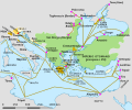
Republik Venedig Handelswege01-IT.png 943 × 501; 345 KB
-
Republik Venedig Handelswege01.png 943 × 501; 335 KB
-
Serenissima.png 2,171 × 633; 84 KB
-
South-eastern Europe 1700.jpg 1,126 × 859; 372 KB
-
The Lands of Venice in the 15th century.jpg 2,807 × 1,877; 2.75 MB
-
The Republic of Venice .png 1,837 × 1,655; 808 KB
-
The Republic of Venice in the mid-18th century.jpg 1,600 × 1,200; 574 KB
-
The Venetia c 600 AD.jpg 6,145 × 3,952; 3.01 MB
-
The Venetia c 720 AD.jpg 6,145 × 3,952; 6.45 MB
-
The Venetia c 840 AD.jpg 6,145 × 3,952; 7.95 MB
-
Venetian Holdings.png 5,016 × 3,148; 12.38 MB
-
Venetian Republic evolution en.png 5,833 × 3,750; 4.76 MB
-
Venetian seaside properties in Montenegro 1448.png 1,020 × 1,024; 240 KB
-
Venetian seside properties in Montenegro 1448-es.svg 1,156 × 1,170; 524 KB
-
Venezia patriarcato.png 2,847 × 1,808; 240 KB
-
Venise et Gênes.jpg 600 × 319; 281 KB
-
Östliches Mittelmeer 1450 DE.svg 2,529 × 2,395; 201 KB
-
מפת רפובליקת ונציה.png 1,109 × 598; 196 KB


