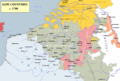
Category:Maps of the Spanish Netherlands
Jump to navigation
Jump to search
For the purpose of this category, 'Spanish Netherlands' will be considered those territories in the Low Countries owned by the House of Habsburg between 1556 and 1714, including the 1598–1621 period when they were owned by Albert VII, Archduke of Austria and Isabella Clara Eugenia of Spain, Archduchess of Austria. See also Category:Southern Netherlands.
Subcategories
This category has only the following subcategory.
M
Media in category "Maps of the Spanish Netherlands"
The following 28 files are in this category, out of 28 total.
-
 Map Union of Arras and Utrecht 1579-bg.svg 749 × 872; 62 KB
-
 Map Union of Arras and Utrecht 1579-en.svg 749 × 872; 140 KB
-
 Map Union of Arras and Utrecht 1579-fr.svg 750 × 860; 132 KB
-
 Map Union of Arras and Utrecht 1579-no.svg 749 × 872; 139 KB
-
 Utrecht-Atrecht French.jpg 488 × 583; 58 KB
-
 Utrecht-atrecht.jpg 488 × 583; 82 KB
-

-

-
 Carte Pays-bas espagnol-es.svg 509 × 708; 132 KB
-
 Carte Pays-bas espagnol.svg 509 × 708; 81 KB
-
 Dominios de Felipe II-hu.svg 927 × 573; 521 KB
-
 Dominios de Felipe II-it.png 800 × 494; 67 KB
-
 Dominios de Felipe II-pt.svg 927 × 573; 377 KB
-
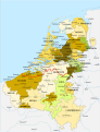
 Dominios de Felipe II.svg 927 × 573; 719 KB
-

-
 Habsburgse Nederlanden 1555-2-es.svg 1,651 × 2,162; 3.06 MB
-
 Habsburgse Nederlanden 1555-Simple-es.svg 1,651 × 2,162; 920 KB
-
 Habsburgse Nederlanden 1555.svg 1,651 × 2,162; 871 KB
-

-

-
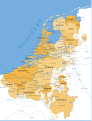
 Low Countries 1700.png 1,520 × 1,028; 582 KB
-
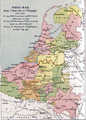
 Map of the Habsburg Netherlands by Alexis-Marie Gochet-es.svg 1,651 × 2,162; 1.79 MB
-
 Map of the Habsburg Netherlands by Alexis-Marie Gochet.png 532 × 744; 813 KB
-
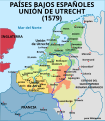 Map Union of Arras and Utrecht 1579-es.svg 750 × 860; 132 KB
-
 Map Union of Arras and Utrecht 1579-gl.svg 750 × 860; 173 KB
-
 Namurcum Comitatus.jpg 6,052 × 4,960; 10.45 MB
-
 Novissima et Accuratissima Brabantiae Ducatus Tabula.jpg 6,596 × 5,106; 12.21 MB
-
 Spanish Netherlands.svg 750 × 900; 232 KB


.4.(19).jpg)


,_RP-P-AO-18-189.jpg)
,_RP-P-AO-18-163.jpg)


