Category:Maps of the history of Transylvania
Jump to navigation
Jump to search
Subcategories
This category has the following 12 subcategories, out of 12 total.
A
D
H
J
- Josephinische Landaufnahme (1 P, 821 F)
M
- Maps of Eurasian Avars (72 F)
- Maps of the Gepids (51 F)
O
Media in category "Maps of the history of Transylvania"
The following 163 files are in this category, out of 163 total.
-
 13szköz.jpg 800 × 595; 42 KB
-
 1570 borders of the Principality of Transylvania.svg 970 × 970; 42 KB
-
 1570 grenzen van Vorstendom Transsylvanië.svg 970 × 970; 42 KB
-
 15szeleje.jpg 800 × 595; 46 KB
-

-
 Albanians as a migrant Dacian people.png 1,584 × 1,140; 455 KB
-
 AmlasFagaras.svg 925 × 406; 278 KB
-
 AmlasFagarasRomanian.svg 925 × 406; 295 KB
-
 Aranyos map.PNG 1,139 × 920; 79 KB
-
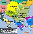 AtlBalk1250.jpg 318 × 327; 171 KB
-
 AtlBalk1300.jpg 318 × 327; 170 KB
-
 AtlBalk1350.jpg 318 × 327; 177 KB
-
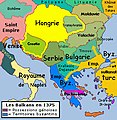 AtlBalk1375.jpg 318 × 327; 179 KB
-
 AtlBalk1400.jpg 318 × 327; 163 KB
-
 AtlBalk1500.jpg 318 × 327; 162 KB
-
 AtlBalk1600.jpg 318 × 327; 171 KB
-
 AtlBalk1700.jpg 318 × 327; 173 KB
-
 AtlBalk1730.jpg 318 × 327; 175 KB
-
 AtlBalk1750.jpg 318 × 327; 179 KB
-
 AtlBalk1850.jpg 318 × 327; 158 KB
-
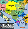
 AtlBalk965.jpg 318 × 327; 174 KB
-
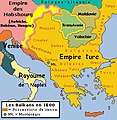
 Balkans map 1810.jpg 318 × 327; 153 KB
-
 BALKANS ROMAN ROADS .jpg 1,686 × 1,239; 394 KB
-
 Bethlen Gábor fejedelemsége.png 14,880 × 13,485; 18.02 MB
-
 BihorSolnocCrasnaCountyJosephinischeLandesaufnahme.jpg 800 × 762; 809 KB
-
 CampañaRumanaAgostoSeptiembre1916.svg 1,204 × 922; 899 KB
-
 CampañaRumanaSeptiembreOctubre1916.svg 2,615 × 2,000; 1.22 MB
-
 Central europe 1572 hu.svg 922 × 880; 117 KB
-
 Central europe 1572.png 922 × 880; 120 KB
-
 Central Erope 1572 es.svg 1,122 × 883; 248 KB
-
 Central Erope 1572 HU.svg 1,122 × 883; 243 KB
-
 Central europe 1683.png 1,280 × 971; 390 KB
-
 Vassal states of the Ottoman Empire in 1683 hu.svg 877 × 688; 397 KB
-
 Vassal states of the Ottoman Empire in 1683.svg 877 × 688; 278 KB
-
 Vassal states of the Ottoman Empire in 1683-es.svg 2,557 × 2,000; 1.11 MB
-
 Vassal states of the Ottoman Empire in 1683-pt.svg 2,557 × 2,000; 583 KB
-
 Varat Eyalet, Central europe 1683.png 1,499 × 974; 785 KB
-
 Cosmographia (Sebastian Münster) p 105.jpg 2,000 × 1,455; 530 KB
-
 Daakian-provinssi.png 1,045 × 574; 626 KB
-
 Dacia (Imperium Romanum).PNG 2,495 × 1,775; 55 KB
-
 Dacia 82 BC bg.png 312 × 261; 32 KB
-
 Dacia 82 BC heb.png 650 × 544; 349 KB
-
 Dacia 82 BC.png 306 × 246; 53 KB
-
 Dacia 82 vChr.png 780 × 506; 1.02 MB
-
 Dacia SPQR.png 800 × 548; 28 KB
-
 Danubian Principalities 1800 es.svg 551 × 387; 381 KB
-
 Danubian Principalities 1800 no.svg 549 × 386; 89 KB
-
 Danubian Principalities 1800.svg 549 × 386; 89 KB
-
 Donaumonarchie Zevenburgen.png 519 × 393; 12 KB
-
 East-hungary13th.PNG 287 × 259; 38 KB
-
 East-hungary16th.PNG 310 × 260; 37 KB
-
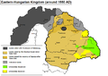
 Eastern-hungarian-kingdom1550.JPG 1,500 × 1,057; 576 KB
-
 Eastern-hungarian-kingdom1550.PNG 1,107 × 780; 83 KB
-
 Ottoman vojvodina01-sr.png 944 × 978; 92 KB
-
 Ottoman vojvodina01.png 944 × 978; 107 KB
-
 Elayet of temesvar-sr.png 833 × 1,075; 109 KB
-
 Elayet of temesvar.png 833 × 1,075; 123 KB
-
 Erdély adminisztratív felosztása.jpg 1,139 × 920; 188 KB
-
 Europa-HyeronimusMunzer-1493.jpg 3,140 × 2,130; 1.55 MB
-
 Fiefs wallachia.png 1,084 × 746; 356 KB
-
 FilialstuhlTalmesch.svg 1,152 × 1,053; 644 KB
-
 Gepid kingdom 6th century - es.svg 1,102 × 1,154; 218 KB
-
 Gepid kingdom 6th century - pt.svg 1,102 × 1,154; 223 KB
-
 Gepid kingdom 6th century - ru.svg 1,033 × 1,082; 161 KB
-
 Gepid kingdom 6th century - zh.svg 1,102 × 1,154; 82 KB
-
 Gepid kingdom 6th century-hu.svg 1,102 × 1,154; 70 KB
-
 Gepid kingdom 6th century-sr.png 858 × 894; 53 KB
-
 Gepid kingdom 6th century.png 858 × 894; 55 KB
-
 GraniţaMilitarăTransilvăneană.PNG 699 × 643; 87 KB
-
 Greater austria.png 1,500 × 1,280; 45 KB
-
 Vereinigte Staaten von Groß-Österreich.png 1,500 × 1,280; 192 KB
-
 대 오스트리아.png 1,500 × 1,280; 64 KB
-
 Greater austriaPL.png 1,500 × 1,280; 74 KB
-
 Großfürstentum Siebenbürgen-Komitat Kokelburg um 1770.jpg 1,280 × 847; 473 KB
-
 Historic map of Balkan peninsula around 1150 AD - French.jpg 318 × 327; 160 KB
-
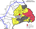
 Hungarian autonomous province01.png 443 × 371; 5 KB
-
 Hungarian autonomous province02 (hun).svg 710 × 647; 73 KB
-
 Hungarian autonomous province02.png 751 × 727; 60 KB
-
 Magyar Autonomous Region.png 619 × 599; 103 KB
-
 Hungary 13th cent corrected.png 1,757 × 1,307; 458 KB
-
 Hungary 13th cent.png 1,757 × 1,307; 451 KB
-
 Hungary 13th century hu.svg 1,757 × 1,307; 557 KB
-
 Hungary 13th century.png 1,757 × 1,307; 356 KB
-
 Hungary Bihar.png 1,000 × 661; 55 KB
-
 KuK Nichtunierte.jpg 1,465 × 1,497; 1.29 MB
-
 L'impero bizantino nel 1045.jpg 800 × 554; 351 KB
-
 Magyar Okmánytárak documenta historiam kenéz1941.jpg 5,286 × 6,277; 6.41 MB
-
 Magyar- és Erdélyország 1629-ben (Pallas).jpg 2,280 × 1,800; 946 KB
-
 Magyarország a szatmári-béke korában.jpg 1,100 × 828; 311 KB
-
 MagyarsInTransylvania.PNG 724 × 490; 125 KB
-
 Map Byzantine Empire 1045 2000px svg.png 2,000 × 1,385; 1,000 KB
-
 Map Byzantine Empire 1045 el.svg 1,300 × 900; 338 KB
-
 Maramures Josephinische Landesaufnahme 1782-1785 Background.jpg 800 × 781; 317 KB
-
 Maros-Torda.jpg 1,659 × 1,412; 556 KB
-
 MAT.gif 800 × 564; 38 KB
-
 Mezoseg-CampiaTransilvaniei.png 1,829 × 1,476; 195 KB
-
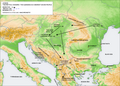
 MigrationRouteOnRomanianTeritory.svg 1,736 × 1,166; 2.38 MB
-
 Mihai 1600 es.svg 551 × 387; 457 KB
-
 Mihai 1600-ar.png 587 × 413; 79 KB
-

-
 Northern Transylvania yellow.png 471 × 371; 7 KB
-
 Németek Erdélyben.svg 695 × 568; 93 KB
-
 Ottomaanse Rijk in Centraal Europa in 1683 (NL).svg 877 × 605; 412 KB
-
 Partium1570 hu.png 1,027 × 1,015; 202 KB
-
 Partium1570.PNG 1,027 × 1,015; 165 KB
-
 PodzialWegier hu.svg 840 × 602; 71 KB
-
 PodzialWegier.png 840 × 602; 37 KB
-

-
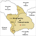
 Principality of Transylvania.png 640 × 632; 1.55 MB
-
 REmpire-Dacia.png 400 × 296; 78 KB
-
 Roemenië 1600.png 360 × 284; 37 KB
-
 Rom1793-1812 fr2.png 588 × 413; 100 KB
-
 Rom1793-1812.png 587 × 413; 78 KB
-
 Rom1918.jpg 587 × 430; 124 KB
-
 Rom1942.jpg 648 × 480; 343 KB
-
 Roman Byzantine Gothic Walls Romania Plain.svg 1,500 × 1,300; 1,005 KB
-
 Roman Empire Map AlexanderFindlay1849.png 2,038 × 1,828; 2 MB
-
 Roman Gothic Walls Romania Plain-pt.svg 512 × 444; 131 KB
-
 Roman Gothic Walls Romania Plain.svg 1,500 × 1,300; 384 KB
-
 Roman province of Dacia (106 - 271 AD)-ca.svg 1,500 × 1,300; 395 KB
-
 Roman province of Dacia (106 - 271 AD)-es.svg 1,500 × 1,300; 802 KB
-
 Roman province of Dacia (106 - 271 AD)-pt.svg 512 × 444; 142 KB
-
 Roman province of Dacia (106 - 271 AD).svg 1,500 × 1,300; 392 KB
-
 Romania 1600.png 367 × 285; 27 KB
-
 Romania 1859-1878.jpg 588 × 413; 196 KB
-
 Romania 1938 - Arges.svg 1,052 × 790; 104 KB
-
 Romania 1938 - Crisuri.svg 1,052 × 790; 104 KB
-
 Romania 1938 - Mures.svg 1,052 × 790; 104 KB
-
 Romania 1938 - Timis.svg 1,052 × 790; 104 KB
-

-
 Romania-WW1-1.jpg 1,036 × 862; 149 KB
-
 Romania-WW1-2.jpg 974 × 898; 159 KB
-
 Romania1330-1395.jpg 587 × 413; 92 KB
-
 Romania1396-1484-es.svg 551 × 387; 362 KB
-
 Romania1396-1484.jpg 587 × 413; 69 KB
-
 Romania1484-1672.jpg 587 × 413; 77 KB
-
 Romania1673-1713-es.svg 551 × 387; 432 KB
-
 Romania1673-1713.jpg 587 × 413; 92 KB
-
 Romania1713-1812.jpg 587 × 413; 81 KB
-
 Romania1812-1829.jpg 588 × 413; 77 KB
-
 Romania1829-56.jpg 588 × 413; 70 KB
-
 RomanianPrincipalities1812-1829.jpg 588 × 413; 78 KB
-
 RomanianPrincipalities1848.jpg 588 × 413; 72 KB
-
 RomaniansInHungary1890.png 1,892 × 1,422; 422 KB
-
 Romantart.png 588 × 413; 44 KB
-
 Románia területe 1713-1812.svg 551 × 387; 168 KB
-
 Rumanía1713-1812.svg 551 × 387; 168 KB
-
 Rumanía1914.svg 2,609 × 2,000; 866 KB
-
 Rumanía1920.svg 1,744 × 1,270; 1.21 MB
-
 Siebenbuergen Donaumonarchie.png 674 × 510; 7 KB
-
 Siebenbürgen 1300-1867.jpg 1,280 × 1,344; 832 KB
-
 Szeklers-in-hungary.PNG 514 × 375; 123 KB
-
 Székely Land.PNG 1,139 × 920; 78 KB
-
 Székelyhíd vára 1665 (metszet).jpg 574 × 451; 104 KB
-
 Tara Fagarasului.svg 801 × 486; 305 KB
-
 Tarile romanesti 271 - 1247.jpg 536 × 473; 137 KB
-
 Tarile romanesti in timpul lui Mircea cel Batran.jpg 573 × 477; 157 KB
-
 Theoretical map of Romanian origins.png 972 × 751; 705 KB
-
 TransilvaniaDeEspira1570.svg 1,027 × 1,015; 75 KB
-
 Transylvania-Germanus&Roselli-XV.jpg 3,110 × 1,987; 964 KB
-
 Transylvania-LazarusTannstetter-1528.jpg 2,120 × 2,630; 1.28 MB
-
 Transylvania-NicolausCusanus-1451.jpg 2,500 × 1,728; 1.32 MB
-
 Transylvanian Principality.svg 2,200 × 1,900; 447 KB


%27_(11303528385).jpg)


_p_105.jpg)

.PNG)


.svg)


.jpg)


.svg)


-ca.svg)
-es.svg)
-pt.svg)
.svg)


.jpg)


.png)