Category:Maps of the Austrian Kingdom of Illyria
Jump to navigation
Jump to search
Media in category "Maps of the Austrian Kingdom of Illyria"
The following 18 files are in this category, out of 18 total.
-
 Austrian kingdom of illyria.png 700 × 908; 72 KB
-
 Flag map of the Kingdom of Illyria.png 612 × 612; 92 KB
-

-
 General-Karte des Königreichs Illyrien nebst dem Königlich Ungarischen Littorale 1843.jpg 10,338 × 13,256; 113.39 MB
-
 Ilirsko kraljestvo po ustanovitvenem aktu 1816.PNG 426 × 434; 40 KB
-
 Ilirsko kraljestvo-idejna zasnova.PNG 441 × 435; 39 KB
-
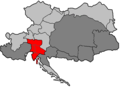 Illyrien Donaumonarchie.png 702 × 510; 11 KB
-
 Karte von Tirol, Steyermark und Illyrien 1832.jpg 7,733 × 5,848; 8 MB
-
-
 Königreich Illyrien und Herzogthum Steyermark 1819.jpg 25,281 × 27,029; 96.29 MB
-
 Königreich Illyrien, Gouvernement Laibach Charte der Kreise 1836.jpg 10,292 × 8,608; 10.04 MB
-
 Königreich Illyrien. Das Gebiet der Stadt Triest in grösserem Maasse.jpg 2,977 × 2,351; 841 KB
-
 Königreich Illyrien.jpg 4,509 × 5,430; 6.94 MB
-
 Mapa do Reino da Ilíria 1822-1849.png 900 × 1,167; 451 KB
-
 Neueste Specialkarte von Krain nach der dermaligen Eintheilung in Bezirke 1831.jpg 9,294 × 7,224; 13.37 MB
-
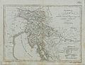
 Riedl - Koenigreiche Illyrien.jpg 7,150 × 5,808; 39.43 MB
-
 Upravni zemljevid Ilirskega kraljestva leta 1817.jpg 7,365 × 9,760; 9.56 MB
-
 Upravni zemljevid Kranjske leta 1836.jpg 800 × 669; 155 KB


.jpg)


