Category:Locator maps of the Netherlands
Jump to navigation
Jump to search
Subcategories
This category has the following 10 subcategories, out of 10 total.
!
B
C
G
L
M
~
Media in category "Locator maps of the Netherlands"
The following 35 files are in this category, out of 35 total.
-
 Acht zaligheden geografisch.png 1,080 × 578; 167 KB
-
 BES islands location map.svg 1,346 × 1,156; 177 KB
-
 Dubbelstad Amsterdam Almere.svg 2,000 × 931; 343 KB
-
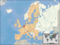
 EU location NED.png 1,600 × 1,200; 469 KB
-
 EU location NED.svg 1,600 × 1,200; 2.47 MB
-
 EU-Netherlands2.png 520 × 515; 63 KB
-
 Europe location NED.png 1,600 × 1,200; 711 KB
-
 Europe map netherlands.png 1,231 × 929; 41 KB
-
 Europe netherlands.svg 680 × 520; 795 KB
-
 Hamaland.png 304 × 343; 15 KB
-
 Hollanda cb.png 194 × 172; 7 KB
-
 Kingdom of Netherlands (1914).svg 450 × 456; 468 KB
-
 Kingdom of the Netherlands (orthographic projection).svg 553 × 553; 304 KB
-
 Kingdom of the Netherlands 1890.svg 450 × 456; 457 KB
-
 Kuinre in nederland.JPG 117 × 135; 3 KB
-
 Landkarte Druten Gelderland.png 280 × 150; 10 KB
-
 LandvanSwentibold.png 1,920 × 1,563; 223 KB
-
 LocatieDrentseHoofdvaart.PNG 487 × 620; 42 KB
-
 LocationNetherlands.png 250 × 115; 6 KB
-
 LocationNetherlands2.png 800 × 400; 82 KB
-
 LocationNetherlandsInEurope.png 415 × 422; 5 KB
-
 Locator Frisian Lands (1350).svg 2,818 × 3,608; 427 KB
-
 Locator Imperial Abbey of Kornelimünster (1350).svg 2,818 × 3,608; 427 KB
-
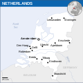
 Locator map of the Netherlands.svg 680 × 520; 657 KB
-
 N-Holland.png 232 × 251; 3 KB
-
 Netherlands - Location Map (2013) - NLD - UNOCHA.svg 250 × 251; 905 KB
-
 Netherlands Wikivoyage locator maps - Northern Netherlands.png 532 × 600; 68 KB
-
 Netherlands Wikivoyage locator maps - Southern Netherlands.png 532 × 600; 68 KB
-
 Netherlands Wikivoyage locator maps - Western Netherlands.png 532 × 600; 68 KB
-
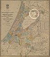 Netherlands, Amsterdam, Lutkemeer, map of 1855.jpg 4,000 × 4,593; 9.17 MB
-
 Netherlands, Kaag en Braassem, Googer polder, map of 1855.jpg 4,000 × 4,590; 8.95 MB
-
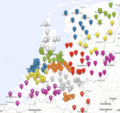 Tafels in Nederland.png 1,458 × 1,370; 1.21 MB
-
 The Netherlands-Pos.png 330 × 284; 50 KB
-
 World Factbook (1982) Netherlands.jpg 586 × 585; 90 KB
-
 Карта Холандије.png 300 × 225; 96 KB


.svg)
.svg)


.svg)
.svg)


_-_NLD_-_UNOCHA.svg)


_Netherlands.jpg)
