Category:Locator maps of Portugal
Jump to navigation
Jump to search
Subcategories
This category has the following 6 subcategories, out of 6 total.
Media in category "Locator maps of Portugal"
The following 61 files are in this category, out of 61 total.
-
A.M. Lisboa.png 498 × 732; 56 KB
-
A.M.Porto.png 498 × 732; 57 KB
-
Algarve location map.png 313 × 600; 52 KB
-
AMPorto 20130912.png 249 × 366; 60 KB
-
C.I. A.M.Porto.png 499 × 731; 56 KB
-
C.I. Alentejo Central.png 498 × 732; 56 KB
-
C.I. Alentejo Litoral.png 498 × 732; 56 KB
-
C.I. Algarve.png 498 × 732; 56 KB
-
C.I. Alto Alentejo.png 498 × 732; 57 KB
-
C.I. Alto Minho.png 498 × 732; 57 KB
-
C.I. Alto Tâmega.png 498 × 732; 57 KB
-
C.I. Ave.png 498 × 732; 57 KB
-
C.I. Aveiro.png 498 × 732; 57 KB
-
C.I. Baixo Alentejo.png 498 × 732; 56 KB
-
C.I. Beira Baixa.png 498 × 732; 56 KB
-
C.I. Beiras e Serra da Estrela.png 498 × 732; 57 KB
-
C.I. Coimbra.png 498 × 732; 57 KB
-
C.I. Cávado.png 498 × 732; 57 KB
-
C.I. Douro.png 498 × 732; 57 KB
-
C.I. Leiria.png 498 × 732; 56 KB
-
C.I. Lezíria do Tejo.png 498 × 732; 56 KB
-
C.I. Médio Tejo.png 498 × 732; 56 KB
-
C.I. Oeste.png 498 × 732; 56 KB
-
C.I. Terras de Trás-os-Montes.png 498 × 732; 57 KB
-
C.I. Tâmega e Sousa.png 498 × 732; 57 KB
-
C.I. Viseu Dão-Lafões.png 498 × 732; 57 KB
-
C.I.-Coimbra.png 498 × 732; 56 KB
-
Castelo Branco-Mapa.png 419 × 849; 405 KB
-
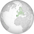
EU location POR.png 1,600 × 1,200; 470 KB
-
EU location POR.svg 1,600 × 1,200; 2.47 MB
-
EU-Portugal (orthographic projection).png 2,000 × 2,000; 982 KB
-
EU-Portugal (orthographic projection).svg 2,000 × 2,000; 5.27 MB
-
EU-Portugal with Madeira circled.svg 2,080 × 1,717; 2.05 MB
-
Europe location ALG.PNG 1,600 × 1,200; 763 KB
-
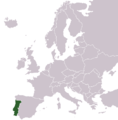
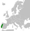
Europe location POR.png 1,600 × 1,200; 711 KB
-
Europe map portugal.png 1,231 × 929; 41 KB
-
Europe portugal.svg 680 × 520; 799 KB
-
LocationPortugal.png 250 × 115; 6 KB
-
LocationPortugalInEurope.png 415 × 422; 5 KB
-
Madeira location (PT and EU).jpg 2,048 × 1,720; 226 KB
-
Madeira location map.png 438 × 393; 18 KB
-
Northern Portugal location map.png 313 × 600; 48 KB
-
Porto, Lisboa, Port of Sines, Faro, on the Portuguese coast.png 514 × 689; 26 KB
-
Portugal (1974).svg 450 × 456; 475 KB
-
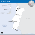
Portugal - Location Map (2013) - PRT - UNOCHA.svg 251 × 251; 953 KB
-
Portugalrachelrocket72.jpg 500 × 388; 53 KB
-
Região Algarve.png 150 × 314; 5 KB
-
Região Beira Alta.png 150 × 314; 5 KB
-
Região Beira Baixa.png 150 × 314; 5 KB
-
Região Beira Litoral.png 150 × 314; 5 KB
-
Região da Beira.png 150 × 314; 6 KB
-
Região do Minho.png 150 × 314; 5 KB
-
Região Douro Litoral.png 150 × 314; 5 KB
-
Região Estremadura.png 150 × 314; 5 KB
-
Região Ribatejo.png 150 × 314; 5 KB
-
Região Trás os Montes e Alto Douro (cropped).png 150 × 84; 1,003 bytes
-
Região Trás os Montes e Alto Douro.png 150 × 314; 5 KB
-
Republic of Portugal (1914).svg 450 × 456; 468 KB
-
Silvalde em Espinho.png 655 × 761; 43 KB
-
World Factbook (1982) Portugal.jpg 588 × 585; 77 KB


