Category:Locator maps of the Dutch Caribbean
Jump to navigation
Jump to search
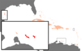
- This category is for locator maps of the Dutch Caribbean, which is a geographic group of all territories in the Kingdom of the Netherlands located in the Caribbean geographic area.
- It consists of three states (Aruba, Curaçao, Sint Maarten) that are components of the Kingdom of the Netherlands, and the Caribbean Netherlands which is a group of three special municipalities (Bonaire, Sint Eustatius, and Saba) that are parts of the state of the Netherlands in the Kingdom.
- Three of these islands (Aruba, Bonaire and Curaçao) are along the coasts and on the continental shelf of South America (near Venezuela), the three others (Saba, Sint Eustatius, and Sint Maarten) are in the Lesser Antillas (considered part of North America, but on a separate tectonic plate).
- All of them have been part (in their history but at different times) of the former Netherlands Antillas, and they are also all located along the southern and eastern borders of the Caribbean Sea.
Subcategories
This category has the following 5 subcategories, out of 5 total.
C
Media in category "Locator maps of the Dutch Caribbean"
The following 2 files are in this category, out of 2 total.
-
 Karibik Niederländische Antillen.png 1,024 × 636; 12 KB
-
 Netherlands Caribbean - Caribbean.svg 3,690 × 2,323; 3.26 MB

