Category:Locator maps of Finland
Jump to navigation
Jump to search
Subcategories
This category has the following 18 subcategories, out of 18 total.
Media in category "Locator maps of Finland"
The following 49 files are in this category, out of 49 total.
-
 LocationAland.png 250 × 115; 14 KB
-
 LocationAland2.png 250 × 115; 10 KB
-
 LocationÅland.svg 1,000 × 500; 2.76 MB
-
 Armenia Finland Locator.png 342 × 253; 9 KB
-
 Espoo dot.png 1,804 × 3,002; 284 KB
-
 EU location FIN.png 1,600 × 1,200; 470 KB
-
 EU location FIN.svg 1,600 × 1,200; 2.47 MB
-
 EU-Finland (orthographic projection).svg 2,000 × 2,000; 5.79 MB
-
 EU-Finland.svg 2,045 × 1,720; 7.33 MB
-
 EUR location FIN.PNG 1,600 × 1,200; 579 KB
-
 Europe location FIN.png 1,600 × 1,200; 712 KB
-
 Europe map finland.png 1,231 × 929; 41 KB
-
 Finland - Location Map (2013) - FIN - UNOCHA-pt.svg 251 × 251; 1.02 MB
-
 Finland - Location Map (2013) - FIN - UNOCHA.svg 251 × 251; 1.03 MB
-
 Finland and Sweden.svg 1,236 × 1,245; 84 KB
-
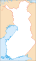 Finland equi.png 3,828 × 6,476; 185 KB
-
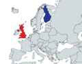 Finland-UK map.png 1,514 × 1,190; 411 KB
-
 Finlandiaren mapa.jpg 1,080 × 880; 115 KB
-
 Finlandiya cb.png 305 × 358; 11 KB
-
 Finlandrachelrocket72.webp 500 × 388; 50 KB
-
 Finnic countries.svg 6,500 × 4,000; 535 KB
-
 Grand Duchy of Finland Governorate-General.png 3,000 × 1,973; 1.06 MB
-
 Greater-Finland.png 2,038 × 1,708; 514 KB
-
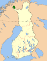
 Location of Kilpisjärvi in Finland.png 230 × 400; 7 KB
-
 Käsivarsieremubasatia.png 600 × 773; 134 KB
-
 Larsmo location.png 230 × 400; 6 KB
-
 Location Finland (square).jpg 417 × 417; 67 KB
-
 Location Finland EU Europe.png 2,000 × 1,682; 556 KB
-
 Location Finland.svg 680 × 520; 511 KB
-
 Location of Lappo river.png 230 × 400; 8 KB
-
 Location of Vörå in Finland.png 230 × 400; 7 KB
-
 LocationFinlandInEurope.png 415 × 422; 5 KB
-
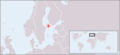
 LocationGreaterHelsinki.png 250 × 115; 9 KB
-
 LocationRaahe.PNG 250 × 115; 8 KB
-
 LocationTurku.png 250 × 115; 9 KB
-
 Maailman kartta, jossa maanosat ja valtameret merkattu.svg 2,560 × 1,314; 1.22 MB
-
 Norway Finland Locator.png 1,236 × 1,245; 79 KB
-
 Nötö, Nagu highlighted on Map.png 1,200 × 800; 232 KB
-
 Nötö, Nagu OSM-karta.jpg 580 × 392; 37 KB
-
 Oulu dot.png 1,804 × 3,002; 284 KB
-
 Perapohjola.png 230 × 400; 7 KB
-
 Peräpohjola.svg 1,850 × 3,220; 269 KB
-
 Saaristomeri.png 230 × 410; 9 KB
-
 Suomi Viro.png 1,236 × 1,245; 90 KB
-
 Suur-Pirkkala2gif.gif 1,957 × 3,429; 207 KB
-
 Tarvantovaaraeremubasatia.png 600 × 772; 134 KB
-
 Tremplins tournée nordique.png 331 × 473; 68 KB
-
 Vantaa dot.png 1,804 × 3,002; 284 KB
-
 オルキルオト原子力発電所地図.jpg 235 × 463; 90 KB


.svg)


_-_FIN_-_UNOCHA-pt.svg)
_-_FIN_-_UNOCHA.svg)


.jpg)


