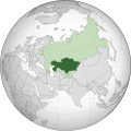
Category:Locator maps of Kazakhstan
Appearance
Subcategories
This category has the following 6 subcategories, out of 6 total.
Media in category "Locator maps of Kazakhstan"
The following 21 files are in this category, out of 21 total.
-
EuropeesKazachstan.png 1,357 × 628; 45 KB
-
A12 KZ map.png 600 × 336; 83 KB
-
A14 KZ map.png 600 × 336; 80 KB
-
Customs Union of Belarus, Kazakhstan and Russia 2011.png 2,000 × 2,000; 803 KB
-
Diplomatic missions of Kazakhstan.PNG 1,425 × 625; 65 KB
-
Europe-Kazakhstan.svg 2,045 × 1,720; 714 KB
-
KazachstanEasternEurope.PNG 157 × 170; 3 KB
-
Kazachstán - SNS.svg 553 × 553; 366 KB
-
Kazakhstan (orthographic projection).svg 553 × 553; 309 KB
-
Kazakistan cb.png 534 × 395; 22 KB
-
Kotayk Oblast.svg 1,169 × 1,198; 163 KB
-
KZ Abay Region Outline.png 1,640 × 1,837; 182 KB
-
KZ Almatı Region Outline 2022.png 1,516 × 1,341; 157 KB
-
KZ Jetisiw Region Outline.png 1,457 × 1,101; 102 KB
-
KZ Qarağandı Region Outline 2022.svg 512 × 348; 3.4 MB
-
KZ Ulıtaw Region Outline.svg 512 × 330; 831 KB
-
KZ Şığıs Qazaqstan Region Outline 2022.png 1,274 × 1,340; 187 KB
-
KZ Şığıs Qazaqstan Region Outline 2022.svg 512 × 498; 13.65 MB
-
LocationKazakhstan.png 1,425 × 625; 29 KB
-
LocationKazakhstan.svg 1,000 × 500; 2.66 MB
-
Казахстан и Дания.png 1,452 × 672; 184 KB


