Category:Locator maps of municipalities in Kreis Soest
Jump to navigation
Jump to search
Media in category "Locator maps of municipalities in Kreis Soest"
The following 17 files are in this category, out of 17 total.
-
 Anreise soest 1.jpg 200 × 271; 20 KB
-
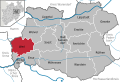
 Anröchte in SO.svg 580 × 395; 289 KB
-
 Bad Sassendorf in SO.svg 580 × 395; 289 KB
-
 Ense in SO.svg 580 × 395; 289 KB
-
 Erwitte in SO.svg 580 × 395; 289 KB
-
 Geseke in SO.svg 580 × 395; 289 KB
-
 Karte Warstein Ortsteile.png 984 × 1,000; 187 KB
-
 Lippetal in SO.svg 580 × 395; 289 KB
-
 Lippstadt in SO.svg 580 × 395; 289 KB
-
 Municipalities in SO.svg 580 × 395; 570 KB
-
 Möhnesee in SO.svg 580 × 395; 289 KB
-
 Rüthen in SO.svg 580 × 395; 289 KB
-
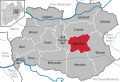
 Soest in SO.svg 580 × 395; 289 KB
-
 Warstein in SO.svg 580 × 395; 289 KB
-
 Welver in SO.svg 580 × 395; 289 KB
-
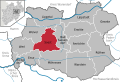
 Werl in SO.svg 580 × 395; 289 KB
-
 Wickede (Ruhr) in SO.svg 580 × 395; 289 KB


_in_SO.svg)