Category:Locator maps of municipalities in Kreis Olpe
Jump to navigation
Jump to search
Media in category "Locator maps of municipalities in Kreis Olpe"
The following 9 files are in this category, out of 9 total.
-
 Attendorn in OE.svg 390 × 390; 262 KB
-
 Drolshagen in OE.svg 390 × 390; 262 KB
-
 Finnentrop in OE.svg 390 × 390; 262 KB
-
 Kirchhundem in OE.svg 390 × 390; 262 KB
-
 Lennestadt in OE.svg 390 × 390; 262 KB
-
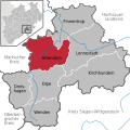
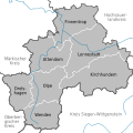 Municipalities in OE.svg 390 × 390; 523 KB
-
 Municipalities in SI and OE.svg 592 × 625; 470 KB
-
 Olpe in OE.svg 390 × 390; 262 KB
-
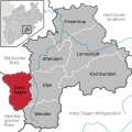
 Wenden in OE.svg 390 × 390; 262 KB


