Category:Locator maps of municipalities in Rhein-Erft-Kreis
Jump to navigation
Jump to search
English: Locator maps of municipalities in Rhein-Erft-Kreis
Media in category "Locator maps of municipalities in Rhein-Erft-Kreis"
The following 11 files are in this category, out of 11 total.
-
Bedburg in BM.svg 426 × 393; 273 KB
-
Bergheim in BM.svg 426 × 393; 273 KB
-
Brühl in BM.svg 426 × 393; 273 KB
-
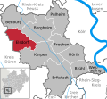
Elsdorf in BM.svg 426 × 393; 273 KB
-
Erftstadt in BM.svg 426 × 393; 273 KB
-
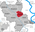
Frechen in BM.svg 426 × 393; 273 KB
-
Hürth in BM.svg 426 × 393; 273 KB
-
Kerpen in BM.svg 426 × 393; 273 KB
-
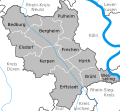
Municipalities in BM.svg 426 × 393; 92 KB
-
Pulheim in BM.svg 426 × 393; 273 KB
-
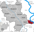
Wesseling in BM.svg 426 × 393; 274 KB


