Category:Locator maps of municipalities in Kreis Borken
Jump to navigation
Jump to search
Media in category "Locator maps of municipalities in Kreis Borken"
The following 19 files are in this category, out of 19 total.
-
 Ahaus in BOR.svg 621 × 613; 312 KB
-
 Bocholt in BOR.svg 621 × 613; 312 KB
-
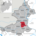
 Borken in BOR.svg 621 × 613; 312 KB
-
 Gescher in BOR.svg 621 × 613; 312 KB
-
 Gronau (Westf.) in BOR.svg 621 × 613; 312 KB
-
 Heek in BOR.svg 621 × 613; 312 KB
-
 Heiden in BOR.svg 621 × 613; 312 KB
-
 Isselburg in BOR.svg 621 × 613; 312 KB
-
 Legden in BOR.svg 621 × 613; 312 KB
-
 MissionsstationenFürstbistumMünster.JPG 592 × 575; 40 KB
-
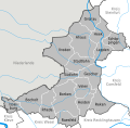 Municipalities in BOR.svg 621 × 613; 547 KB
-
 Raesfeld in BOR.svg 621 × 613; 312 KB
-
 Reken in BOR.svg 621 × 613; 312 KB
-
 Rhede in BOR.svg 621 × 613; 312 KB
-
 Schöppingen in BOR.svg 621 × 613; 312 KB
-
 Stadtlohn in BOR.svg 621 × 613; 312 KB
-
 Südlohn in BOR.svg 621 × 613; 312 KB
-
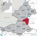
 Velen in BOR.svg 621 × 613; 312 KB
-
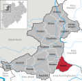
 Vreden in BOR.svg 621 × 613; 312 KB


_in_BOR.svg)


