Category:Locator maps of Bhutan
Jump to navigation
Jump to search
Subcategories
This category has the following 3 subcategories, out of 3 total.
!
B
- Bilateral maps of Bhutan (54 F)
Media in category "Locator maps of Bhutan"
The following 60 files are in this category, out of 60 total.
-
Bhutan - Location Map (2013) - BTN - UNOCHA.svg 250 × 250; 520 KB
-
Bhutan highways blank location map.png 1,000 × 653; 107 KB
-
Bhutan highways labeled location map.png 1,000 × 653; 149 KB
-
Bhutan map blank (1992-2007).svg 800 × 450; 247 KB
-
Bhutan protected areas location map.png 1,000 × 653; 221 KB
-
Bhutan Relations 2010.svg 940 × 477; 1.24 MB
-
Bhutan subdivisions flood hit between July 3 and August 15 2007.png 800 × 449; 22 KB
-
Bhutan-Bumthang.png 150 × 86; 3 KB
-
Bhutan-Chukha.png 150 × 86; 3 KB
-
Bhutan-Dagana.png 150 × 86; 3 KB
-
Bhutan-Gasa.png 150 × 86; 3 KB
-
Bhutan-Haa.png 150 × 86; 3 KB
-
Bhutan-Lhuntse.png 150 × 86; 3 KB
-
Bhutan-Mongar.png 150 × 86; 3 KB
-
Bhutan-Paro.png 150 × 86; 3 KB
-
Bhutan-Pemagatshel.png 150 × 86; 3 KB
-
Bhutan-Pos.png 330 × 302; 20 KB
-
Bhutan-Punakha.png 150 × 86; 3 KB
-
Bhutan-Samdrup Jongkhar.png 150 × 86; 3 KB
-
Bhutan-Samtse.png 150 × 86; 3 KB
-
Bhutan-Sarpang.png 150 × 86; 3 KB
-
Bhutan-Thimphu.png 150 × 86; 3 KB
-
Bhutan-Tongsa.png 150 × 86; 3 KB
-
Bhutan-Trashigang.png 150 × 86; 3 KB
-
Bhutan-Trashiyangste.png 150 × 86; 3 KB
-
Bhutan-Tsirang.png 150 × 86; 3 KB
-
Bhutan-Wangdue Phodrang.png 150 × 86; 3 KB
-
Bhutan-Zhemgang.png 150 × 86; 3 KB
-
BhutanBhumthang.png 800 × 449; 35 KB
-
BhutanChukha.png 800 × 449; 35 KB
-
BhutanDagana.png 800 × 449; 35 KB
-
BhutanGasa.png 800 × 449; 35 KB
-
BhutanHaa.png 800 × 449; 35 KB
-
BhutanLhuntse.png 800 × 449; 35 KB
-
BhutanMongar.png 800 × 449; 35 KB
-
BhutanParo.png 800 × 449; 35 KB
-
BhutanPemagatshel.png 800 × 449; 35 KB
-
BhutanPunakha.png 800 × 449; 35 KB
-
BhutanSamdrupJongkhar.png 800 × 449; 35 KB
-
BhutanSamtse.png 800 × 449; 35 KB
-
BhutanSarpang.png 800 × 449; 35 KB
-
BhutanThimphu.png 800 × 449; 35 KB
-
BhutanTrashigang.png 800 × 449; 35 KB
-
BhutanTrashiyangste.png 400 × 225; 6 KB
-
BhutanTrashiyangtse.png 800 × 449; 35 KB
-
BhutanTrongsa.png 800 × 449; 35 KB
-
BhutanTsirang.png 800 × 449; 35 KB
-
BhutanWangduePhodrang.png 800 × 449; 35 KB
-
BhutanWangduePhodrang.svg 744 × 405; 220 KB
-
BhutanZhemgang.png 800 × 449; 35 KB
-
Central dsongdey in Bhutan (1992-2007).svg 800 × 450; 247 KB
-
Diplomatic missions of Bhutan.png 1,425 × 625; 64 KB
-
Eastern dsongdey in Bhutan (1992-2007).svg 800 × 450; 247 KB
-
Kurtoe Gewog Bhutan Location.png 640 × 418; 1.03 MB
-
Localisation France Bouthan.png 2,752 × 1,396; 456 KB
-
Location of Nathula.svg 800 × 740; 70 KB
-
LocationBhutan.png 250 × 115; 6 KB
-
Southern dsongdey in Bhutan (1992-2007).svg 800 × 450; 247 KB
-
Western dsongdey in Bhutan (1992-2007).svg 800 × 450; 247 KB
-
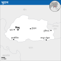
भुटानको नक्सा.svg 250 × 250; 519 KB


