Category:19th-century maps of Yorkshire
Jump to navigation
Jump to search
Ceremonial counties of England: Bedfordshire · Berkshire · Buckinghamshire · Cambridgeshire · Cheshire · Cornwall · Derbyshire · Devon · Dorset · Durham · Essex · Gloucestershire · Greater London · Hampshire · Herefordshire · Hertfordshire · Isle of Wight · Kent · Lancashire · Leicestershire · Lincolnshire · Norfolk · Northamptonshire · Northumberland · Nottinghamshire · Oxfordshire · Rutland · Shropshire · Somerset · Staffordshire · Suffolk · Surrey · Warwickshire · Wiltshire · Worcestershire
City-counties:
Former historic counties: Cumberland · Huntingdonshire · Middlesex · Sussex · Westmorland · Yorkshire
Other former counties:
City-counties:
Former historic counties: Cumberland · Huntingdonshire · Middlesex · Sussex · Westmorland · Yorkshire
Other former counties:
Subcategories
This category has the following 2 subcategories, out of 2 total.
1
- 1890s maps of Yorkshire (28 F)
Media in category "19th-century maps of Yorkshire"
The following 56 files are in this category, out of 56 total.
-
 Aikin(1800) p070 - Yorkshire.jpg 2,020 × 1,184; 511 KB
-

-
 Cary's Traveller's companion 1806 (72194690).jpg 8,942 × 7,767; 12.32 MB
-
 Ordnance Survey Drawings - Howden, Yorkshire (OSD 292).jpg 4,000 × 1,824; 1.92 MB
-

-
 Ordnance Survey Drawings - Crowle (OSD 294).jpg 4,000 × 2,370; 2.5 MB
-
 Gray1824.eastriding.jpg 830 × 998; 122 KB
-
 Gray1824.northriding.jpg 787 × 988; 122 KB
-
 Gray1824.westriding.jpg 816 × 982; 166 KB
-
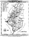
 Gray1824.yorkshire.jpg 790 × 957; 163 KB
-

-
 18 of 'The history of Pontefract, in Yorkshire' (11006741166).jpg 3,464 × 2,493; 1.97 MB
-
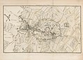
 Potternewton map from 1842.jpg 1,473 × 1,014; 649 KB
-
 Pigot and Co (1842) p2.488 - Map of Yorkshire.jpg 4,148 × 3,722; 4.1 MB
-
 75 of 'England and Wales Delineated, etc' (11032010626).jpg 1,519 × 2,431; 604 KB
-
 78 of 'England and Wales Delineated, etc' (11033584494).jpg 1,519 × 2,431; 771 KB
-
 79 of 'England and Wales Delineated, etc' (11034362925).jpg 1,519 × 2,431; 908 KB
-
 82 of 'England and Wales Delineated, etc' (11032593465).jpg 1,519 × 2,431; 571 KB
-
 86 of 'England and Wales Delineated, etc' (11032616925).jpg 1,519 × 2,431; 995 KB
-
 87 of 'England and Wales Delineated, etc' (11034475226).jpg 1,519 × 2,431; 695 KB
-
 PHILLIPS(1853) p373 - Geology of Yorkshire.jpg 2,304 × 1,474; 684 KB
-

-
-

-

-
 PHILLIPS(1855) p383 - Geology of Yorkshire.jpg 2,320 × 1,517; 767 KB
-

-

-

-
 Haltemprice priory os map 1855.png 1,314 × 1,029; 56 KB
-
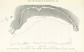
 PHILLIPS(1855) p8 - Elevation of ground in Yorkshire.jpg 2,240 × 1,372; 596 KB
-
 OS old series 1 63360 97sw.jpg 3,792 × 2,695; 3.38 MB
-

-

-
 BAKER(1863) p91 - Lithological Map of North Yorkshire.jpg 2,224 × 1,566; 675 KB
-

-

-

-
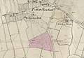
 Barony of Moor.jpg 5,242 × 3,660; 1.75 MB
-

-

-

-

-

-

-
 The earth and its inhabitants (1881) (14597806467).jpg 1,820 × 2,486; 591 KB
-
 The earth and its inhabitants (1881) (14761332956).jpg 1,850 × 2,430; 360 KB
-

-
 The earth and its inhabitants (1882) (14586681757).jpg 1,896 × 2,558; 450 KB
-

-
 16 of 'The History of Conisborough Castles, with glimpses of Ivanhoe-Land' (11189925526).jpg 5,122 × 2,270; 1.31 MB
-

-

-

-
 20 of 'Ingleton- bygone and present. (With a map and illustrations.)' (11194677156).jpg 4,604 × 4,146; 3.38 MB
-

_p070_-_Yorkshire.jpg)
.jpg)
.jpg)
.jpg)
.jpg)
.jpg)


.jpg)
.jpg)

_p2.488_-_Map_of_Yorkshire.jpg)
.jpg)
.jpg)
.jpg)
.jpg)
.jpg)
.jpg)
_p373_-_Geology_of_Yorkshire.jpg)
%27_(11234729464).jpg)
.jpg)
%27_(11045915473).jpg)
%27_(11045199163).jpg)
_p383_-_Geology_of_Yorkshire.jpg)
.jpg)
%27_(11047483676).jpg)
.jpg)

_p8_-_Elevation_of_ground_in_Yorkshire.jpg)

.jpg)
.jpg)
_p91_-_Lithological_Map_of_North_Yorkshire.jpg)
%27_(11086441703).jpg)
%27_(11085238925).jpg)
.jpg)

.jpg)
.jpg)
.jpg)
.jpg)
.jpg)
.jpg)
_(14597806467).jpg)
_(14761332956).jpg)
%27_(11157159135).jpg)
_(14586681757).jpg)
.jpg)
.jpg)
%27_(11194677156).jpg)
_Edited_by_E._G._Ravenstein_..._Illustrated,_etc%27_(11188494854).jpg)
_Edited_by_E._G._Ravenstein_..._Illustrated,_etc%27_(11188114994).jpg)
_Edited_by_E._G._Ravenstein_..._Illustrated,_etc%27_(11189562674).jpg)
%27_(11298557103).jpg)