Category:19th-century maps of Worcestershire
Jump to navigation
Jump to search
Ceremonial counties of England: Bedfordshire · Berkshire · Buckinghamshire · Cambridgeshire · Cheshire · Cornwall · Derbyshire · Devon · Dorset · Durham · Essex · Gloucestershire · Greater London · Hampshire · Herefordshire · Hertfordshire · Isle of Wight · Kent · Lancashire · Leicestershire · Lincolnshire · Norfolk · Northamptonshire · Northumberland · Nottinghamshire · Oxfordshire · Rutland · Shropshire · Somerset · Staffordshire · Suffolk · Surrey · Warwickshire · Wiltshire · Worcestershire
City-counties:
Former historic counties: Cumberland · Huntingdonshire · Middlesex · Sussex · Westmorland · Yorkshire
Other former counties:
City-counties:
Former historic counties: Cumberland · Huntingdonshire · Middlesex · Sussex · Westmorland · Yorkshire
Other former counties:
Subcategories
This category has only the following subcategory.
Media in category "19th-century maps of Worcestershire"
The following 23 files are in this category, out of 23 total.
-
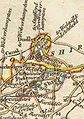
 Aikin(1800) p203 - Worcestershire.jpg 1,143 × 1,740; 303 KB
-

-
 Cary's Traveller's companion 1806 (72194687).jpg 2,736 × 4,346; 2.18 MB
-
 Ordnance Survey Drawings - Pershore, Worcestershire (OSD 217).jpg 4,000 × 3,168; 3.31 MB
-
 Ordnance Survey Drawings - Tewkesbury (OSD 173).jpg 4,000 × 2,553; 4.39 MB
-
 1812 Samuel Neele Worcestershire County Antique Map Print Shipston.jpg 6,224 × 4,840; 9.49 MB
-
 Ordnance Survey Drawings - Great Malvern, Worcestershire (OSD 216).jpg 2,931 × 4,000; 4.29 MB
-
 CAPPER(1813) p1142 - Worcestershire.jpg 2,320 × 1,359; 666 KB
-
 Ordnance Survey Drawings - Tardebigge, Worcestershire (OSD 218).jpg 4,000 × 3,663; 5.01 MB
-
 Ordnance Survey Drawings - Worcester, Worcestershire (OSD 215).jpg 4,000 × 2,966; 4.1 MB
-
 DudleyTraditionalDetail.jpg 233 × 331; 23 KB
-
 Ordnance Survey Drawings - Stourbridge, Dudley (OSD 219).jpg 4,123 × 5,317; 4.31 MB
-
 Ordnance Survey Drawings - Kidderminster, Worcester (OSD 214).jpg 3,016 × 4,000; 4.1 MB
-
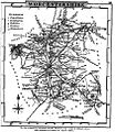 Gray1824.worcs.jpg 839 × 972; 179 KB
-
 CAPPER(1825) p02.295 - Worcestershire.jpg 2,413 × 1,360; 814 KB
-

-
 1832 Westmoreland County Map Chapman & Sidney Hall Print Winander Mere.jpg 6,912 × 4,976; 10.9 MB
-
 Pigot and Co (1842) p2.460 - Map of Worcestershire.jpg 1,310 × 2,158; 866 KB
-
 70 of 'England and Wales Delineated, etc' (11031884633).jpg 1,519 × 2,431; 747 KB
-
 71 of 'England and Wales Delineated, etc' (11033174806).jpg 1,519 × 2,431; 708 KB
-

-

-

_p203_-_Worcestershire.jpg)

.jpg)
.jpg)
.jpg)

.jpg)
_p1142_-_Worcestershire.jpg)
.jpg)
.jpg)

.jpg)
.jpg)

_p02.295_-_Worcestershire.jpg)
.jpg)

_p2.460_-_Map_of_Worcestershire.jpg)
.jpg)
.jpg)
%27_(11111181863).jpg)
%27_(11296497653).jpg)
%27_(11291360933).jpg)