Category:19th-century maps of Rutland
Jump to navigation
Jump to search
Ceremonial counties of England: Bedfordshire · Berkshire · Buckinghamshire · Cambridgeshire · Cheshire · Cornwall · Cumbria · Derbyshire · Devon · Dorset · County Durham · East Riding of Yorkshire · East Sussex · Essex · Gloucestershire · London · Greater Manchester · Hampshire · Herefordshire · Hertfordshire · Isle of Wight · Kent · Lancashire · Leicestershire · Lincolnshire · Merseyside · Norfolk, England · North Yorkshire · Northamptonshire · Northumberland · Nottinghamshire · Oxfordshire · Rutland · Shropshire · Somerset · South Yorkshire · Staffordshire · Suffolk · Surrey · Tyne and Wear · Warwickshire · West Midlands (county) · West Sussex · West Yorkshire · Wiltshire · Worcestershire
City-counties: Bristol · City of London
Former historic counties: Cumberland · Huntingdonshire · County of London · Middlesex · North Riding of Yorkshire · Sussex · West Riding of Yorkshire · Westmorland · Yorkshire
Other former counties: Avon · Cambridgeshire and Isle of Ely · Cleveland · East Suffolk · Hereford and Worcester · Hexhamshire · Humberside · Huntingdon and Peterborough · Isle of Ely · Parts of Holland · Parts of Kesteven · Parts of Lindsey · Soke of Peterborough · West Suffolk
Media in category "19th-century maps of Rutland"
The following 12 files are in this category, out of 12 total.
-
 Aikin(1800) p182 - Rutland.jpg 1,176 × 1,565; 314 KB
-

-
 Cary's Traveller's companion 1806 (72194666).jpg 2,779 × 4,353; 1.97 MB
-
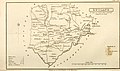
 CAPPER(1813) p910 - Rutland.jpg 2,320 × 1,346; 600 KB
-
 002osd000000003u00227000.jpg 3,680 × 4,000; 5.99 MB
-
 CAPPER(1825) p02.98 - Map of Rutland.jpg 2,400 × 1,374; 612 KB
-
-
 Pigot and Co (1842) p2.196 - Map of Leicestershire and Rutlandshire.jpg 2,144 × 1,310; 904 KB
-
 70 of 'England and Wales Delineated, etc' (11033815424).jpg 1,453 × 2,391; 809 KB
-
 71 of 'England and Wales Delineated, etc' (11034063595).jpg 1,453 × 2,391; 719 KB
-

-

_p182_-_Rutland.jpg)
.jpg)
.jpg)
_p910_-_Rutland.jpg)

_p02.98_-_Map_of_Rutland.jpg)
.jpg)
_p2.196_-_Map_of_Leicestershire_and_Rutlandshire.jpg)
.jpg)
.jpg)
%27_(11087287756).jpg)
%27_(11085327374).jpg)