Category:19th-century maps of Lincolnshire
Jump to navigation
Jump to search
Ceremonial counties of England: Bedfordshire · Berkshire · Buckinghamshire · Cambridgeshire · Cheshire · Cornwall · Cumbria · Derbyshire · Devon · Dorset · County Durham · East Riding of Yorkshire · East Sussex · Essex · Gloucestershire · London · Greater Manchester · Hampshire · Herefordshire · Hertfordshire · Isle of Wight · Kent · Lancashire · Leicestershire · Lincolnshire · Merseyside · Norfolk, England · North Yorkshire · Northamptonshire · Northumberland · Nottinghamshire · Oxfordshire · Rutland · Shropshire · Somerset · South Yorkshire · Staffordshire · Suffolk · Surrey · Tyne and Wear · Warwickshire · West Midlands (county) · West Sussex · West Yorkshire · Wiltshire · Worcestershire
City-counties: Bristol · City of London
Former historic counties: Cumberland · Huntingdonshire · County of London · Middlesex · North Riding of Yorkshire · Sussex · West Riding of Yorkshire · Westmorland · Yorkshire
Other former counties: Avon · Cambridgeshire and Isle of Ely · Cleveland · East Suffolk · Hereford and Worcester · Hexhamshire · Humberside · Huntingdon and Peterborough · Isle of Ely · Parts of Holland · Parts of Kesteven · Parts of Lindsey · Soke of Peterborough · West Suffolk
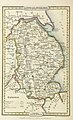
Media in category "19th-century maps of Lincolnshire"
The following 13 files are in this category, out of 13 total.
-
 Aikin(1800) p244 - Lincolnshire.jpg 1,104 × 1,923; 451 KB
-
 CAPPER(1813) p665 - Lincolnshire.jpg 1,359 × 2,326; 950 KB
-
 Gray1824.lincs.jpg 818 × 983; 202 KB
-
 CAPPER(1825) p01.573 - Lincolnshire.jpg 1,364 × 2,375; 1.03 MB
-
 Pigot and Co (1842) p2.224 - Map of Lincolnshire.jpg 1,310 × 2,158; 961 KB
-

-

-
 The earth and its inhabitants (1881) (14597806467).jpg 1,820 × 2,486; 591 KB
-
 98 of '(Our own country. Descriptive, historical, pictorial.)' (11286908935).jpg 1,201 × 1,355; 372 KB
-
 The Quarterly journal of the Geological Society of London (13937426081).jpg 1,760 × 3,200; 1.3 MB
-
 74 of 'The Round World ... New edition, revised, etc' (11116959324).jpg 620 × 808; 151 KB
-
 100 of '(Our own country. Descriptive, historical, pictorial.)' (11292897346).jpg 1,168 × 1,326; 397 KB
-
 SCHOFIELD(1898) p27 - Lincolnshire.jpg 1,963 × 2,153; 930 KB
_p244_-_Lincolnshire.jpg)
_p665_-_Lincolnshire.jpg)

_p01.573_-_Lincolnshire.jpg)
_p2.224_-_Map_of_Lincolnshire.jpg)
%27_(11087201656).jpg)
%27_(11084482685).jpg)
_(14597806467).jpg)
%27_(11286908935).jpg)
.jpg)
.jpg)
%27_(11292897346).jpg)
_p27_-_Lincolnshire.jpg)