Category:19th-century maps of Dorset
Jump to navigation
Jump to search
Ceremonial counties of England: Bedfordshire · Berkshire · Buckinghamshire · Cambridgeshire · Cheshire · Cornwall · Cumbria · Derbyshire · Devon · Dorset · County Durham · East Riding of Yorkshire · East Sussex · Essex · Gloucestershire · London · Greater Manchester · Hampshire · Herefordshire · Hertfordshire · Isle of Wight · Kent · Lancashire · Leicestershire · Lincolnshire · Merseyside · Norfolk, England · North Yorkshire · Northamptonshire · Northumberland · Nottinghamshire · Oxfordshire · Rutland · Shropshire · Somerset · South Yorkshire · Staffordshire · Suffolk · Surrey · Tyne and Wear · Warwickshire · West Midlands (county) · West Sussex · West Yorkshire · Wiltshire · Worcestershire
City-counties: Bristol · City of London
Former historic counties: Cumberland · Huntingdonshire · County of London · Middlesex · North Riding of Yorkshire · Sussex · West Riding of Yorkshire · Westmorland · Yorkshire
Other former counties: Avon · Cambridgeshire and Isle of Ely · Cleveland · East Suffolk · Hereford and Worcester · Hexhamshire · Humberside · Huntingdon and Peterborough · Isle of Ely · Parts of Holland · Parts of Kesteven · Parts of Lindsey · Soke of Peterborough · West Suffolk
Subcategories
This category has only the following subcategory.
- Ordnance Survey 1st series 1:10560, Map of Dorset (1 P, 378 F)
Media in category "19th-century maps of Dorset"
The following 25 files are in this category, out of 25 total.
-
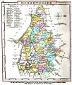
Aikin(1800) p381 - Dorset.jpg 1,952 × 1,070; 346 KB
-
Ordnance Survey Drawings - Dorchester (OSD 57).jpg 4,000 × 2,672; 3.88 MB
-
Ordnance Survey Drawings - Poole Harbour (OSD 66).jpg 4,000 × 3,056; 4.51 MB
-
Ordnance Survey Drawings - Weymouth (OSD 56).jpg 4,000 × 2,032; 2.41 MB
-
Cary's Traveller's companion 1806 (72194627).jpg 2,813 × 4,355; 2.23 MB
-
Ordnance Survey Drawings - Beaminster (OSD 54).jpg 5,699 × 3,009; 3.46 MB
-
Ordnance Survey Drawings - Bridport (OSD 55).jpg 4,000 × 1,487; 1.81 MB
-
Ordnance Survey Drawings - Ilminster (OSD 46B).jpg 1,048 × 4,000; 1.11 MB
-
Ordnance Survey Drawings - Cranbourne, Hampshire (OSD 65).jpg 4,000 × 2,647; 3.39 MB
-
A topographical dictionary of the United Kingdom (1808) (14762117066).jpg 2,766 × 1,680; 1.25 MB
-
Ordnance Survey Drawings - Shaftesbury (OSD 58).jpg 2,367 × 4,000; 1.55 MB
-
Ordnance Survey Drawings - Sherborne (OSD 53).jpg 4,000 × 2,703; 4 MB
-
Beaminster tunnel maps.png 850 × 337; 197 KB
-
OS old series 1 63360 15.jpg 6,264 × 5,010; 7.43 MB
-
Gray1824.dorset.jpg 832 × 978; 157 KB
-
CAPPER(1825) p01.324 - Dorsetshire.jpg 2,368 × 1,364; 894 KB
-
Mapperton Civil Parish 1830.JPG 1,286 × 936; 186 KB
-
Pigot and Co (1842) p1.166 - Map of Dorsetshire.jpg 2,160 × 1,359; 852 KB
-
348 of '(Our own country. Descriptive, historical, pictorial.)' (11297513664).jpg 1,182 × 1,096; 352 KB
-
Corfe Castle 1856 OS map.png 384 × 384; 250 KB


