Category:19th-century maps of Cheshire
Jump to navigation
Jump to search
Ceremonial counties of England: Bedfordshire · Berkshire · Buckinghamshire · Cambridgeshire · Cheshire · Cornwall · Cumbria · Derbyshire · Devon · Dorset · County Durham · East Riding of Yorkshire · East Sussex · Essex · Gloucestershire · London · Greater Manchester · Hampshire · Herefordshire · Hertfordshire · Isle of Wight · Kent · Lancashire · Leicestershire · Lincolnshire · Merseyside · Norfolk, England · North Yorkshire · Northamptonshire · Northumberland · Nottinghamshire · Oxfordshire · Rutland · Shropshire · Somerset · South Yorkshire · Staffordshire · Suffolk · Surrey · Tyne and Wear · Warwickshire · West Midlands (county) · West Sussex · West Yorkshire · Wiltshire · Worcestershire
City-counties: Bristol · City of London
Former historic counties: Cumberland · Huntingdonshire · County of London · Middlesex · North Riding of Yorkshire · Sussex · West Riding of Yorkshire · Westmorland · Yorkshire
Other former counties: Avon · Cambridgeshire and Isle of Ely · Cleveland · East Suffolk · Hereford and Worcester · Hexhamshire · Humberside · Huntingdon and Peterborough · Isle of Ely · Parts of Holland · Parts of Kesteven · Parts of Lindsey · Soke of Peterborough · West Suffolk
Subcategories
This category has only the following subcategory.
- Ordnance Survey 1st series 1:10560, Map of Cheshire (1 P, 140 F)
Media in category "19th-century maps of Cheshire"
The following 21 files are in this category, out of 21 total.
-
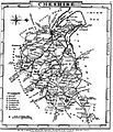
 Aikin(1800) p114 - Cheshire.jpg 1,904 × 1,070; 373 KB
-
 A topographical dictionary of the United Kingdom (1808) (14781955921).jpg 2,736 × 1,673; 943 KB
-
 BRITTON(1818) p7 - Cheshire.jpg 3,098 × 2,543; 1.68 MB
-
 Gray1824.cheshire.jpg 804 × 936; 149 KB
-

-
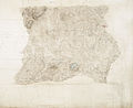 Ordnance Survey Drawings - Combermere (OSD 327).jpg 4,802 × 3,913; 2.48 MB
-
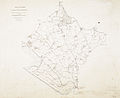
 Ordnance Survey Drawings - Betley (OSD 329).jpg 4,036 × 4,209; 3.06 MB
-
 Ordnance Survey Drawings - Hooton Hall, Cheshire (OSD 344).jpg 5,123 × 4,168; 2.48 MB
-
 Ordnance Survey Drawings - Macclesfield (OSD 351).jpg 5,061 × 4,183; 4.04 MB
-
 Crewe Hall park 1840.jpg 800 × 747; 360 KB
-
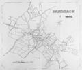 Sandbach town centre map 1840.png 2,379 × 2,041; 1.77 MB
-
 Pigot and Co (1842) p2.018 - Map of Cheshire.jpg 2,144 × 1,310; 937 KB
-
 Sale 1842 map.jpg 2,000 × 2,274; 6.26 MB
-
 Ordnance Survey Quarter-inch sheet 10 North Wales and Lancashire, published 1957.jpg 9,689 × 8,871; 8.96 MB
-

-

-

-
 Roman Roads in Delamere Forest and Neighbourhood, c.1885.jpg 2,543 × 1,751; 822 KB
-
 Turnpike roads of Lancashire and Cheshire.jpg 1,630 × 2,537; 813 KB
-
 217 of '(Our own country. Descriptive, historical, pictorial.)' (11208247825).jpg 1,057 × 2,525; 769 KB
-
 55 of 'Object Lessons in Geography for Standards I. II. & III' (11289634733).jpg 1,215 × 1,391; 376 KB
_p114_-_Cheshire.jpg)
_(14781955921).jpg)
_p7_-_Cheshire.jpg)

.jpg)
.jpg)
.jpg)
.jpg)
.jpg)


_p2.018_-_Map_of_Cheshire.jpg)


%27_(11060690294).jpg)
%27_(11061300056).jpg)
%27_(11059395156).jpg)


%27_(11208247825).jpg)
.jpg)