Category:1966 maps of Africa
Jump to navigation
Jump to search
Subcategories
This category has the following 2 subcategories, out of 2 total.
G
- 1966 maps of Ghana (2 F)
S
- 1966 maps of Sierra Leone (2 F)
Media in category "1966 maps of Africa"
The following 13 files are in this category, out of 13 total.
-
 Africa on January 10, 1966.jpg 1,430 × 1,896; 888 KB
-
 Africa, 10 January 1966. LOC 97687656.jpg 3,137 × 4,156; 2.02 MB
-
 Africa, 10 January 1966. LOC 97687656.tif 3,137 × 4,156; 37.3 MB
-
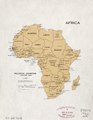
 Africa, political divisions, 1 January 1966. LOC 97687613.jpg 3,355 × 4,343; 1.4 MB
-
 Africa, political divisions, 1 January 1966. LOC 97687613.tif 3,355 × 4,343; 41.69 MB
-
 Africa, political divisions. LOC 97687611.jpg 3,171 × 4,180; 1.32 MB
-
 Africa, political divisions. LOC 97687611.tif 3,171 × 4,180; 37.92 MB
-
 Africa. LOC 97687645.jpg 11,831 × 12,667; 11.66 MB
-
 Africa. LOC 97687645.tif 11,831 × 12,667; 428.76 MB
-
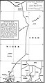 Chad-Niger Boundary.jpg 1,554 × 2,843; 1.2 MB
-
 Dahomey. 2-66. LOC 76696103.jpg 4,391 × 8,056; 3.68 MB
-
 Dahomey. 2-66. LOC 76696104.jpg 4,434 × 8,098; 4.1 MB
-
 Rwanda-Tanzania border.png 866 × 1,273; 414 KB


