Category:1964 maps of Africa
Jump to navigation
Jump to search
Temperate regions: North America · Africa · Europe · Asia · Oceania – Polar regions: – Other regions:
| ← 1960 1961 1962 1963 1964 1965 1966 1967 1968 1969 → |
Subcategories
This category has the following 3 subcategories, out of 3 total.
M
- 1964 maps of Mali (2 F)
- 1964 maps of Mozambique (2 F)
Media in category "1964 maps of Africa"
The following 6 files are in this category, out of 6 total.
-
 Africa, administrative divisions, 1 May 1964. LOC 97687653.jpg 3,162 × 4,165; 2.02 MB
-
 Africa, administrative divisions, 1 May 1964. LOC 97687653.tif 3,162 × 4,165; 37.68 MB
-
 Africa, administrative divisions, October 1964. LOC 97687654.jpg 3,151 × 4,172; 2.02 MB
-
 Africa, administrative divisions, October 1964. LOC 97687654.tif 3,151 × 4,172; 37.61 MB
-
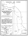 Malawi-Tanzania border.png 856 × 1,113; 322 KB
-
 Zambia-Zimbabwe border.png 1,112 × 876; 306 KB


