Category:1967 maps of Africa
Jump to navigation
Jump to search
Temperate regions: North America · Africa · Europe · Asia · Oceania – Polar regions: – Other regions:
| ← 1960 1961 1962 1963 1964 1965 1966 1967 1968 1969 → |
Subcategories
This category has the following 2 subcategories, out of 2 total.
E
- 1967 maps of Egypt (4 F)
T
- 1967 maps of Tunisia (5 F)
Media in category "1967 maps of Africa"
The following 13 files are in this category, out of 13 total.
-
 1967 data of Western African countries.jpg 3,936 × 2,892; 1.58 MB
-
 Admiralty Chart Catalogue 1967 Page 044 Index G.jpg 8,571 × 6,853; 8.77 MB
-
 Africa 1967 - history.jpg 2,204 × 2,896; 1.01 MB
-
 Africa 1967 - physical geography.jpg 4,016 × 2,900; 1.83 MB
-
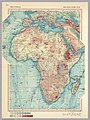 Africa 1967 - physical.jpg 2,164 × 2,880; 1.33 MB
-
 Africa 1967 - political.jpg 2,184 × 2,884; 1,000 KB
-
 Africa 1967 - population.jpg 2,200 × 2,884; 1.05 MB
-
 Africa. LOC 97687657.jpg 3,153 × 4,177; 1.73 MB
-
 Africa. LOC 97687657.tif 3,153 × 4,177; 37.68 MB
-
 Africa. LOC 97687658.jpg 3,167 × 4,185; 1.62 MB
-
 Africa. LOC 97687658.tif 3,167 × 4,185; 37.92 MB
-
 Northern Africa, 1967.jpg 5,944 × 2,896; 3.82 MB
-
 Southern Africa, 1967.jpg 2,896 × 4,059; 2.61 MB


