Category:1963 maps of Africa
Jump to navigation
Jump to search
Temperate regions: North America · Africa · Europe · Asia · Oceania – Polar regions: – Other regions:
| ← 1960 1961 1962 1963 1964 1965 1966 1967 1968 1969 → |
Subcategories
This category has the following 12 subcategories, out of 12 total.
B
- 1963 maps of Botswana (4 F)
E
- 1963 maps of Egypt (2 F)
G
- 1963 maps of Ghana (2 F)
K
- 1963 maps of Kenya (2 F)
L
- 1963 maps of Liberia (5 F)
M
- 1963 maps of Mali (1 F)
- 1963 maps of Mauritania (1 F)
N
- 1963 maps of Namibia (2 F)
S
- 1963 maps of South Africa (4 F)
- 1963 maps of Sudan (6 F)
T
- 1963 maps of Algeria (1 F)
Media in category "1963 maps of Africa"
The following 8 files are in this category, out of 8 total.
-
 African Cup of Nations-Ghana-1963.png 360 × 392; 6 KB
-

-
 Cameroon Nigeria border coast.jpg 580 × 575; 163 KB
-
 Ghana. LOC 97680071.tif 7,645 × 8,120; 177.61 MB
-
 Ghana. LOC 97680072.jpg 7,721 × 8,160; 5.06 MB
-
 Ghana. LOC 97680072.tif 7,721 × 8,160; 180.25 MB
-
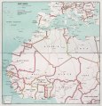
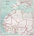 West Africa. 5-63. LOC 75690458.jpg 15,759 × 16,420; 22.98 MB
-
 West Africa. 5-63. LOC 75690458.tif 15,759 × 16,420; 740.33 MB


