Category:1962 maps of Africa
Jump to navigation
Jump to search
Temperate regions: North America · South America · Africa · Europe · Asia · Oceania – Polar regions: – Other regions:
| ← 1960 1961 1962 1963 1964 1965 1966 1967 1968 1969 → |
Media in category "1962 maps of Africa"
The following 11 files are in this category, out of 11 total.
-
 Africa administrative divisions, 1 January 1962. LOC 97687631.jpg 4,782 × 4,345; 2.2 MB
-
 Africa administrative divisions, 1 January 1962. LOC 97687631.tif 4,782 × 4,345; 59.45 MB
-
 Africa, administrative divisions, 1 November 1962. LOC 97687647.jpg 3,377 × 4,392; 1.35 MB
-
 Africa, administrative divisions, 1 November 1962. LOC 97687647.tif 3,377 × 4,392; 42.43 MB
-
 Africa, administrative status, April 1962. LOC 98681210.jpg 6,847 × 6,443; 3.83 MB
-
 Africa, administrative status, April 1962. LOC 98681210.tif 6,847 × 6,443; 126.21 MB
-
 African Cup 1962.png 360 × 392; 4 KB
-
 Political map of Africa, November 1962. LOC 97687630.jpg 3,368 × 4,358; 1.4 MB
-
 Political map of Africa, November 1962. LOC 97687630.tif 3,368 × 4,358; 41.99 MB
-
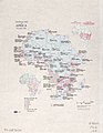
 South Africa. LOC 96680415.jpg 4,721 × 3,878; 1.94 MB
-
 South Africa. LOC 96680415.tif 4,721 × 3,878; 52.38 MB


