Category:1966 maps
Jump to navigation
Jump to search
| ← · 1960 · 1961 · 1962 · 1963 · 1964 · 1965 · 1966 · 1967 · 1968 · 1969 · → |
Deutsch: Karten mit Bezug zum Jahr 1966
English: Maps related to the year 1966
Español: Mapas relativos al año 1966
Français : Cartes concernant l’an 1966
Русский: Карты 1966 года
Subcategories
This category has the following 6 subcategories, out of 6 total.
Media in category "1966 maps"
The following 77 files are in this category, out of 77 total.
-
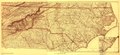
 (North Carolina LOC 99447452.jpg 9,173 × 4,235; 9.71 MB
-
 (North Carolina LOC 99447452.tif 9,173 × 4,235; 111.14 MB
-
 1966 Atlantic hurricane season map.png 1,024 × 802; 114 KB
-
 1966 MBTA system map.png 2,587 × 3,475; 15.17 MB
-
 Admiralty Routeing Chart No 5127(7) North Pacific July, Published 1966.jpg 18,451 × 11,312; 41.63 MB
-
 Admiralty Routeing Chart No 5128(3) South Pacific March, Published 1966.jpg 18,358 × 11,214; 44.07 MB
-
 Air France 1966 - Regional 1.jpg 2,304 × 1,344; 859 KB
-
 Air France 1966 - Regional 2.jpg 2,092 × 1,346; 790 KB
-
 Air France 1966 regional routes.jpg 3,210 × 1,336; 1.94 MB
-
 Azimuthal equidistant projection centered on Bogotá, Colombia. 3-66. LOC 75693304.jpg 9,696 × 9,669; 11.37 MB
-
 Azimuthal equidistant projection centered on Bogotá, Colombia. 3-66. LOC 75693304.tif 9,696 × 9,669; 268.22 MB
-
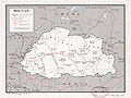 Bhutan. LOC 81692503.jpg 4,170 × 3,140; 2.03 MB
-
 Bhutan. LOC 81692503.tif 4,170 × 3,140; 37.46 MB
-
 Bhutan. LOC 81692504.jpg 4,137 × 3,162; 1.82 MB
-
 Bhutan. LOC 81692504.tif 4,137 × 3,162; 37.43 MB
-
 Blue Ridge Parkway, North Carolina-Virginia LOC 2009575390.jpg 12,093 × 5,761; 12.82 MB
-
 Blue Ridge Parkway, North Carolina-Virginia LOC 2009575390.tif 12,093 × 5,761; 199.32 MB
-
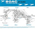 BOAC 1966.jpg 1,686 × 1,405; 314 KB
-
 Bolivia-Chile border.png 878 × 1,215; 449 KB
-
 Burundi-Rwanda boundary. 3-66. LOC 76696264.jpg 5,073 × 3,368; 1.41 MB
-
 Burundi-Rwanda boundary. 3-66. LOC 76696264.tif 5,073 × 3,368; 48.88 MB
-
 Burundi-Tanzania boundary. 4-66. LOC 76696266.jpg 3,312 × 4,282; 1.18 MB
-
 Burundi-Tanzania boundary. 4-66. LOC 76696266.tif 3,312 × 4,282; 40.58 MB
-
 C85135s1 Ant.Map Leverett Glacier.jpg 3,360 × 3,746; 1.53 MB
-
 C85150s1 Mount Goodale.jpg 3,844 × 3,240; 1.65 MB
-
 C86135s1 Ant.Map Mount Blackburn.jpg 7,687 × 6,480; 5.71 MB
-
 Carta della provincia di Salerno. LOC 2001620480.jpg 10,200 × 7,200; 9.83 MB
-
 Carta della provincia di Salerno. LOC 2001620480.tif 10,200 × 7,200; 210.11 MB
-
 Chad-Niger boundary. LOC 85697523.jpg 3,164 × 4,176; 1.34 MB
-
 Chad-Niger boundary. LOC 85697523.tif 3,164 × 4,176; 37.8 MB
-
 Commonwealth games 1966 countries map.PNG 1,357 × 628; 29 KB
-
 Dahomey. 2-66. LOC 76696103.tif 4,391 × 8,056; 101.21 MB
-
 Dahomey. 2-66. LOC 76696104.tif 4,434 × 8,098; 102.73 MB
-
 Davy Crockett National Forest, Texas. LOC 75695969.jpg 6,697 × 8,043; 6.66 MB
-
 Davy Crockett National Forest, Texas. LOC 75695969.tif 6,697 × 8,043; 154.11 MB
-
 Green Mountain National Forest, Vermont - 1966 LOC 2011589174.jpg 10,350 × 16,020; 20.48 MB
-
 Green Mountain National Forest, Vermont - 1966 LOC 2011589174.tif 10,350 × 16,020; 474.38 MB
-
 III CTZ May to September 1965.jpg 1,018 × 995; 213 KB
-
 Kenya-Somalia boundary. LOC 2002622514.jpg 3,158 × 4,143; 1.32 MB
-
 Kenya-Somalia boundary. LOC 2002622514.tif 3,158 × 4,143; 37.43 MB
-
 KLM 1966.jpg 1,772 × 1,207; 922 KB
-
 Landmarks of historic or aesthetic merit - (Washington D.C. central business district). LOC 87694099.jpg 14,167 × 12,524; 26.01 MB
-
 Landmarks of historic or aesthetic merit - (Washington D.C. central business district). LOC 87694099.tif 14,167 × 12,524; 507.62 MB
-
 New Orleans Section and West Bank 1966 Map.jpg 3,806 × 4,500; 5.81 MB
-
 Ozark National Forest (Magazine Mountain Ranger District), Arkansas. LOC 75695913.jpg 5,818 × 5,672; 5.06 MB
-
 Ozark National Forest (Magazine Mountain Ranger District), Arkansas. LOC 75695913.tif 5,818 × 5,672; 94.41 MB
-
 Ozark National Forest, Boston Mountain Ranger District, Arkansas, 1966. LOC 75695910.jpg 6,526 × 8,260; 7.57 MB
-
 Ozark National Forest, Boston Mountain Ranger District, Arkansas, 1966. LOC 75695910.tif 6,526 × 8,260; 154.22 MB
-
 Pisgah National Forest (Pisgah Ranger District), North Carolina, 1966. LOC 75695945.jpg 5,244 × 7,336; 6.99 MB
-
 Pisgah National Forest (Pisgah Ranger District), North Carolina, 1966. LOC 75695945.tif 5,244 × 7,336; 110.06 MB
-
 Plattegrond plan Kuiper - Utrecht - 20212255 - RCE.jpg 901 × 1,200; 220 KB
-
 ROKArmyVietnamWarMap.jpg 441 × 721; 166 KB
-
 Samou Battle 1966.png 1,252 × 914; 478 KB
-
 State of West Virginia, base map - compiled in 1963 LOC 79690123.jpg 6,082 × 5,363; 4.55 MB
-
 State of West Virginia, base map - compiled in 1963 LOC 79690123.tif 6,082 × 5,363; 93.32 MB
-
 Survey of Israel, Israel (FL44246313 2366997).jpg 9,339 × 21,667; 315.62 MB
-
 Survey of Israel, ישראל (FL80719702 2367806).jpg 4,598 × 10,988; 60.64 MB
-
 Survey of Israel, לד (FL39697019 3770148).jpg 11,831 × 16,553; 287.97 MB
-
 Survey of Israel, מפה גיאולוגית (FL155332369 2675800).jpg 8,968 × 21,745; 252.75 MB
-
 Survey of Israel, נחל פארן (FL44749095 3770465).jpg 11,830 × 16,744; 272.79 MB
-
 Survey of Israel, נצנה (FL147409160 2723480).jpg 11,413 × 12,752; 163.44 MB
-
 Survey of Israel, נתניה (FL32686373 2367832).jpg 13,910 × 27,176; 478.94 MB
-
 Survey of Israel, רס אבו קרון (FL168339299 2694660).jpg 16,423 × 11,802; 211.84 MB
-
 Survey of Israel, שרם א-שיח (FL168339380 2694694).jpg 16,404 × 11,825; 178.38 MB
-
 Surveys Departmen of Israel, מפת ישראל 01 (FL81913702 2367807).jpg 10,118 × 23,096; 274.77 MB
-
 Surveys Departmen of Israel, מפת ישראל 02 (FL81913703 2367807).jpg 9,832 × 22,870; 220.66 MB
-
 The battle of Moores Creek Bridge, February 27, 1776. 1964. LOC 73695954.jpg 6,117 × 5,700; 5.57 MB
-
 The battle of Moores Creek Bridge, February 27, 1776. 1964. LOC 73695954.tif 6,117 × 5,700; 99.76 MB
-
 Route of the 1966 Tour de France.png 3,198 × 3,204; 2.66 MB
-
 Triangulation diagram, vicinity of Washington, D.C. - August 1966. LOC 87693486.jpg 9,372 × 11,660; 19.73 MB
-
 Triangulation diagram, vicinity of Washington, D.C. - August 1966. LOC 87693486.tif 9,372 × 11,660; 312.65 MB
-
 USAF lunar reference mosaic - LEM-1. LOC 92684356.jpg 10,507 × 10,220; 11.86 MB
-
 USAF lunar reference mosaic - LEM-1. LOC 92684356.tif 10,507 × 10,220; 307.22 MB
-
 Vietnam demarcation line and demilitarized zone. 12-66. LOC 75690898.jpg 14,353 × 8,625; 15.59 MB
-
 Vietnam demarcation line and demilitarized zone. 12-66. LOC 75690898.tif 14,353 × 8,625; 354.18 MB
-
 White Mountain National Forest, New Hampshire, Maine LOC 2011589176.jpg 5,550 × 14,700; 13.01 MB
-
 White Mountain National Forest, New Hampshire, Maine LOC 2011589176.tif 5,550 × 14,700; 233.42 MB


_North_Pacific_July,_Published_1966.jpg)
_South_Pacific_March,_Published_1966.jpg)


._LOC_87694099.jpg)

,_Arkansas._LOC_75695913.jpg)

,_North_Carolina,_1966._LOC_75695945.jpg)


.jpg)
.jpg)
.jpg)
.jpg)
.jpg)
.jpg)
.jpg)
.jpg)
.jpg)
.jpg)


.jpg)