Category:1960s maps of Poland
Jump to navigation
Jump to search
Subcategories
This category has the following 2 subcategories, out of 2 total.
- 1963 maps of Poland (1 F)
- 1967 maps of Poland (2 F)
Media in category "1960s maps of Poland"
The following 5 files are in this category, out of 5 total.
-
 Hungary-Ukraine border.png 830 × 1,067; 345 KB
-
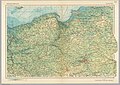 Poland 1967 - north.jpg 4,035 × 2,874; 2.55 MB
-
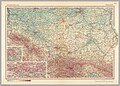 Poland 1967 - south.jpg 4,038 × 2,884; 3.09 MB
-
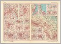 Selected cities of Poland, 1967.jpg 3,936 × 2,896; 2.62 MB
-
 Slovakia-Ukraine border.png 842 × 1,108; 355 KB


