
Category:1960s maps of Ireland
Media in category "1960s maps of Ireland"
The following 6 files are in this category, out of 6 total.
-
 Ireland- Terrain and transportation. 11-60. LOC 75693760.jpg 6,943 × 8,972; 4.59 MB
-
 British Isles- Terrain and transportation. 4-61. LOC 75693763.jpg 6,645 × 8,645; 6.5 MB
-
 1967 data of the British Isles - part 2.jpg 3,948 × 2,873; 1.23 MB
-
 England, Wales and Ireland, 1967.jpg 4,766 × 2,884; 3.23 MB
-
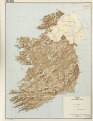
 Ireland 1967 (cropped).jpg 1,085 × 1,304; 379 KB
-
 Ireland- Terrain and transportation. 11-60. LOC 75693760.tif 6,943 × 8,972; 178.22 MB


.jpg)